Welcome to our Ozark Hiking Trail list. Nestled in the heart of America, the Ozark Mountains boast a mesmerizing landscape of rugged terrain, lush forests, and crystal-clear streams. If you’re an avid hiker or simply looking to escape into nature’s embrace, the Ozarks offer a treasure trove of hiking experiences that will leave you awe-inspired.
At Lost in the Ozarks, we’ve personally completed each of these remarkable hiking trails to bring you the ultimate guide to outdoor adventure. Our curated list of Ozark hiking trails is your gateway to discovering the natural wonders of this enchanting region.
Each trail featured on our website comes with a comprehensive review, with vivid descriptions, insider tips, and personal anecdotes to help you plan your next hiking adventure. We’ve also included GPS coordinates, stunning photos, detailed maps, and even videos to ensure you have all the information you need to maximize your journey.
Whether you’re a seasoned hiker seeking a new challenge or a beginner looking for a serene stroll in nature, our Ozark hiking trail reviews cater to all skill levels and interests. So, lace up your hiking boots, grab your backpack, and explore the Ozarks’ scenic beauty.
Start your hiking journey today by clicking on any of the links below to access the complete descriptions of these Ozark hiking trails, complete with reviews, GPS coordinates, photos, and map information. Get ready to immerse yourself in the breathtaking landscapes that the Ozarks have to offer.
The trails are presented in no particular order, and new trails will be added as we complete each new adventure.
If you prefer a reference you can carry with you on the trail, consider purchasing my book on Amazon that contains all these trails and some bonus attractions to visit.
Ozark Hiking Trail List
Magnolia Falls – Magnolia Falls lies within the Ozark National Forest near Deer, AR. The trail to Magnolia Falls is a little over 2 miles in and out if you only want to visit Magnolia Falls. There are two other falls you can visit in the same area easily. These falls are Woods Boys Falls and Hadlock Cascade.
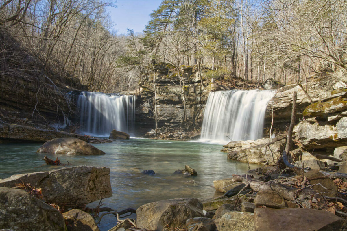
Leatherwood Wilderness Waterfalls – The Leatherwood Wilderness is located in the Boston Mountains, part of the Ozark National Forest in Arkansas. It is a rugged and remote area, covering over 18,000 acres, and is home to some of the most pristine wilderness in the state.
Adkins Canyon Falls – Among the many picturesque areas in the Upper Buffalo Wilderness is Adkins Creek, which features a couple of stunning waterfalls. While this hike is not recommended for beginners, experienced hikers who are comfortable with bushwhacking will find plenty to see and explore.
Dismal Creek Special Interest Area – Dismal Creek Special Interest Area is located in the Ozark National Forest just a short distance from the Glory Hole Falls hiking trail.
Bearcat Hollow Falls – Bearcat Hollow Falls is located in the Richland Creek Wilderness near Witt Springs, AR. This area is part of the Ozark National Forest. It is a wild area with plenty of scenic beauty to be found within its area which encompasses almost 12,000 acres.
Terry Keefe Falls – Terry Keefe Falls is a short hike off Falling Waters Road in the Richland Creek area of the Ozark National Forest. The hike is a little over a mile out and back to the parking area. This short hike is very scenic, with tall bluffs to one side and a small drainage to Falling Waters Creek on the other.
Punchbowl Falls – Punchbowl Falls is located in the Richland Creek Wilderness in the Ozark National Forest near Witt Springs, Arkansas. This Ozark hiking trail is about 7 miles in and out, with an elevation change of about 700′.
Sandstone Castle – The Sandstone Castle is a popular sandstone rock formation located in the Richland Creek Wilderness area of the Ozark National Forest.
Fern Falls – Fern Falls is south of Jasper, AR on Scenic Highway 7. There is an area for parking near the sign for Scenic 7 Byway on the west side of the highway. This Ozark hiking trail is one of the easiest trails on this list.
Lonesome Hollow Falls – To get to Lonesome Hollow Falls take Highway 7 to Cowell, AR. The turn from the highway is located next to the Cowell Cemetary. This Ozark hiking trail is also only about 7 miles from Fern Falls. You can easily visit both waterfalls in a morning or afternoon.
Glory Hole Falls – Glory Hole Falls is a unique sinkhole waterfall in the Ozark National Forest. The parking area for the falls is along AR Highway 16/21 south of Boxley Valley. There is a small sign and a parking area beside the highway. It is also very near the Dismal Creek Special Interest Area listed above.
Antenna Pine Overlook – Begin the hike to Antenna Pine Overlook from the Compton Trailhead in Compton Arkansas. This is the trailhead that also includes the hike down to Hemmed In Hollow Falls. This trail is around 7 miles total, and there are some steep areas and a short climb involved.
Falling Water Falls – This is probably the easiest waterfall you can visit in the Ozarks. Falling Water Falls is easy to visit because it is right beside the road. You can drive right up to the falls. If you are interested in visiting other waterfalls in the area, there are 6 Finger Falls and Terry Keefe Falls on the same road.
Bear Creek Canyon – Bear Creek Canyon is located in the Ozark National Forest near Pelsor, AR. This area is a waterfall lovers’ paradise. We viewed 6 distinct waterfalls within a few hundred yards of each other. It is a little less than a mile down to the first waterfall on the trail. The elevation change was noted as 650′ on my GPS. It is very steep and at times the trail is very narrow along the bluff line beside the creek.
Buzzards Roost Ozark Hiking Trail – The Buzzards Roost hiking trail and scenic area is located in the Ozark National Forest in Newton County, Arkansas. The trail is basically an old ATV road and is fairly flat. The trail is about 2 miles each way. You can add another 1/2 mile each way if you visit the large natural arch that is a little further along the trail after you visit Buzzards Roost.
Big Creek Cave Falls – Big Creek Cave Falls is located in Newton County, Arkansas. It is one of many gorgeous places to hike in the Ozark National Forest. There is plenty to see on this trail, and many photogenic scenes to capture.
Paradise Falls – The parking area for this Ozark hiking trail is along Highway 21 near Deer, AR. The gravel parking area isn’t marked with signs, but it is pretty easy to spot on the west side of the highway. This is a gorgeous cascade waterfall but be prepared for the 500′ elevation change.
Steele Falls – Steele Falls is a waterfall many people have not heard of. It is located in the Ozark National Forest near the Gunner Pool recreation area. If you’ve ever visited Blanchard Springs near Mountain View, Arkansas you were only a short distance from this hidden gem.
Compton’s Double Falls Trail – The trailhead for this trail is along Cave Mountain Road in Newton County. If you have ever heard of or read about Whittaker Point/Hawksbill Crag this trail is in the same area. In fact, if you arrive from State Highway 21 as we did, the trailhead is approximately 1.1 miles beyond the trailhead for Whittaker Point.
Richland Creek Falls – Richland Falls is located in the Ozark National Forest on Richland Creek. The trailhead for this hike is located in the Richland Creek Campground. There is a parking area as you drive into the campground and a small road with a gate to the right. This road leads along Richland Creek up to where Falling Waters Creek empties into it. There is a sign where the creeks meet showing the trailhead.
Bowers Hollow Falls – Bowers Hollow Falls is located in the upper Buffalo River Wilderness. It is listed as 56′ tall, but it seems taller when you are looking down from the bluffs surrounding the falls.
Big Bluff Goat Trail – The Big Bluff Goat Trail is a spur trail off the Centerpoint Trail in the Ponca Wilderness of the Buffalo National River. You start your hike at the Centerpoint trailhead next to Highway 43 at Compton, AR. My GPS measured the hike at 3 miles each way from the Centerpoint trailhead down to the Big Bluff Goat Trail. There is about an 1100′ elevation change from the trailhead to the Big Bluff Goat Trail.
Sweden Falls – Sweden Falls is a fairly high waterfall located in the Sweden Creek Natural Area near Kingston, AR. Sweden Falls is the 5th tallest waterfall in Arkansas at 81′ tall. To reach Sweden Falls you take County Road 9 to the south off of State Highway 21 between Kingston and Ponca.
Paige Falls Trail – Paige Falls Trail is a heavily trafficked trail inside the boundaries of the Buffalo National River Park. To reach these falls you will take Highway 43 out of Harrison. The road to reach the falls is marked and the sign will say NC2660. As you approach the town of Compton the road will be on your left.
Lower Horsetail Falls – Lower Horsetail Falls is found off Falling Waters Road in the Ozark National Forest. You can reach the falls by following what is known as the Horse Trail. To reach the Horse Trail take Highway 16 off Highway 7 from Sand Gap East toward Ben Hur. Turn right onto Falling Waters Road.
Hemmed In Hollow Falls – Hemmed In Hollow Falls is the tallest waterfall between the Rockies and the Appalachian mountains at around 209′ tall. The trail down to the falls is steep and rugged, with an elevation change of about 1200′.
Indian Creek Trail – The trailhead for the Indian Creek Trail is to the left as you enter the campground at Kyle’s Landing. Just follow the road to the left and park at the back of the campground. There is a sign marking the trailhead, and also a map of the area posted. The Indian Creek Trail crosses both the Buffalo River and the Ozark Highlands trails at points near the trailhead.
Six Finger Falls – Six Finger Falls is another of the many waterfalls that can be visited in the Ozark National Forest. This part of the National Forest, near Witt Springs, AR has thousands of acres of wilderness. This waterfall can be seen from Falling Waters Road a short distance after you cross the concrete bridge over Falling Waters Creek. The falls will be visible on the left. There is a small pull-off for parking. Look for blue hash markers on some trees on the left.
Ponca to Steel Creek on the BRT – The hike from the low water bridge at Ponca to the Steel Creek Campground is about 2 miles. I would rate it as moderate because there are a couple of steep areas and the trail is narrow in some spots. The elevation gain is about 400 feet.
North Sylamore Creek Ozark Hiking Trail – North Sylamore Creek runs clear and cold past the campground and eventually empties into the White River near Mountain View, AR. The trail access point is on the road to the Barkshed campground. It is marked by light blue trail markers. The trail from Barkshed to Gunner Pool is 4 miles. You can continue on to the Blanchard Springs campground on this trail, which is a little over 5 miles.
Pedestal Rocks/King’s Bluff Scenic Area – To reach the Pedestal Rocks Scenic Area,
The Indian Rockhouse Trail – This is an easy-to-moderate trail that even the children will enjoy. The trailhead is located in the Buffalo Point recreation area on the Buffalo River. The trail is around 4 miles with 400′ of elevation change. The gem of the trail is the Indian Rockhouse Bluff Shelter.
Elise Falls-Smith Creek Nature Preserve – Elise Falls is one of the amazing sights you can see if you visit the Smith Creek Nature Preserve. The Smith Creek Nature Preserve is over 1300 acres of Ozark forest land preserved to protect the land and wildlife. The preserve is located on State Highway 21 just a few miles south of Ponca, Arkansas.
Twin Falls – aka Triple Falls – Twin Falls trail is a short hiking trail that is located at Camp Orr Boy Scout Camp. The area beyond the parking area is private property and there are signs to show you where to park. There is also a small sign pointing the way to the trail to Twin Falls. Be aware that the road down to the falls is extremely steep. I would not recommend taking anything but a 4-wheel drive or a high SUV down there.
Waterfall Hiking Trail – Branson, MO – The Waterfall Hiking Trail in Branson, MO is a short trail to a low waterfall. The trail is just up from the parking area near the entrance to a local resort. There is a sign at the trailhead. The trail is around 2/3 of a mile each way. There are other hiking trails to visit in Branson. You can hike at the Ruth and Paul Henning Conservation Area, or at the White River State Park.
Thunder Canyon Falls – The hike to Thunder Canyon Falls begins at the Cecil Creek Trailhead. For more information on Thunder Canyon Falls, you can visit the Buffalo National River website.
The Lost Valley Trail – The Lost Valley Trail is maintained by the National Park Service within the Buffalo National River Park. It is a 2 mile in and out trail that has some amazing sights. From high bluffs along Clark Creek to Eden Falls, there is something to see all along the one-mile length of this trail.
Table Rock State Park – Lakeshore Trail – Table Rock State Park is located on the south side of Branson, MO. This is a 4.4-mile point-to-point paved trail that runs from the marina along the lakeshore of Table Rock Lake. You can access the trail at several parking areas along the trail if you just want to do a shorter walk.
Liles Falls – If you are looking for an easy day trip to see a beautiful waterfall while you are in the Ozarks, then Liles Falls should be on your list. To reach Liles Falls, take Highway 7 south out of Harrison, AR. About 3 miles north of Jasper, you will be looking for a sign to Erbie Campground. You will go about 3.5 miles on this road, and you will see a small pull-off area that is large enough to park a couple of vehicles.