Big Creek Cave Falls is located in Newton County, Arkansas. It is one of many gorgeous places to hike in the Ozark National Forest. There is plenty to see on this trail, and many photogenic scenes to capture. Come along as we hike the trail and show you some of the sights in pictures.
To get to Big Creek Cave Falls from the north take Highway 7 South from Harrison through Jasper. About 1.6 miles north of the junction with Highway 16 look for the sign for Newton County 6840. The sign will be on the left side of the road. The road looks more like the turn onto a farm road that would be private property, but it is a county road. After a few hundred feet the road will open up. If coming up from the south, take Highway 7 about 1.6 miles north from the Highway 16 junction, and the sign will be on your right.
If you look on Google Earth for the road it is still marked as County Road 59. Just something to keep in mind.
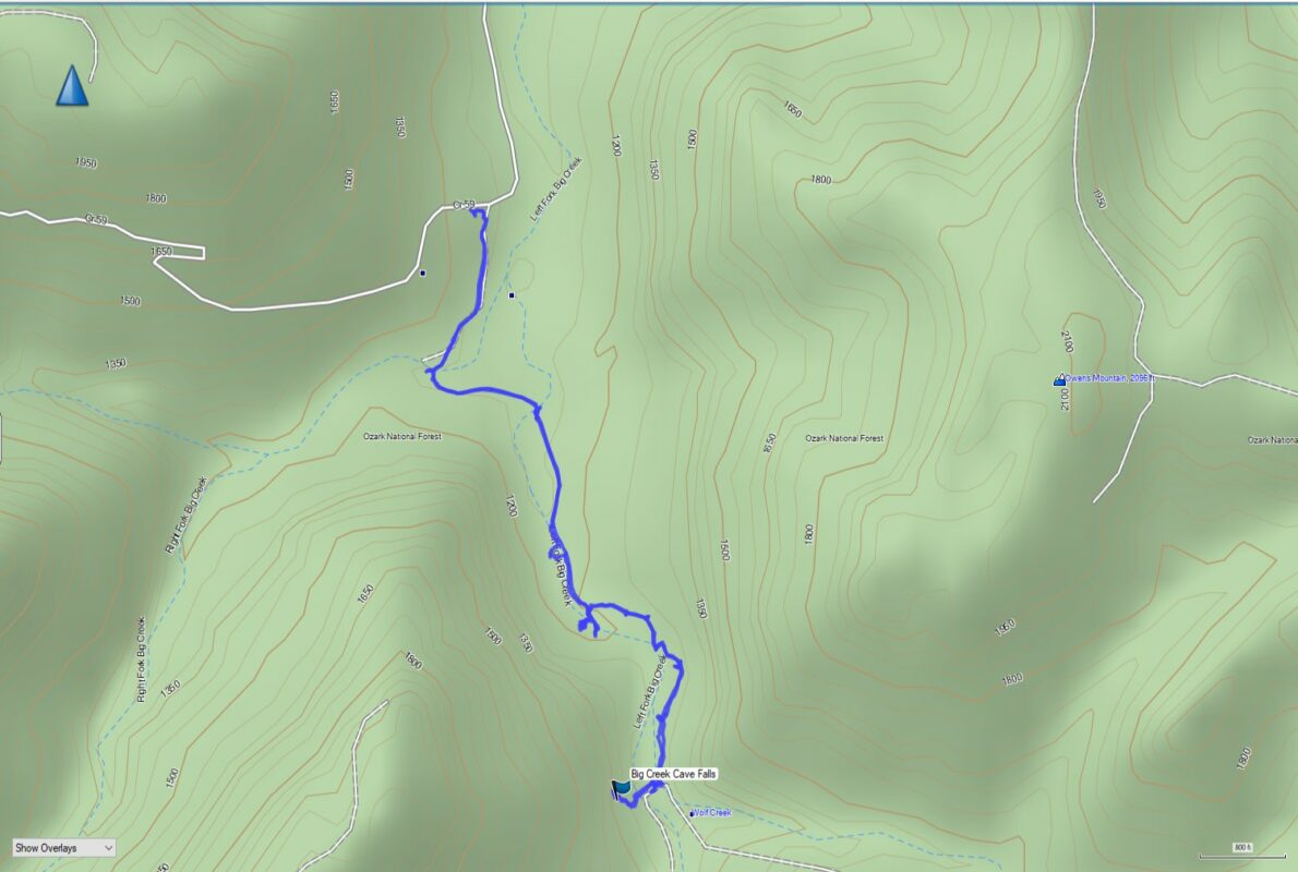
The road down to the parking area for Big Creek Cave Falls is quite steep and rough in places. From the highway to the parking area there is about a 1000′ elevation change. Rocks jut from the roadbed and I would recommend an SUV to get down there. The road was dry when we visited in early March 2021, so it wasn’t slick. I’m sure it could become slick after a heavy rain, so keep that in mind. It is about 2.8 miles from the highway to the parking area.
Once at the parking area it was time to don our backpacks and head out to see if we could find the falls. Walk around the gate here and begin down the old logging road that is still fairly visible. You will encounter an old homestead here, and you’ll see a collapsed building and the remains of an old rock wall and cellar.
You can click on any photos in this article to see a larger version.
2021 Update
We hiked this trail again on Christmas Eve 2021. It was warm and sunny on our second visit, and we were determined to see some of the sights we missed out on when we hiked it in 2020. Below I have added a few other things we were able to visit on this second hike.
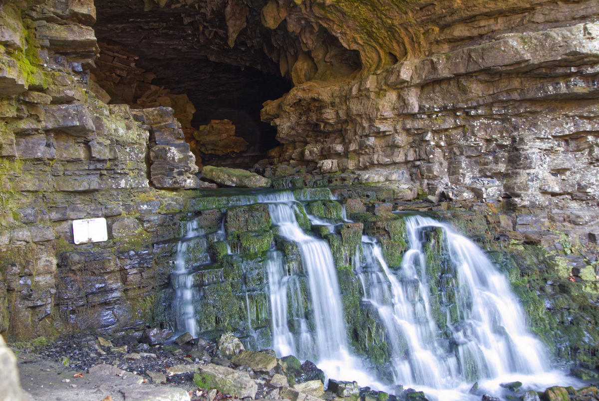
After visiting Big Creek Cave Falls we set out to find Wolf Creek Cave Falls. These falls come out of the cave opening as you can see in the photo below.
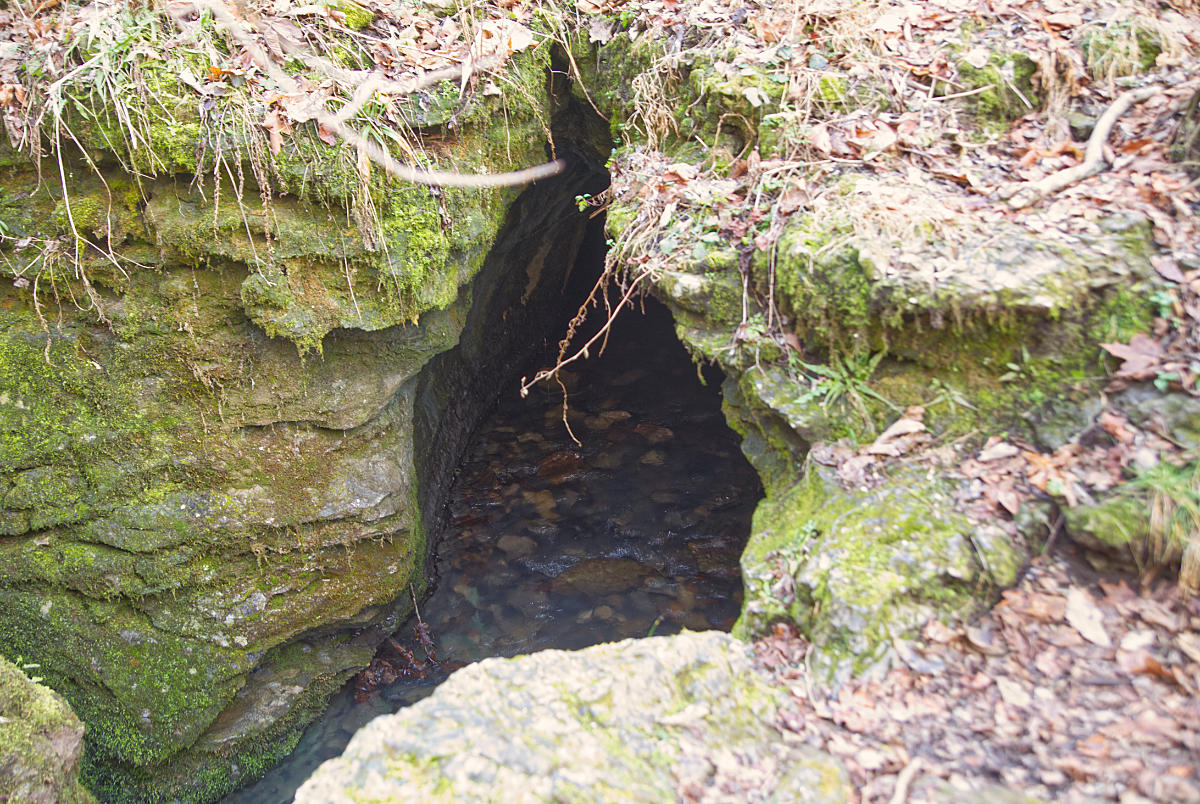
The trail to Wolf Creek Cave Falls has some interesting things to see. There is a gate on the trail with a chain and lock secured to a tree. But there isn’t any type of fencing, so the trail simply goes around the gate. You also pass another interesting formation on the trail up to the falls. The creek runs underground into the rocks below the falls, and the creek disappears underground and it appears at some point to enter the creek below.
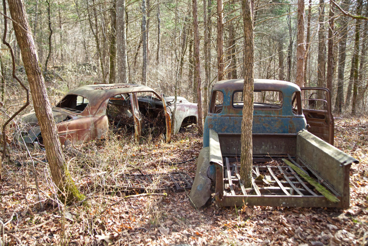
On this trip, we also took a side trail at the cattle grate to see the old homestead. There is a rock wall and several old car bodies to be seen just a short hike off the main trail. Be careful because the area is overgrown with briars that have sharp thorns.
This year I was lucky enough to have added a 360° camera to my arsenal, so below I have put together a virtual tour of the hike which shows many points of interest on the trail. Give the images a little time to load. They are large files to preserve the detail in the images. Enjoy!

The camera we use for 360° photos. Click the photo to get yours today!
Click anywhere in the grey area below to start the virtual tour.
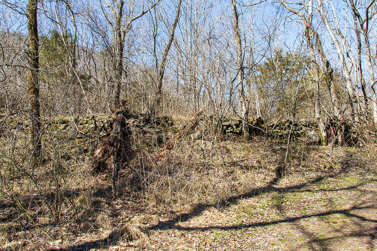
Old Collapsed Structure
Old Rock Wall
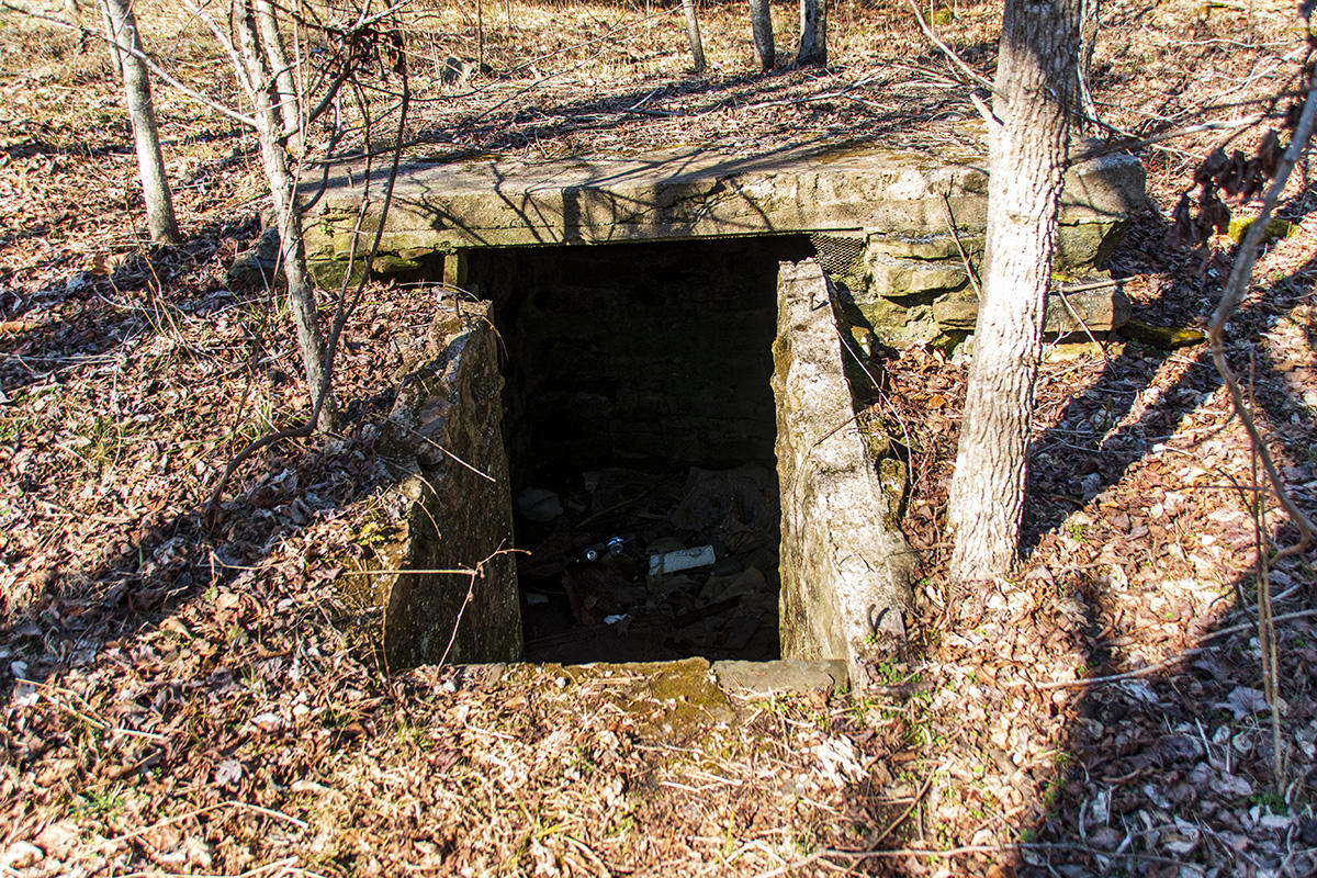
Old Cellar
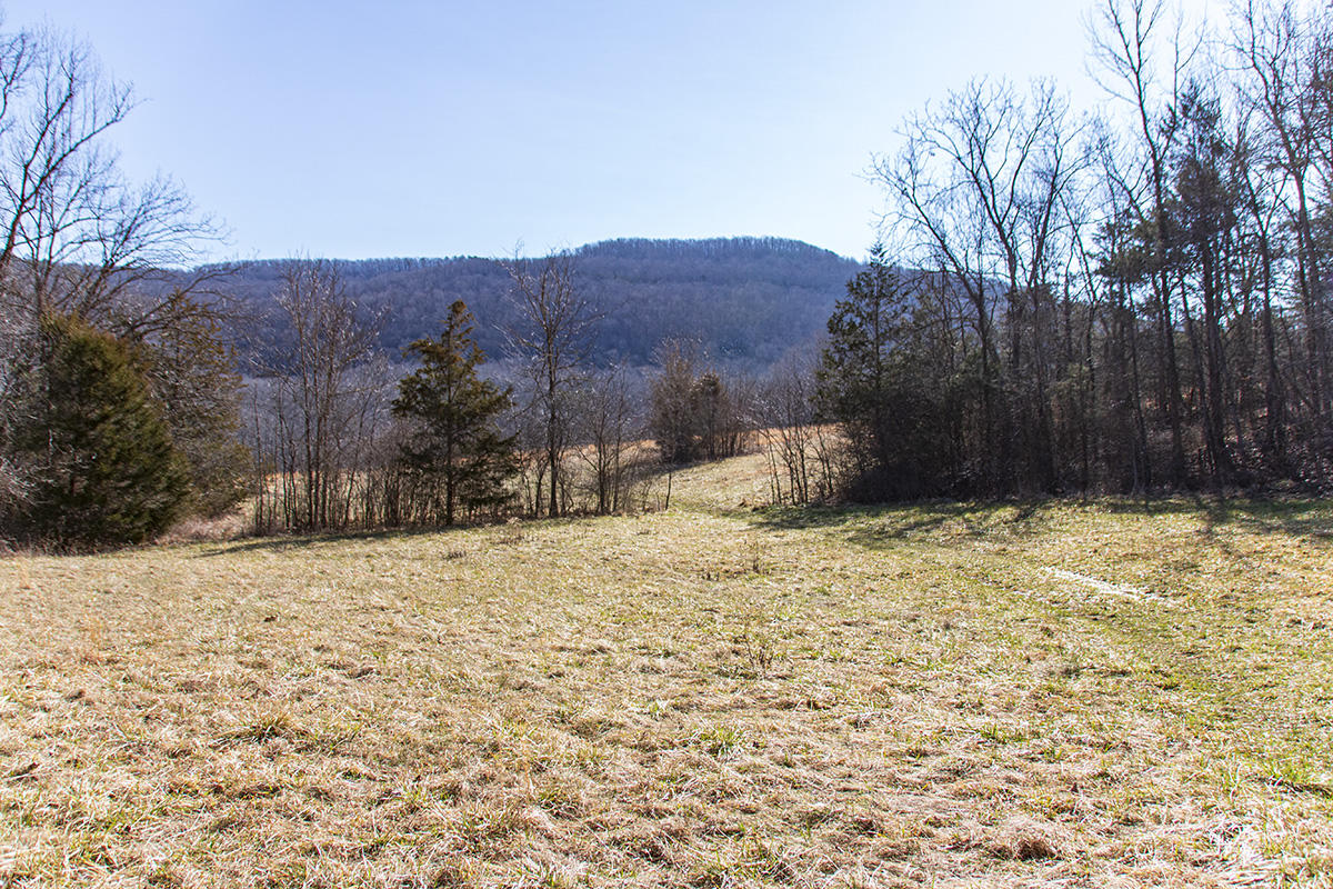
As you pass this area you will come out into a small open field. You will cross the Right Fork of Big Creek here. I didn’t count this as a water crossing since we were able to walk on rocks to cross the creek. Turn right here, and continue through the treeline into a larger field. You can follow the old road remnant that is still visible clearly to cross the field. The views of the surrounding hills are quite stunning, so you may be tempted to take a break and stand here for a few minutes to look around.
The road remnant will take you to the far side of the large field, and you will encounter your first water crossing. If you don’t want to deal with wet feet for the rest of the hike I suggest bringing along water shoes and taking the time to change into them to make the crossing. I couldn’t find any way to jump from rock to rock and not get wet here, so we took the time to change into water shoes and back before continuing the hike.
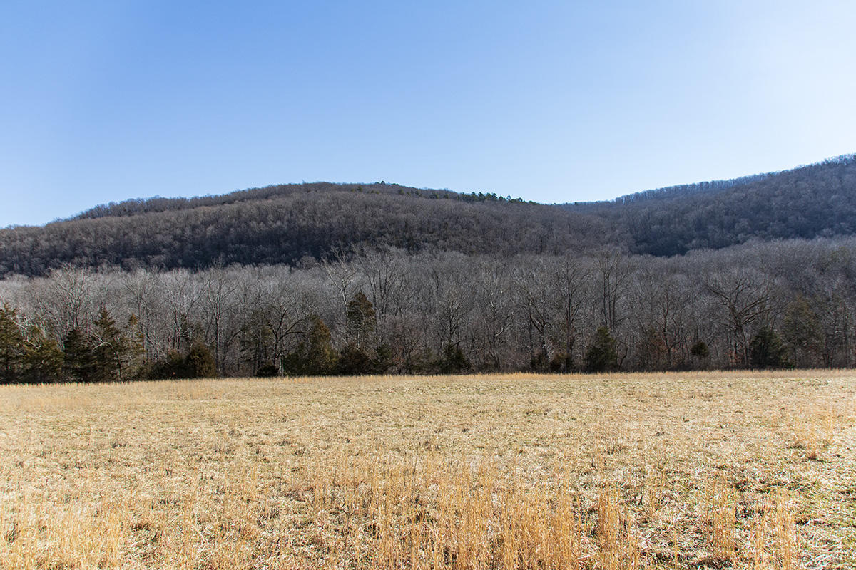
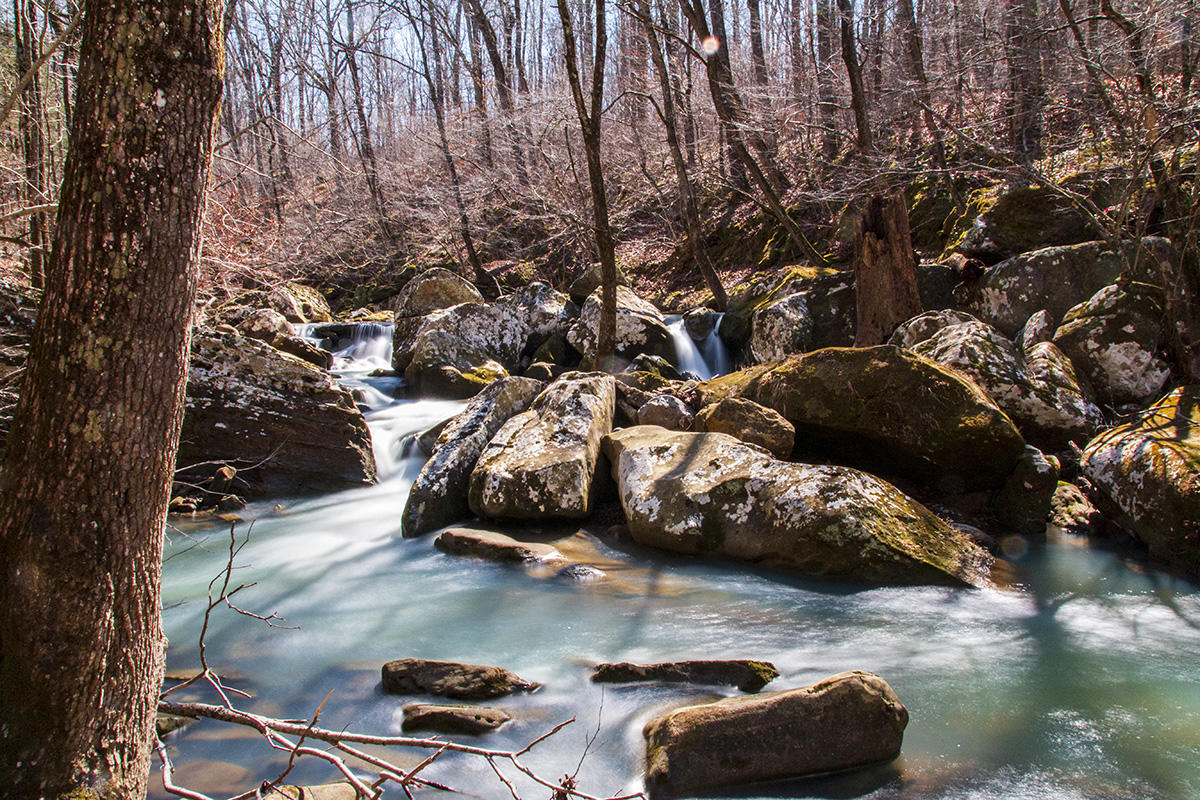
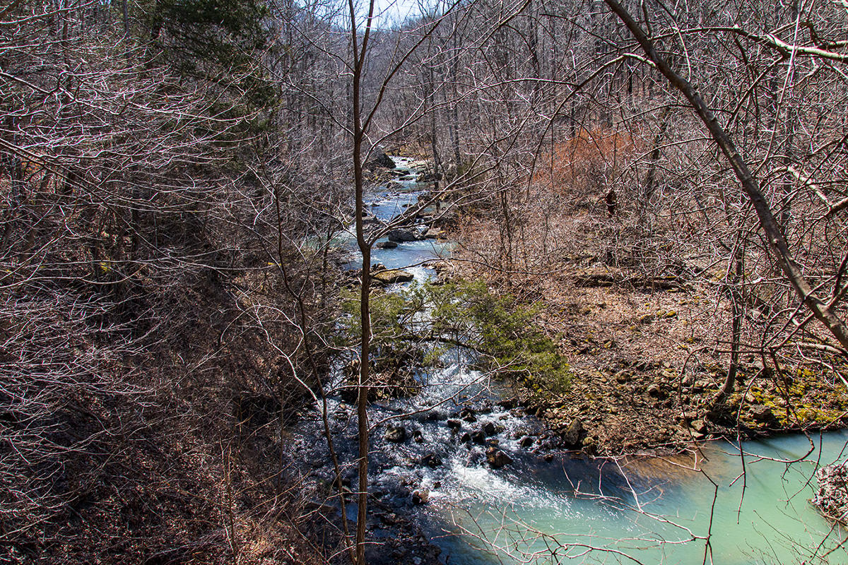
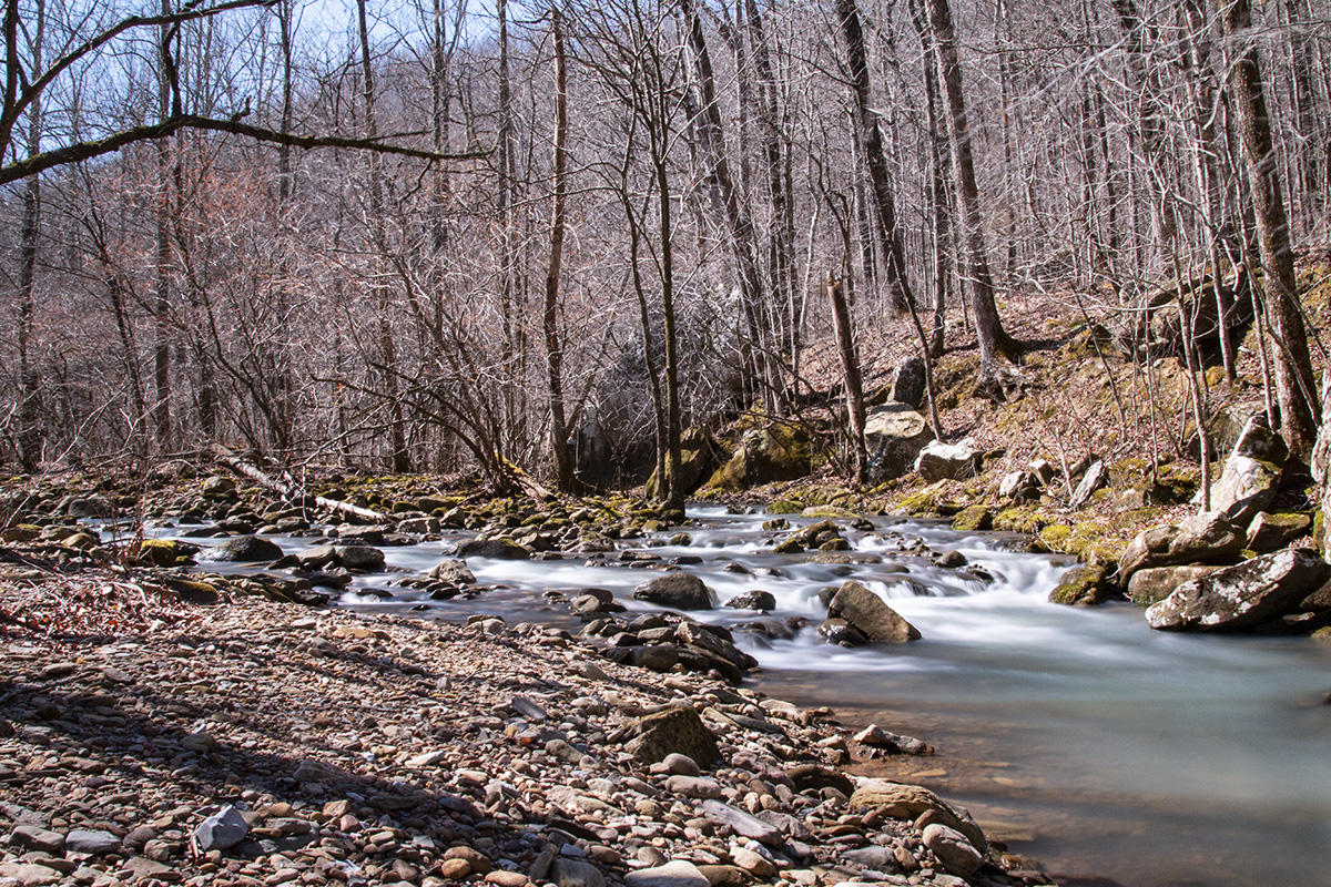
After you cross you will enter another small field. Just follow the road, and you will enter the woods on the far side. Continue to follow the old logging road as it winds along Big Creek. There are a number of side trails you will encounter along the way. These are surrounded by thorny vines so be aware that long pants may keep you from some nasty cuts from those thorns. But the scenes when you go into the creek bed are quite amazing.
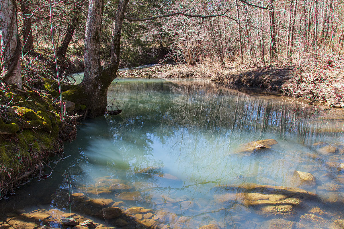
You can continue to follow the road along the creek, and you will continue to see amazing views, even from the trail. This photo is from an area where the trail runs right along the creek edge.
After following the road for a while further you will come upon the place where Wolf Creek and Big Creek converge. This is very close to where you take a small side trail to Big Creek Cave Falls.
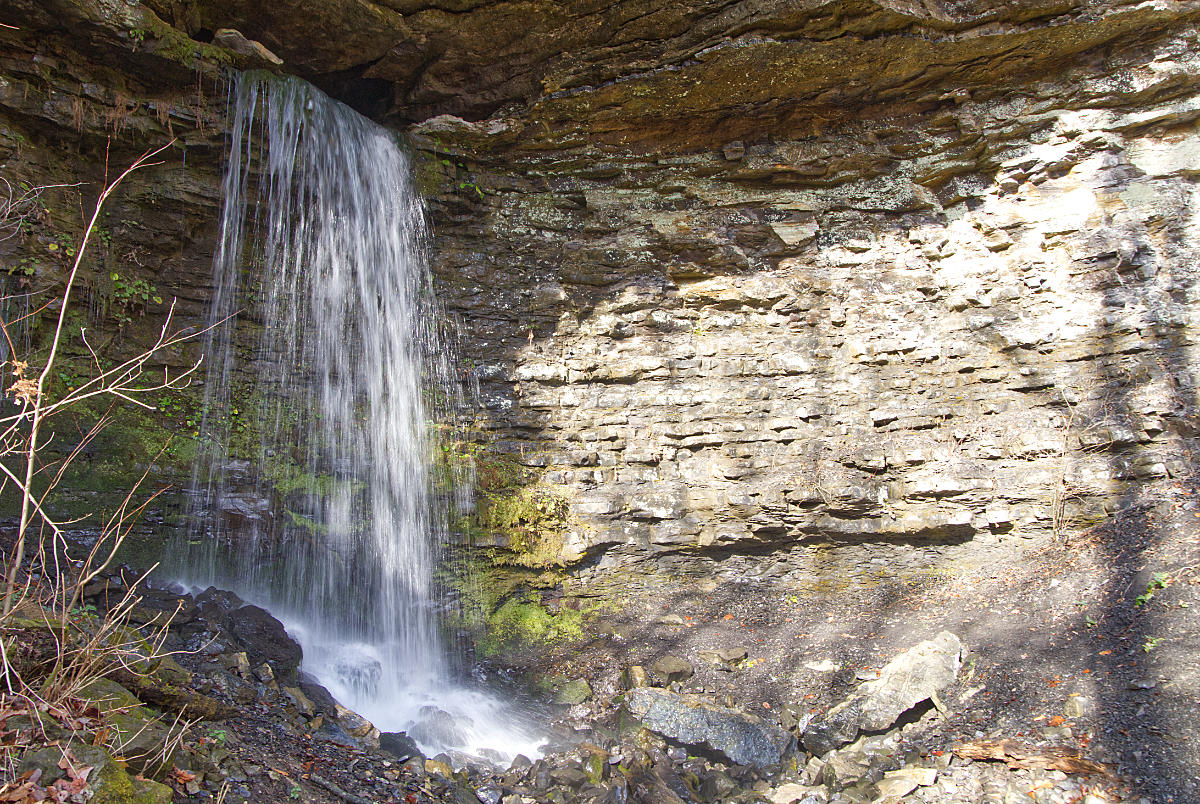
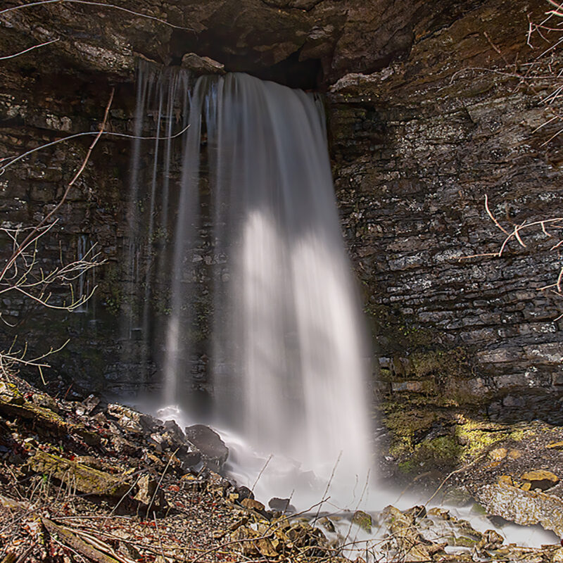
Someone has kindly placed an orange marker ribbon on a tree, so it is easy to spot the crossing. You will need to break out your water shoes again here to cross Wolf Creek. The trail on the far side of Wolf Creek is the only real climb we encountered on the hike. The trail climbs and goes around Big Creek to Big Creek Cave Falls. This is where Big Creek flows out of a cave in the bluff and falls about 30 feet onto the rocks below. It seems that much of the water goes back underground here. The water flow from the cave was much higher than the amount of water flowing down the hill into the creek bed below. Even though the falls are only 30′, they are still very impressive coming out of the opening in the bluff.
Download The GPS File
GPX files are also known as GPS Exchange files. These are text files that contain route data that you can download to your computer and then upload to your phone or handheld GPS unit.

After visiting Big Creek Cave Falls we decided to head back out to the parking area. There are many other areas to explore here, so we decided to come back at a later date and do some more exploring. We had only prepared for a short hike today, and we were eager to get back and relax at the parking area and have some lunch. This was also a chance to enjoy the solitude. We didn’t see anyone else at all until we were preparing to leave.
If you decide to visit the area just be sure and take a GPS or compass if you plan to get off of the old road. Cell reception is spotty all around this area, so another way of navigation is highly recommended. Spare batteries are also essential. I always carry two spare sets of rechargeable batteries for the GPS, even though I have never had to make use of them. Backcountry exploring always has the risk of getting turned around. Better safe than sorry.
If you enjoyed this post please consider following us on Facebook and YouTube.