Pedestal Rocks Scenic Area has been a place on my list of places to hike for a while now. I had read about the area and done some research on Google Earth, so I had a pretty good idea of the terrain. We had even driven by the trailhead a few times on our way to waterfalls in the area. This trip was all about getting to take the hike to Pedestal Rocks and King’s Bluff.
To reach the Pedestal Rocks Scenic Area,
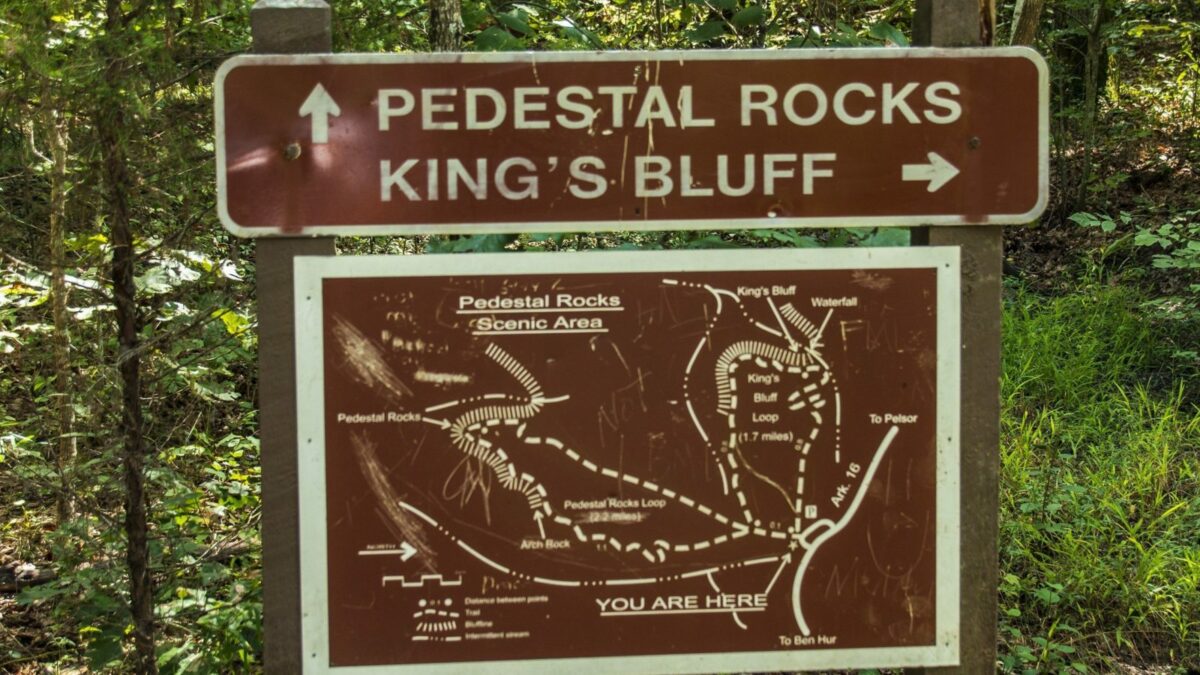
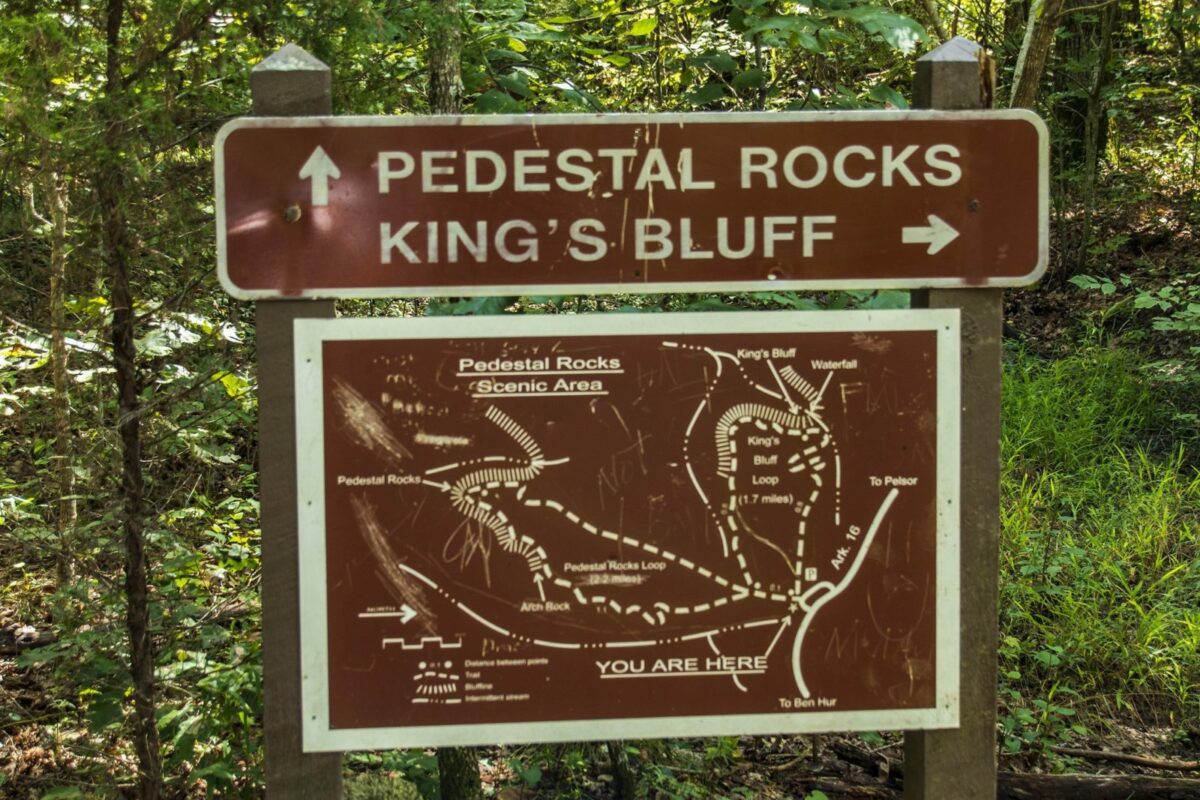
At the trailhead, there is a fork. You will have to decide if you want to hike the King’s Bluff trail or the Pedestal Rocks trail. Both of these are loop trails that will bring you back to the main trailhead. The King’s Bluff Trail is 1.7 miles long and the Pedestal Rocks trail is 2.2 miles.
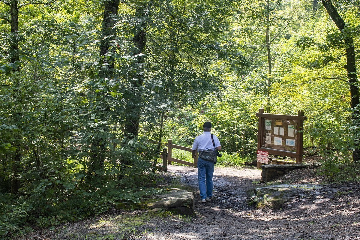
We decided to head out to see the Pedestal Rocks first. The trail is well-worn and easy to follow. You won’t have any trouble staying on the trail.
After you cross the small bridge shown in the photo above, you will see the sign that directs you to the trail. It has a map with trail distances and both areas are clearly marked on the sign. To see a larger version of the photos, simply click on the photo.
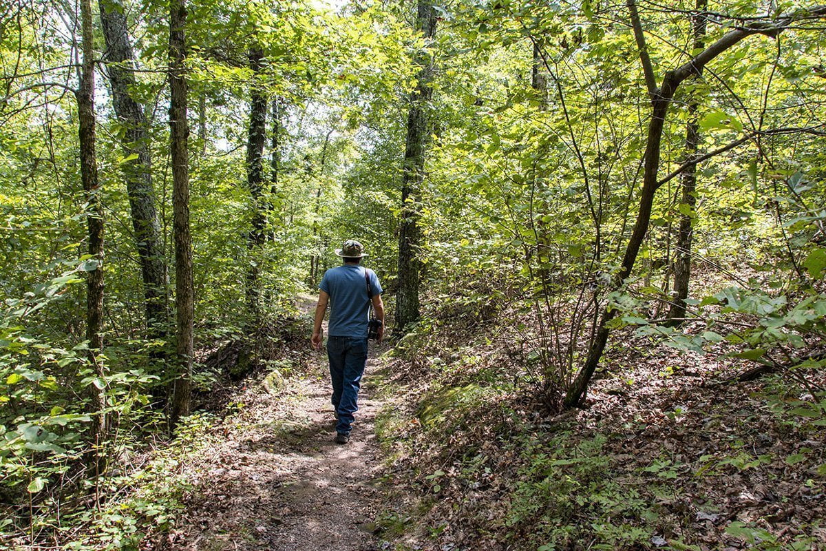
We took the trail on the left and headed for Pedestal Rocks. The trail is rocky and is mostly downhill, so it is a good idea to wear hiking boots. I decided not to change into mine before we left. I shortly regretted that decision. The trail also had some wet areas due to the recent rains in the area. This was another good reason I should have changed into my hiking boots. One day, I’m going to learn not to deviate from my planning at the last minute.
This is a natural area, so there are interesting things to see all along the trail. Many types of native plants surround you on your hike. I took the opportunity to shoot the photo below of some interesting mushrooms I spotted along the trail.
Remember that this is a natural area, so please be respectful of nature and only leave your footprints. Pack out any trash like snack wrappers or drink bottles. Don’t pick the flowers or other flora. Leave them for others to discover and enjoy.

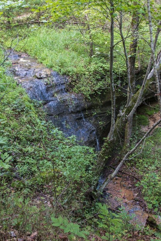
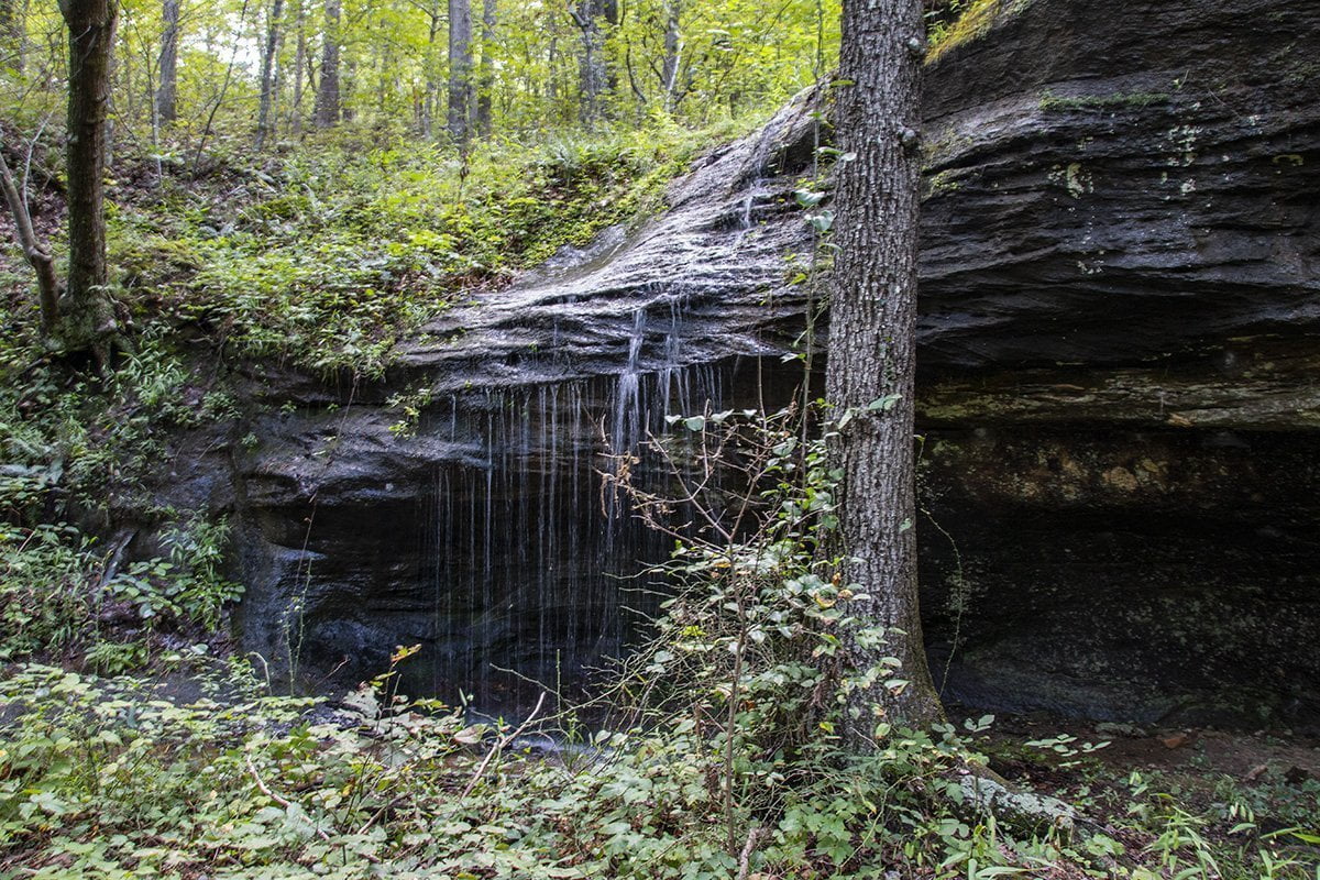
About halfway to the Pedestal Rocks, we encountered a small waterfall. We took a moment to take the trail down and capture a few photos here of the water running down the hillside.
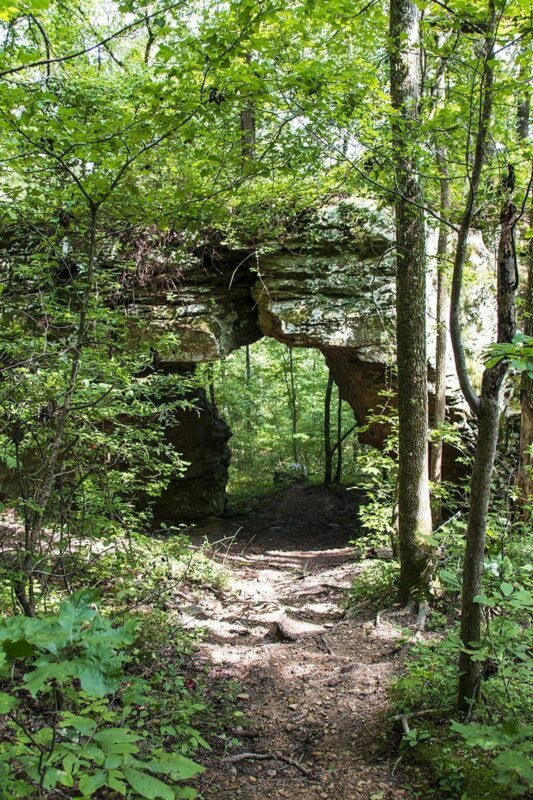
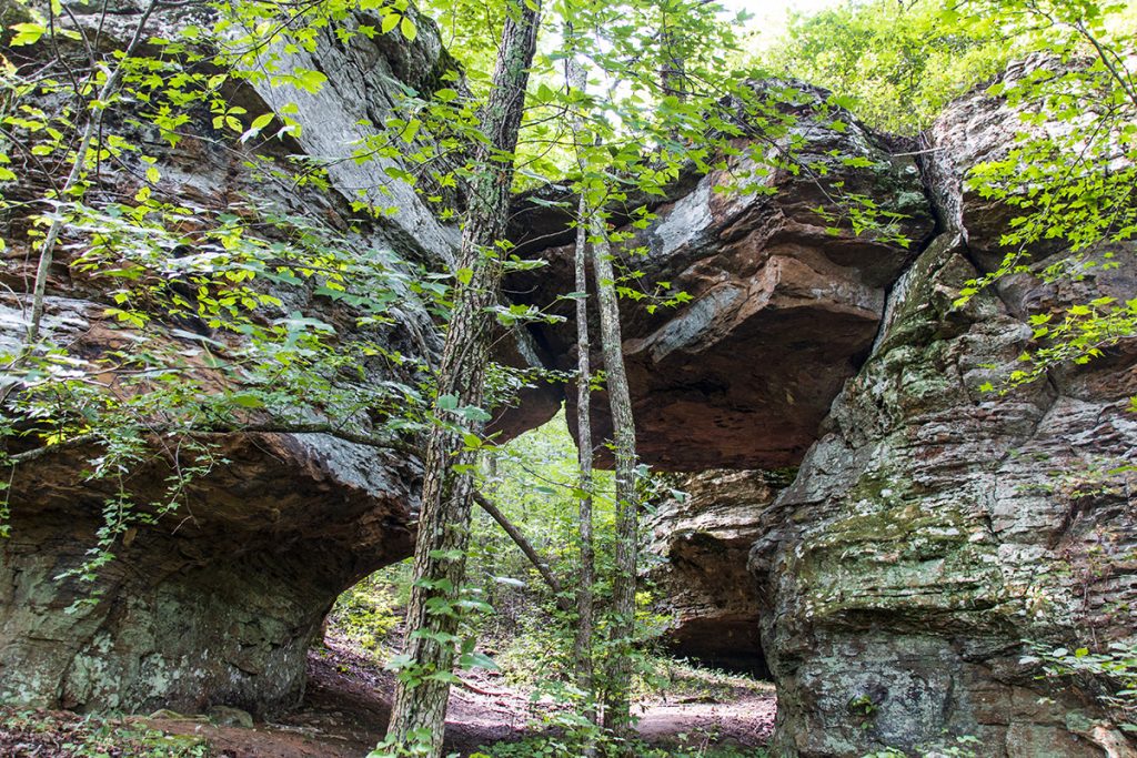
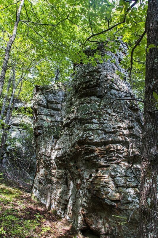
Continue down the trail and you will reach the area for which the trail is named. There are a number of interesting rock formations here. The first one you see is a natural arch formed by rocks. There is a trail that leads down so you can explore this amazing rock formation.
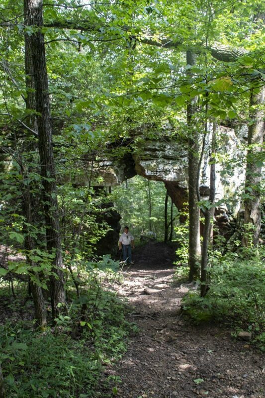
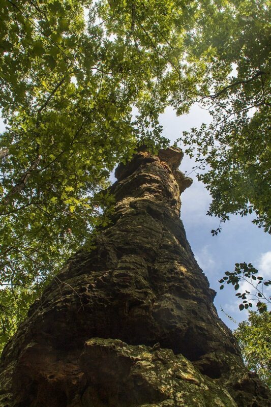
The photo below of me standing under the rock arch gives you an idea of the scale of the massive rock formation.
We climbed back up to the main trail and walked a short distance, and we could see the rock formations we came to see through the trees from the cliffs overlooking them. We did a Facebook Live from that vantage point because it was high enough that we actually had cell phone reception.
It was at this point we realized that if we had simply taken the trail to the right from the arch formation, we would have been right at the Pedestal Rocks formation. So we did a short backtrack and reached the formation so we could get some shots from beside them.
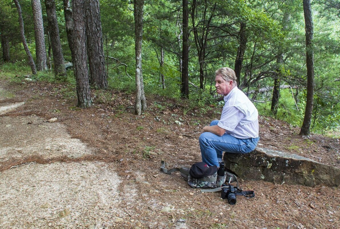
After getting some shots from around the rock formations, we climbed back up to the main trail to take a break. Although the temperature was in the mid-80s, the humidity was stifling and there was no wind moving at all. We were taking a short break and drinking some water when we got a text message from a friend back home. A severe thunderstorm was moving through where we live. They said it had winds around 60 mph and quarter-sized hail. At about the same time, we got alerts on our phones that the storm would be moving into our area shortly.
Since the storm was heading our way, we had to miss hiking to King’s Bluff. We got out just ahead of the storm. We drove through the edge of it on the way home, but we actually missed the worst part. However, when we drove through Harrison, there were limbs down all over the place. It would not have been good to get caught in the open with that storm. It just reinforces that you need to keep an eye on the weather any time you are outdoors because conditions can sometimes change quickly.
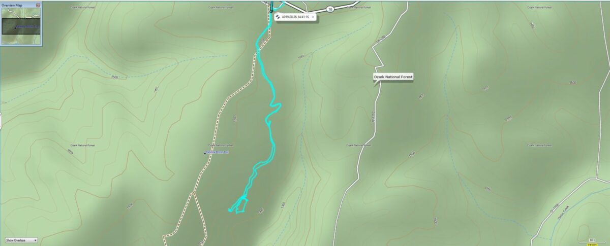
Below is the final track from my GPS unit. It shows we walked a little less than 2 miles. It also showed there was about a 300′ elevation change from the trailhead to where we turned back due to the impending weather. Just be aware that although the trail is mostly downhill in this direction, this makes the trip back to the trailhead mostly all uphill.
King’s Bluff Hike
We finally got a chance to go back and hike King’s Bluff later in the fall. Since it had cooled off, and the weather was forecast to be perfect, we set off on a Sunday afternoon to visit the area and hike to King’s Bluff. Our friends had been wanting to see this too, so they came along and also appear in the video.
The last time we visited the King’s Bluff and Pedestal Rocks area was during the week, and it was hot. There was no one there besides us. This time we visited on a weekend and the parking area was almost full of cars. With that being said, we didn’t see anyone at all until we reached the intersection of the two-loop trails and were almost back to the trailhead.
To reach King’s Bluff from the trailhead, you will cross a small rock bridge. The sign for the King’s Bluff trail will direct you to the right. The trail rises slightly for a short distance and then begins heading downhill. The trail is not difficult and is easy to follow. There are signs along the trail that indicate where the trail doesn’t go to keep you on track. The signs say “Not Trail” with a red circle and line through it.
King’s Bluff is about 0.9 miles from the trailhead. You will come out of the forest onto a wide, flat bluff area with beautiful views of the valley. There is a waterfall to the right. We went several days after a rain, so the waterfall was only a trickle. I would suggest that to see the fall in all its glory, planning to visit right after a substantial rain in the area is your best option.
You should spend a little time exploring the beauty of the bluff area and enjoying the views. On our visit to King’s Bluff, the leaves were just starting to turn. I can imagine the views as even more astounding when the leaves are in full fall colors.
Once you are finished exploring, you can take the trail back the way you came, or continue along the loop trail. The sign says that the trail back to the parking area is actually 0.1
The video below shows some natural wonders you’ll see when you visit.
A word of caution is needed here. As you see in the video, there is a sign that advises that this is a high cliff area. Please stay safe and watch your children if you take them to visit this area. Be safe and enjoy one of the many natural wonders that are so plentiful in the Natural State, especially in the Ozarks.
Please be sure to like and follow our Lost In The Ozarks page on Facebook. Subscribe to our YouTube channel to see all our videos as we post them.
Further information on current conditions in this area can be found on the US Forest Service website.
If you enjoy hiking in the Ozarks then Pedestal Rocks and King’s Bluff Scenic Area should definitely be on your list of places to visit.