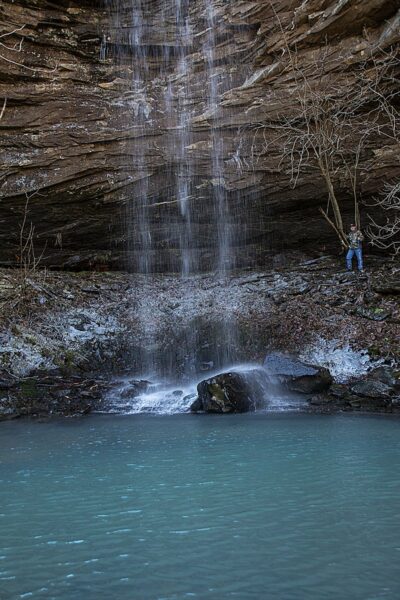
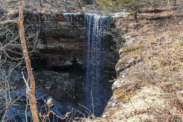
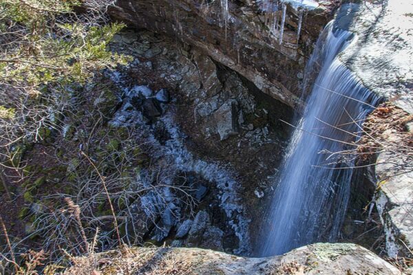
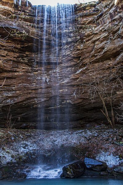
Bowers Hollow Falls is located in the upper Buffalo River Wilderness. I can say that although we spotted several cars on the way in we had the whole trail to ourselves. Let me just say that this is one of the most strikingly beautiful waterfalls we have visited. It is listed as 56′ tall, but it seems taller when you are looking down from the bluffs surrounding the falls.
We set out at around 8 a.m. on a cold morning in January 2021 to drive down to the trailhead. We came in from the north and used Highway 43 from Harrison to Ponca and the Lost Valley Area. If traveling from the north when you reach the intersection of Highway 43 and Highway 21 turn left and travel about 1.2 miles and turn right on Cave Mountain Road (County Road 5) at the Hawksbill Crag sign just before you cross the Buffalo River Bridge.
This road is very steep and rough. It can be very slick in wet weather also. It took us 45 minutes to travel a little less than 10 miles to the trailhead. At around the 8.6-mile mark, you will see FR-1410 to the left. Stay on FR-1410 for a little over 1.5 miles. On your left, you will see FR-1410B. If you don’t have a 4WD be sure and park here. This also adds about a mile to your hike. However, going past here without a 4WD IS NOT a good idea. The road is rough and muddy and could easily get you stuck without a high-profile vehicle.
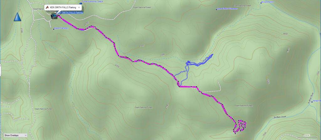
At the T in the road, there are a couple of parking spots. There was one truck there when we arrived, so we were able to park there. However, you can drive a short distance to the right at the T and park at Kapark Cemetery. We didn’t make it down there this time, but we plan to return when the days get a little longer and try to get to the other two falls here. They are Smith Falls and McClure Falls.
After marking the Jeep location in my GPS we started our hike down the trail. This is not a well-worn trail, but it wasn’t a complete bushwhack either. I do recommend a GPS with the coordinates to the falls if you decide to try this one. You can download the GPX file below and upload it to your GPS unit and you will have the track to the falls.
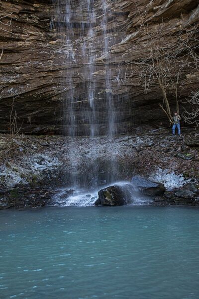
To get below the falls you can walk about a 1/4 mile along the top of the bluff line, and you will find a break in the bluff line where you can get down fairly easily. Then you can make your way back below the falls. We found that staying close to the bluffs is the easiest route to get below the falls.
360° Photos. Use Your Mouse Or Move Your Phone To Look Around.

The camera we use for 360° photos. Click the photo to get yours today!
Download The GPX File
GPX files are also known as GPS Exchange files. These are text files that contain route data that you can download to your computer and then upload to your phone or handheld GPS unit.
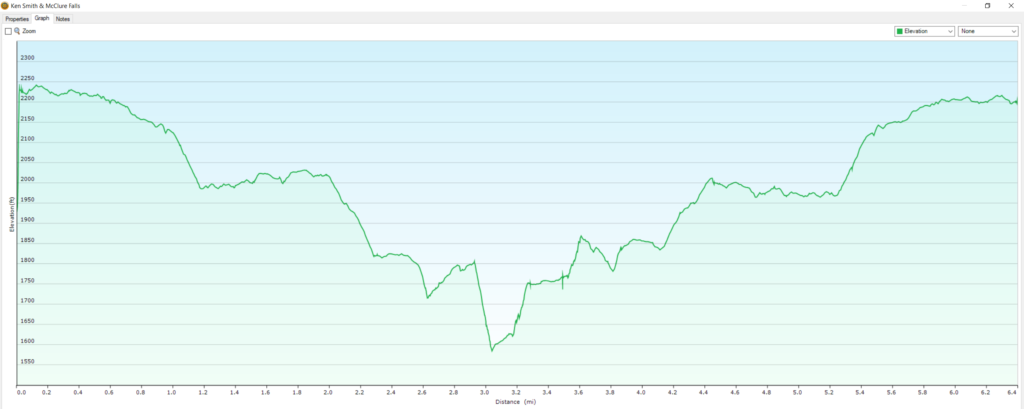
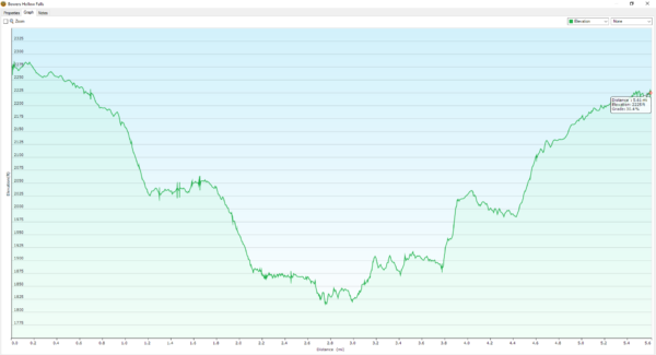
Elevation Graph
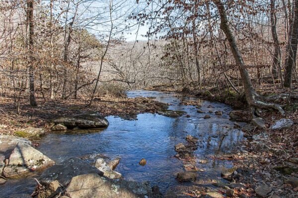
Please be aware that this is one of the few places that Google Maps gets wrong. You can see the actual location if you put in the GPS coordinates from above. You will see it on the map if you look up and to the right from the pin. Look for a blue-green pool in the valley along the creek running west to east.
On the map above click on “View Larger Map” to go to Google Maps. You can copy & paste the code below into Google Maps to view the location if needed. You can also use the code in Google Maps on your phone. Use the satellite view for the best overview.
Code
VH26+JJ Deer, Arkansas
2022 Update
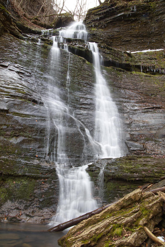
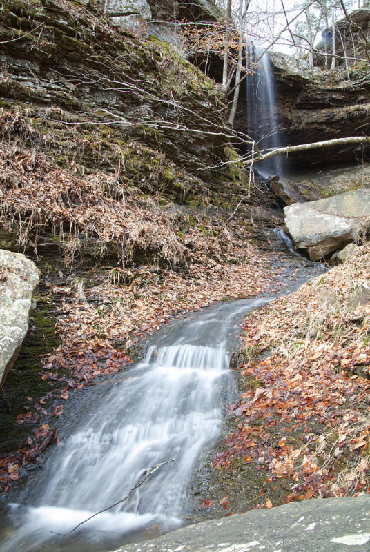
Ken Smith & McClure Falls
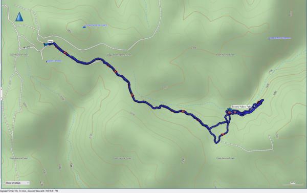
We went back to the trail for Bowers Hollow Falls in mid-February 2022. The day was cold and windy, but that also meant we had the whole place to ourselves.
The entire hike was measured by my GPS as 6.4 miles. This included the walk around the bluff line and the climb down below Lower Ken Smith Falls and then around to below McClure Falls. If you decide to climb down be very careful. It is steep and slick. It can be treacherous in places because there is a large amount of finely broken shale which shifts underfoot easily.
The climb down was well worth the views of the waterfalls from below, and the towering bluffs rising above our heads. The same bluffs we had just walked were now towering over us in stark contrast to the clear blue sky.
Download The GPS File
GPX files are also known as GPS Exchange files. These are text files that contain route data that you can download to your computer and then upload to your phone or handheld GPS unit. Donations help us to continue to bring you information about the Ozarks. No donation is required to download the file, but they are all greatly appreciated!