The Big Bluff Goat Trail is a spur trail off the Centerpoint Trail in the Ponca Wilderness of the Buffalo National River. You start your hike at the Centerpoint trailhead next to Highway 43 at Compton, AR. This trail gets crowded during warmer weather. If you get there and the lot is full, you can park across the highway where a sign is posted. Parking there will cost you $5, so you might want to get to the parking area early.
From the trailhead, the trail follows an old road along the ridge for a while. In the winter, when the leaves are off the trees the views of the surrounding hills and valleys are amazing. I can see how it would look different during spring and summer, and many of the views would be blocked by the trees. This is the flattest walking of the hike. Once you start downhill the trail is mostly downhill. It is rocky with downed trees and large rocks you have to walk around, or under.
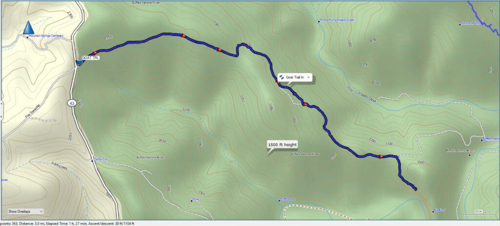
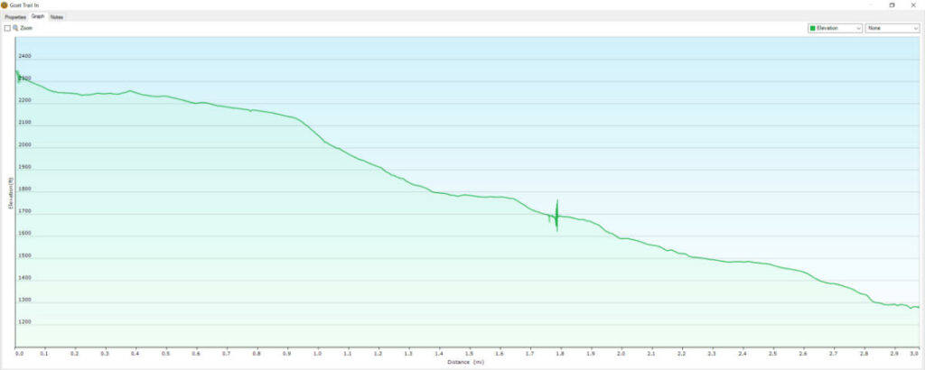
My GPS measured the hike at 3 miles each way from the Centerpoint trailhead down to the Big Bluff Goat Trail. There is about an 1100′ elevation change from the trailhead to the Big Bluff Goat Trail. Check out the GPS map and Elevation graphs below. You can also download the GPX file.
Download The GPX File
GPX files are also known as GPS Exchange files. These are text files that contain route data that you can download to your computer and then upload to your phone or handheld GPS unit.
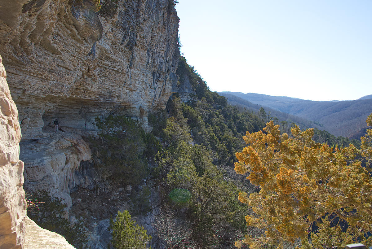
At a little over 2.5 miles into the hike, you will arrive at a campsite and a broad area of bedrock where the trail splits. Take the right fork to head down to the bluff. This is the Big Bluff Goat Trail. The trail will continue downhill and along the bluffs. There is even a hole in the rock that you crawl through to get out on the trail along the bluff. This is one of the scenes in the video above. Below is a 360° photo of the spot where the trail splits.
At the end of the Goat Trail, you arrive at Big Bluff. The bluff is about 550′ above the Buffalo River. This is one of the tallest bluffs between the Appalachians and the Rockies. Check out the view from the bluffs by clicking the icon below to begin loading the 360° photo.
If you want to hike the trail from Centerpoint to Big Bluff, you should bring plenty of water and some snacks. This is especially important during the warmer months. You should also be in fairly good shape, because the 3 miles back to the parking area is mostly uphill, with some grades above 25%. The round trip took us about 4 hours, and we stopped and had some trail mix and just enjoyed the views at the bluff. Not too bad for a couple of guys around 60 years old! Not as good of shape as the young lady we ran into on the trail that was running the trail back up, but still not bad.
Be sure and watch our video to see the sights on the Big Bluff Goat Trail hike, and be sure and subscribe to our Youtube channel to be notified when we upload new hiking videos. You can also find us on Facebook, and join our Facebook Group to follow all the happenings as we get Lost In The Ozarks.