Update Mid-February 2022
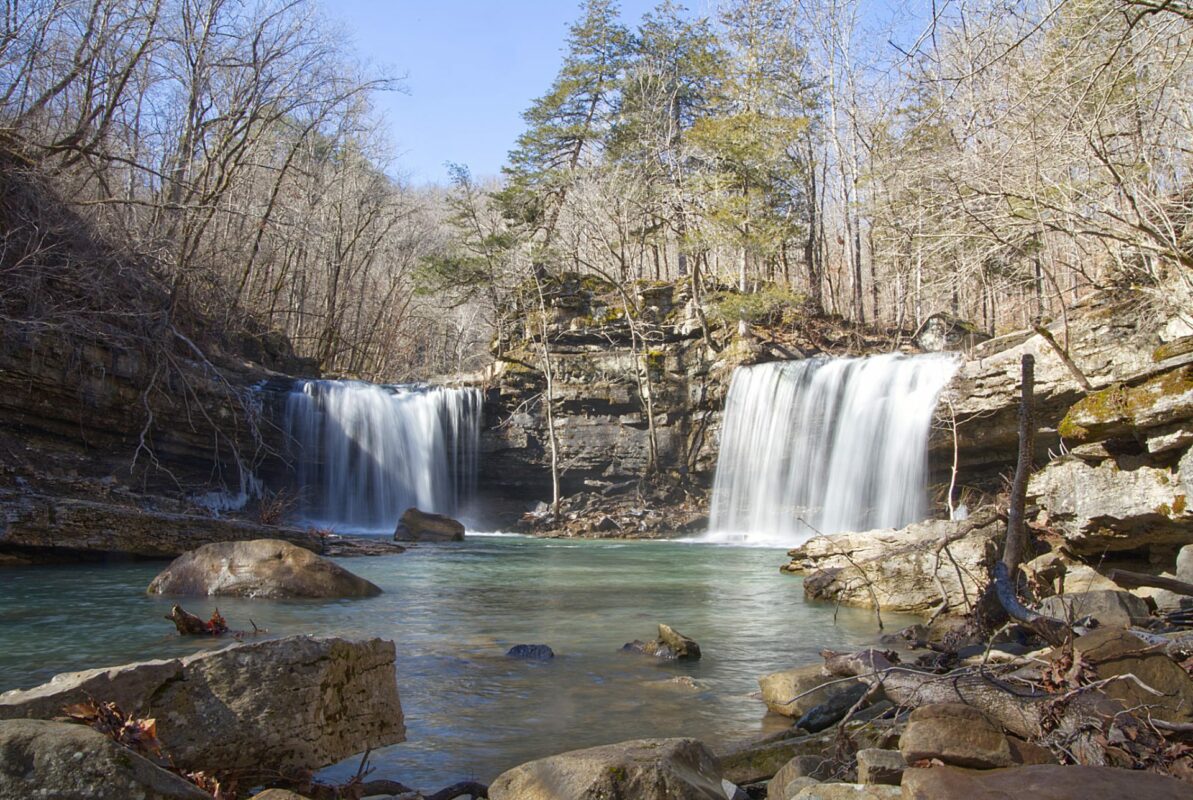
If you remember, we did a story about our camping and hiking trip to the Richland Creek Wilderness back in November of last year. On that trip, we tried but failed to reach Richland Creek Falls, so we went back in mid-February 2022 and hiked both Twin Falls and Richland Falls. You can watch the video of the hike below.
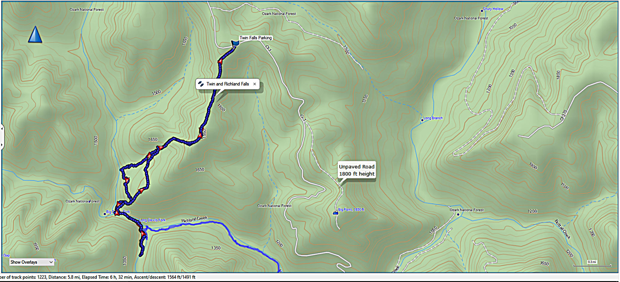
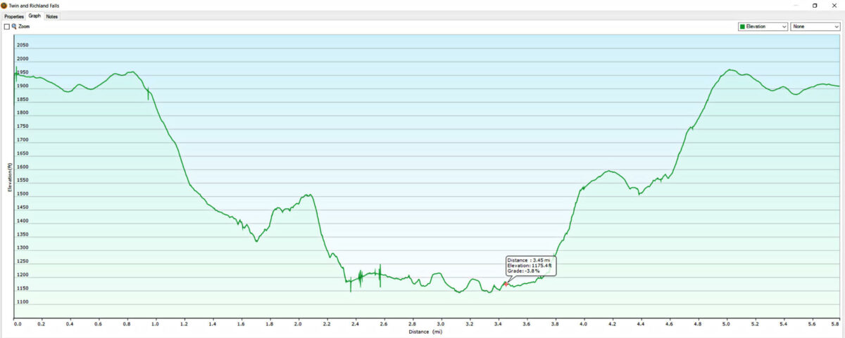
The entire hike was 5.8 miles. We were able to cut off some distance on the way back by using a direct route uphill to intersect the trail. You can see that and also download the GPX file below.
Download The GPX File
GPX files are also known as GPS Exchange files. These are text files that contain route data that you can download to your computer and then upload to your phone or handheld GPS unit.
Richland Creek Falls November 2021
Richland Falls is located in the Ozark National Forest on Richland Creek. Back in mid-November of 2021, we took a 4-day camping trip to the Richland Creek Recreation Area to hike a few of the waterfalls. This is one of the hikes that we didn’t quite make it to the falls, but the amazing scenery made it not so disappointing.
You can read about the other hikes we did by using any of these links. Punchbowl Falls is a long but scenic hike, Six Finger & Fuzzy Butt Falls are easily accessed from Falling Waters Road, Terry Keefe Falls is only a short 1/2-mile hike from the road as well, and Lower Horsetail Falls is a short hike from the road too.
This area is a waterfall hiking enthusiast paradise. It contains 35 named falls, with hundreds of smaller unnamed falls and cascades along the creeks in the area. You can get more information and pick up a handy pamphlet showing all the waterfalls at the Richland Waterfalls Welcome Center in Witts Springs. You can also check out the map below.
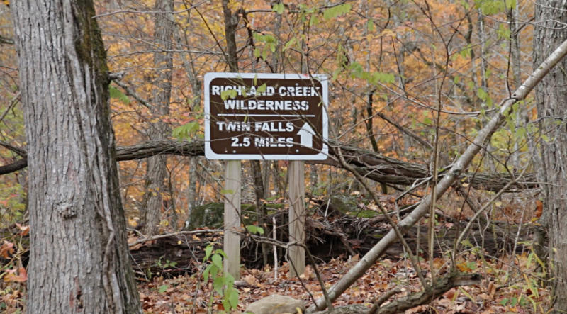
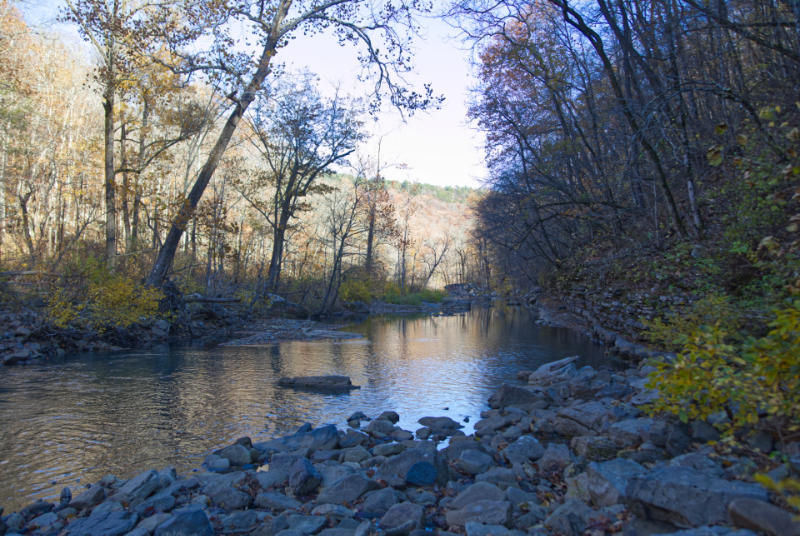
The trailhead for this hike is located in the Richland Creek Campground. There is a parking area as you drive into the campground and a small road with a gate to the right. This road leads along Richland Creek up to where Falling Waters Creek empties into it. There is a sign where the creeks meet showing the trailhead.

The camera we use for 360° photos. Click the photo to get yours today!
This is the place where it is very likely you will need to make your first water crossing, even if there has not been substantial rain. So we put on our water shoes and made the crossing. Twin Falls is a short distance up Long Devils Fork from Richland Creek, and you can follow a separate trail to reach it. This will require another crossing of the creek if you decide to take this trail. But we had our sights set on Richland Falls, so we set out on the trail that follows Richland Creek along the left side of the creek.
The scenery along the trail is amazing. You can view vistas of the creek valley from far above the creek in some areas, and then the trail will wind down to follow right along the creekbed.
After about 2 miles you will come to the spot where Long Devils Fork merges with Richland Creek. This is where you would need to cross if you wanted to hike up to Twin Falls. This is also the point we made our mistake. We decided to follow the trail on the left side of the creek. Unfortunately, as we got to a spot where we could just see the falls in the distance, a rockslide had taken out the trail. I tried crawling through and around some boulders, but there was just no way to go further. At that point, disappointed and tired after close to 15 miles hiked over the last 4 days, we decided to turn back. When we got back to the confluence of the two creeks we had to turn back. It was late when we got started, so by this time, it was getting late afternoon. We didn’t want to get caught on the trail after dark, so we turned back.
As we were heading back we noticed that the terrain on the right side of Richland Creek was much more level than the side of the creek we were on. I suggest crossing the creek at this point to follow the creek to the falls. I know it is one more water crossing, which isn’t pleasant in the cold. It wouldn’t be a big deal in the warmer months, but the water was freezing cold in November.
Be sure and check out this area if you ever get the chance. It is wild and untamed, a true wilderness. There is very rare cellphone reception, so be prepared with offline maps if you go. Or, better yet, have a good GPS receiver with you so you don’t get lost. This is one of the most rugged and beautiful areas that I have seen in Arkansas.