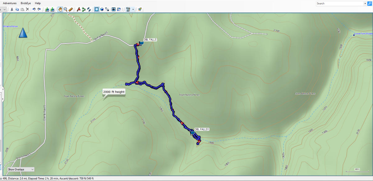
We set out on this hike in mid-March to visit Compton’s Double Falls in the Upper Buffalo Wilderness of Arkansas. It was a great day to hike. There was a cool breeze with temperatures in the upper 50s and a clear blue sky. So we drove down and began the hike around 1:45 pm.
The trailhead for this trail is along Cave Mountain Road in Newton County. If you have ever heard of or read about Whittaker Point/Hawksbill Crag this trail is in the same area. In fact, if you arrive from State Highway 21 as we did, the trailhead is approximately 1.1 miles beyond the trailhead for Whittaker Point. You have to watch closely because the trailhead for Compton’s Double Falls isn’t well marked and there isn’t a parking area, just a slightly wider spot in the road. The GPS coordinates for the trailhead are N35° 53.265′ W93° 28.090′. There was once a sign on the road designating the Upper Buffalo Wilderness/Ozark National Forest, but the only thing left of the sign now is the word, Ozark. If you find the sign, the trail starts right behind it. Also, make sure you don’t park blocking the road, as there is a lot of traffic on this road during good weather.
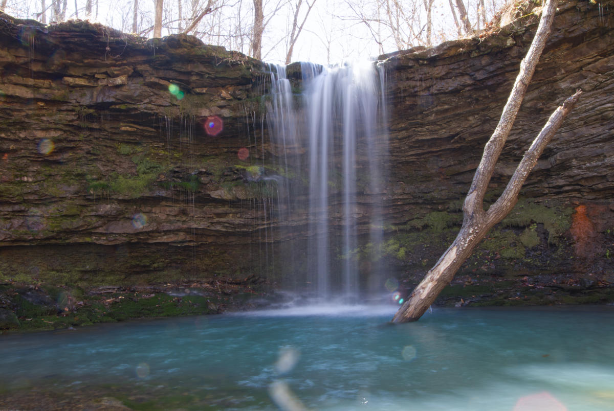
The hike to Compton’s Double Falls is downhill for the first part of the trail. The first 0.3 mile is a pretty steep downhill grade heading in. At the bluff line, there is a fork in the trail. The right fork is a short trail leading down below Amber Falls. Amber Falls is named for the daughter of Tim Earnst, who spent many years documenting the waterfalls and hiking trails in this area. He has a book on Arkansas Waterfalls that is available online at the link. Amber falls is a short waterfall with a pool underneath.
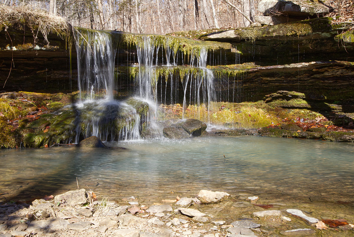
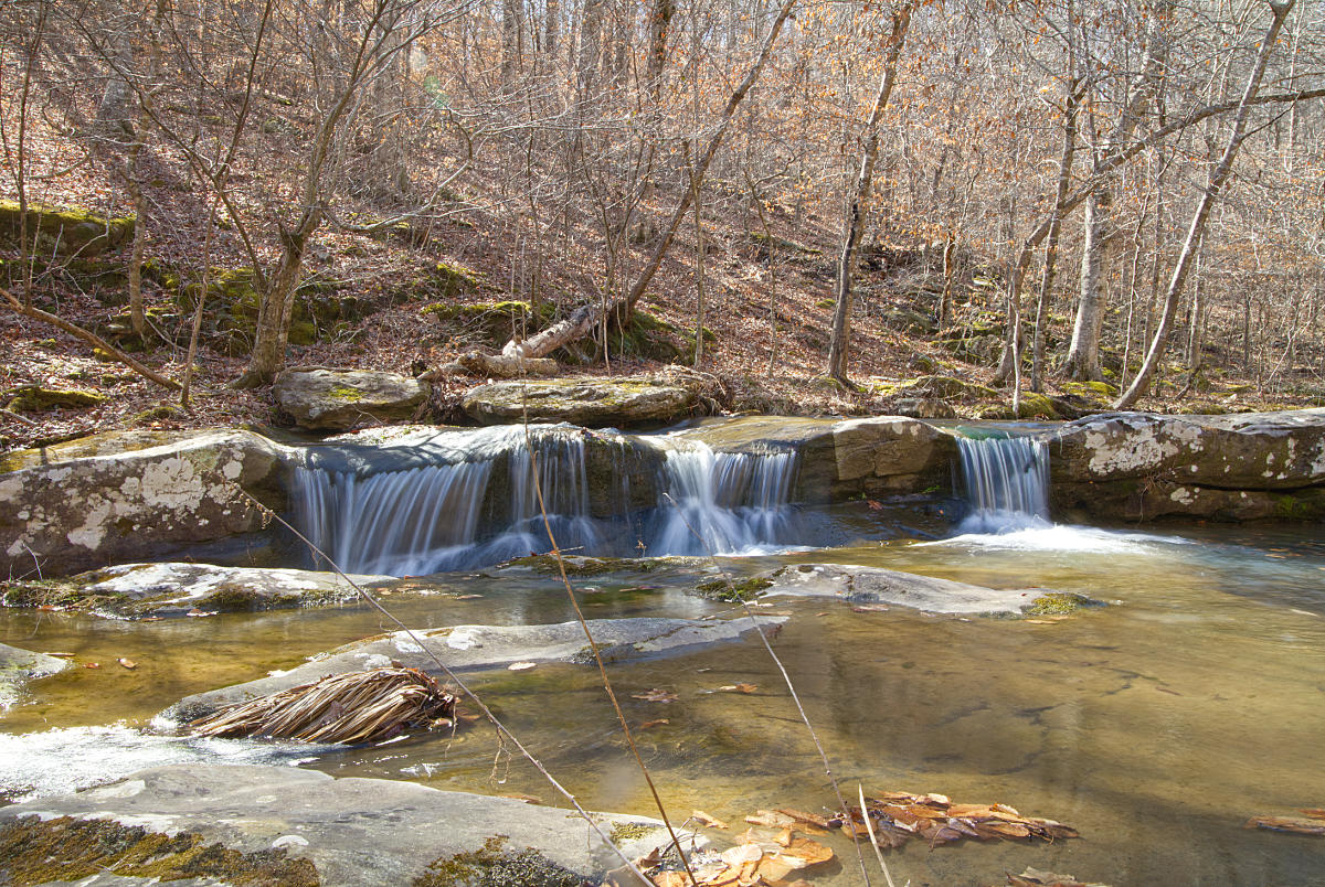
After spending a little time at Amber Falls you can scramble back up to the trail and continue on to Compton’s Double Falls. After a while following the trail along the bluffs, with the creek on your right, you will come to a drainage coming in from the left. This drainage has a small unnamed fall that you will see as you cross the small trickle of water. The photo below is of that unnamed fall.
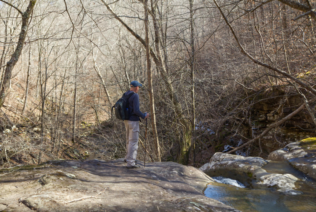
You can cross the creek just below these falls on the rocks and not get your feet wet. Follow the trail around the bluff and there is a spot where I believe you could scramble down and get below this waterfall, but we continued on to Compton’s Double Falls. Just continue to follow the trail (it is fairly well-worn) and you will come to the top of Compton’s Double Falls beside the trail. You can walk into the stream bed and look over the top of the falls. There are also some interesting cascades above Compton’s Double Falls. Below I included photos of my friend Dave at the top of the falls, and a photo of one of the cascades as the water approaches the top of the falls.
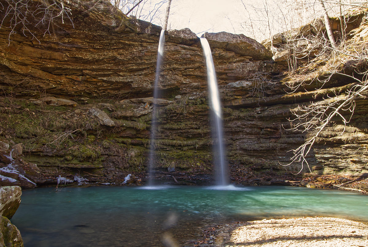
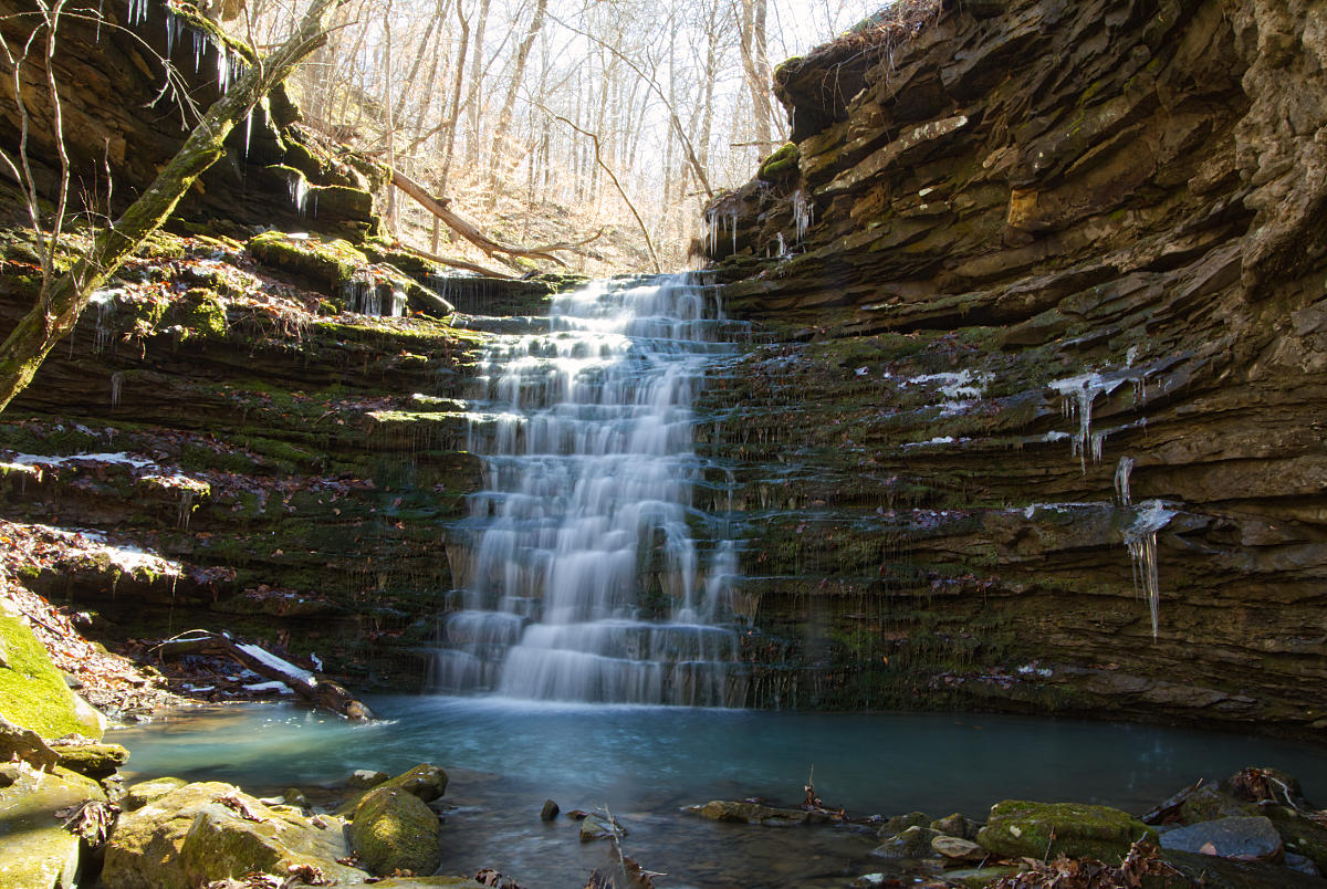
Enjoy some time looking around the top of the falls, then rejoin the trail and continue along the bluff line for a short distance, and the trail leads downhill at a break in the bluff line. This part of the trail is slick and steep, but if you are cautious you should be fine. Once you get down to the creek bed, find a spot where you can cross on the rocks and you can cross the creek again without getting your feet wet. The far side of the creek is a little better walking to get beneath Compton’s Double Falls, and this is the view.

We spent some time here drinking some water and resting on the rocks, and then we had one more waterfall to find. If you look just downstream from the point where you crossed the creek there is a drainage to the right. Go into this drainage for about 50 yards and you will find the beautiful cascade waterfall known as Owl Falls. You’ll have to climb over some rocks to get there, but it is a breathtaking sight, so be sure and see it if you are already this close.
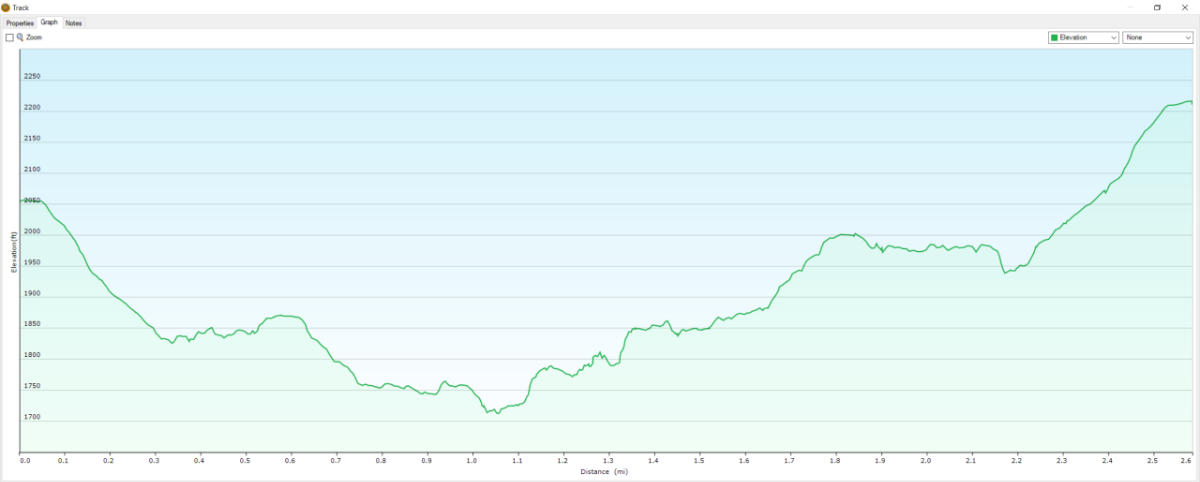
It was at this point that we headed back out. Be prepared for a tough hike out both climbing back up to the bluff and on the last 0.3 miles. Once again, it was well worth the short hike to get there. My GPS showed that we did a total of 2.6 miles, so this is one of the shorter recent hikes we have done. If you’d like to check out some of the other places to visit in this area check out our articles on Bower’s Hollow Falls and Ken Smith Falls. These waterfalls are in the same area but they are considerably longer hikes.
Download The Compton’s Double Falls GPX File
GPX files are also known as GPS Exchange files. These are text files that contain route data that you can download to your computer and then upload to your phone or handheld GPS unit.
Plus Code
VGHP+PW Kingston, Arkansas