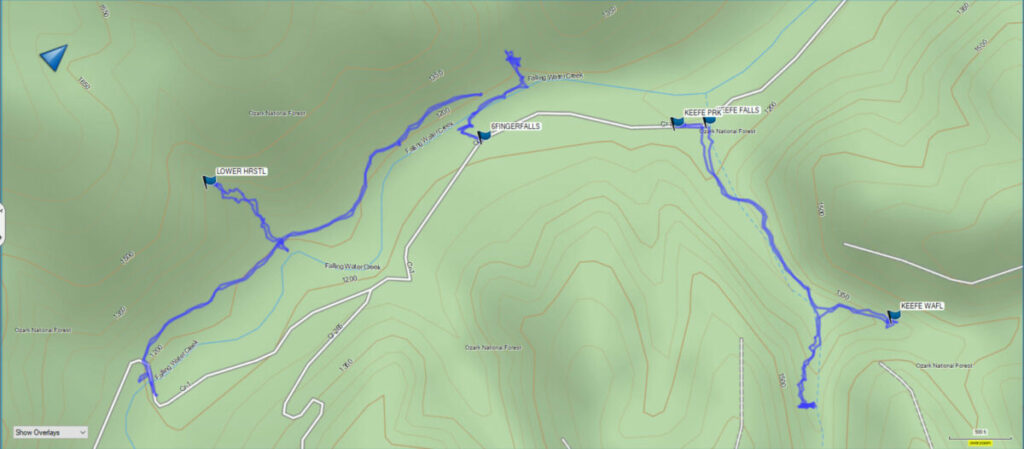
Lower Horsetail Falls is found off Falling Waters Road in the Ozark National Forest. You can reach the falls by following what is known as the Horse Trail. You can use the map below to find the trailhead and parking.
To reach the Horse Trail take Highway 16 off Highway 7 from Sand Gap East toward Ben Hur. Turn right onto Falling Waters Road. This road is fairly well maintained, but lower cars may have trouble with it. You will continue past Falling Water Falls (stop and spend some time here because the falls are directly beside the road) and eventually reach a narrow bridge. Park on the other side of the bridge and walk back across the bridge. The Horse Trail will be on the right.
This trail generally follows the creek. As you can see from the map below we hiked a little over two miles out and back.
Download The GPS File
GPX files are also known as GPS Exchange files. These are text files that contain route data that you can download to your computer and then upload to your phone or handheld GPS unit.
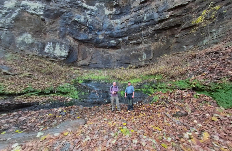
Lower Horsetail Falls is a little less than a half-mile down the trailhead. The trail to the falls is a little hard to see off to the left. A clue you have found it is that there is a short trail to the right leading to the creek and a lovely cascade waterfall that you can walk out on when the creek is low. The trail up to the waterfall is fairly steep, with large boulders littering the drainage that forces you to scramble up and around them. When you finally make it below the falls the view is amazing.
I should also note that the map above includes the marker for upper horsetail falls. We didn’t make the climb up there on this trip since it is said to be a much smaller waterfall, and there hadn’t been any rain here for some time, so there was little water flowing over the falls when we visited.

The camera we use for 360° photos. Click the photo to get yours today!
Below I have added a virtual 360 tour of the hike to the waterfall. Click the icon to start loading the tour.
Once you finish this short hike you can drive around a mile down the road and you can see Six Finger and Fuzzy Butt Falls right beside the road too. By doing this you can see four waterfalls in a day easily. That sounds like a fun day trip, now doesn’t it?
If you would like more information about hiking and other activities in this area be sure and visit the website for the Witts Springs Richland Waterfall Welcome Center.