I was invited on a group hike to check out the Indian Creek Trail to Eye of the Needle on the Buffalo River on Friday, December 10, 2021. We met at Kyle’s Landing on the Buffalo and gathered our gear for the hike after introductions all around. It was a warm day in December for northern Arkansas, with highs forecast in the lowers 70s and high humidity.
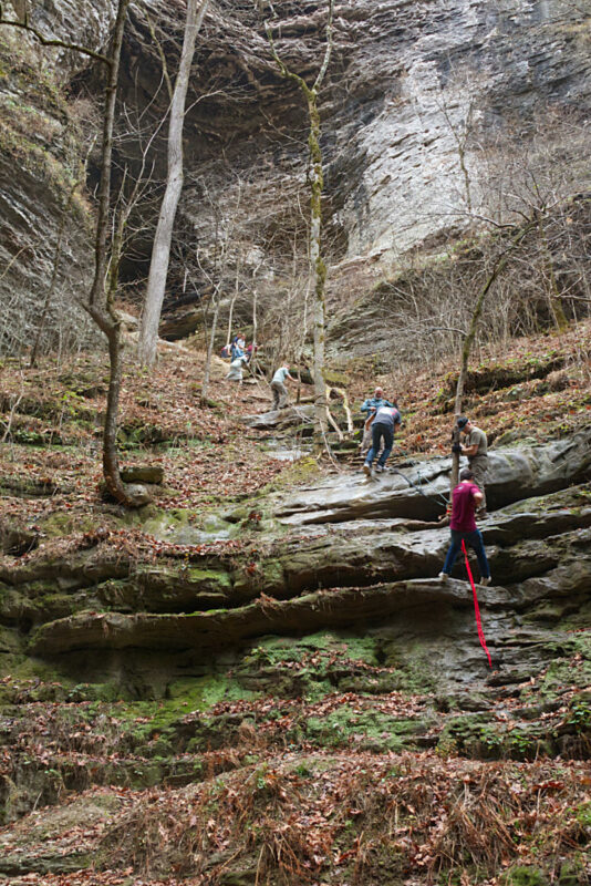
The Indian Creek Trail is about 5 miles in and out to the part of the trail where you have to use ropes to ascend the bluff. I had a knee injury that I figured would slow down everyone else, so I didn’t make the climb. This trail is rated moderate to hard in most online resources, and I would agree. I don’t think my legs have ever been this sore after a hike.
The weather made for interesting conditions, as the rocks were all coated with condensation from the humidity. This made walking on the smooth rocks a little more interesting than it would be normally. There were a few slips and falls, but nothing major.
The trailhead for the Indian Creek Trail is to the left as you enter the campground at Kyle’s Landing. Just follow the road to the left and park at the back of the campground. There is a sign marking the trailhead, and also a map of the area posted. The Indian Creek Trail crosses both the Buffalo River and the Ozark Highlands trails at points near the trailhead. Just continue to stay to the left and you will be on the trail.
The first part of the trail goes through the bottoms near the Buffalo River. If you observe the trees around you it is easy to see how the river rises and rushes through this area, with lots of debris caught in the trees along the trail. You wouldn’t want to be caught here during a flash flood.
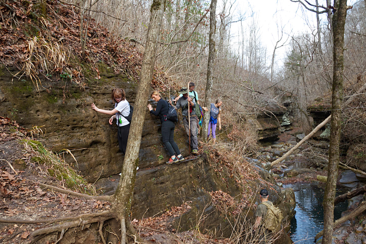
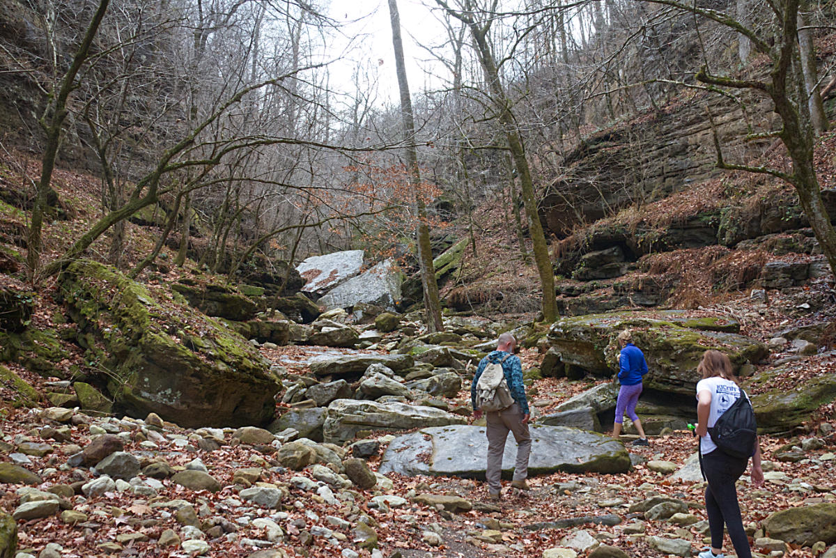
As you continue along the trail you will enter the creekbed of Indian Creek. Following the trail can be challenging at times, as it is not well marked. But if you take your time you can find the route up and around the water and huge boulders. As you can see from the cover photo, sometimes you may have to walk a thin ledge to keep from getting wet. This makes it a somewhat challenging trail.
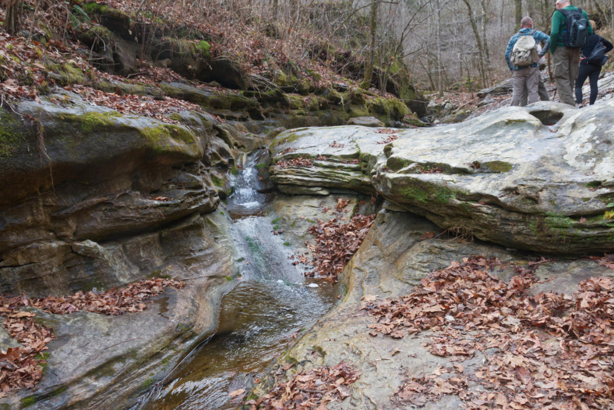
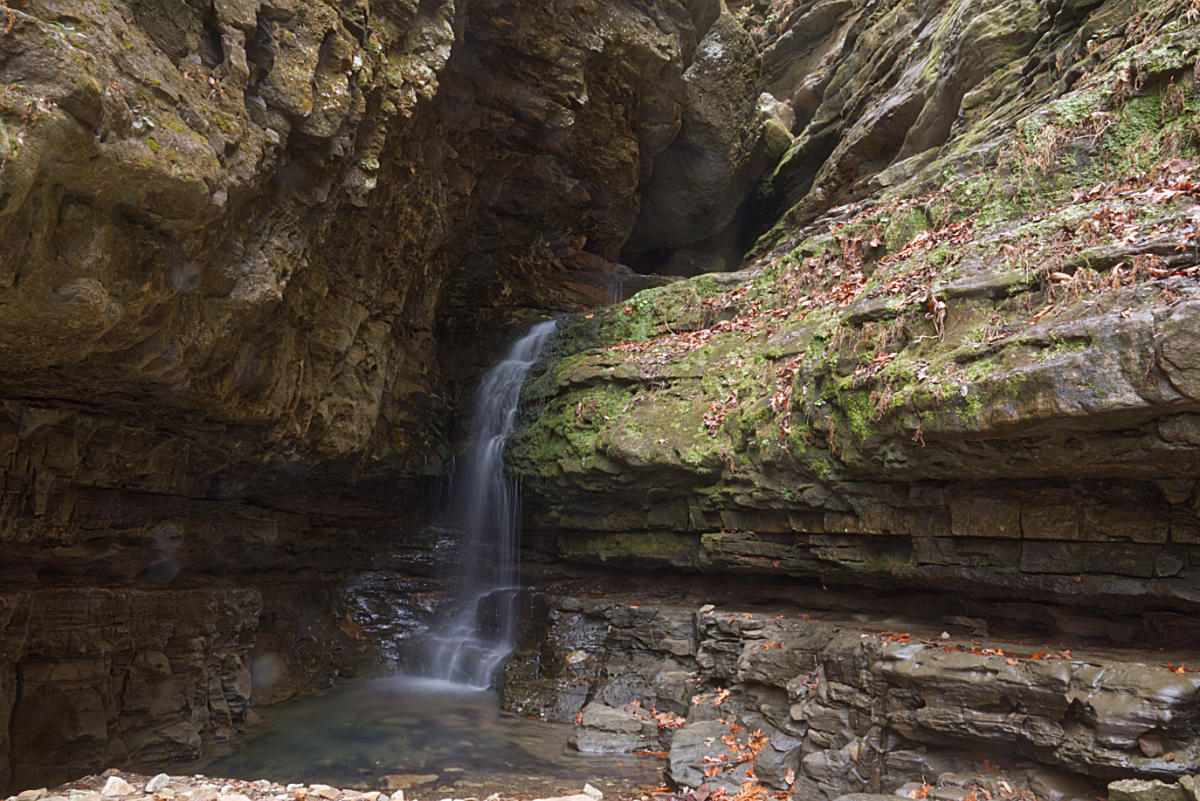
After following the trail a little over 2 miles you reach a box canyon and a small waterfall that is coming out of the rocks. This is the point where you need to climb to reach the Eye of the Needle.
Since I stopped at this point I was able to explore the canyon and the bluffs surrounding the creek. This rugged wilderness is amazingly beautiful. There are waterfalls and caves to explore, and you will observe springs flowing from the rocks along the sides of the creek. At many points along the Indian Creek Trail, the water flows underground beneath your feet, only to emerge as it encounters bedrock. Below is the small waterfall at the point where you begin the climb.
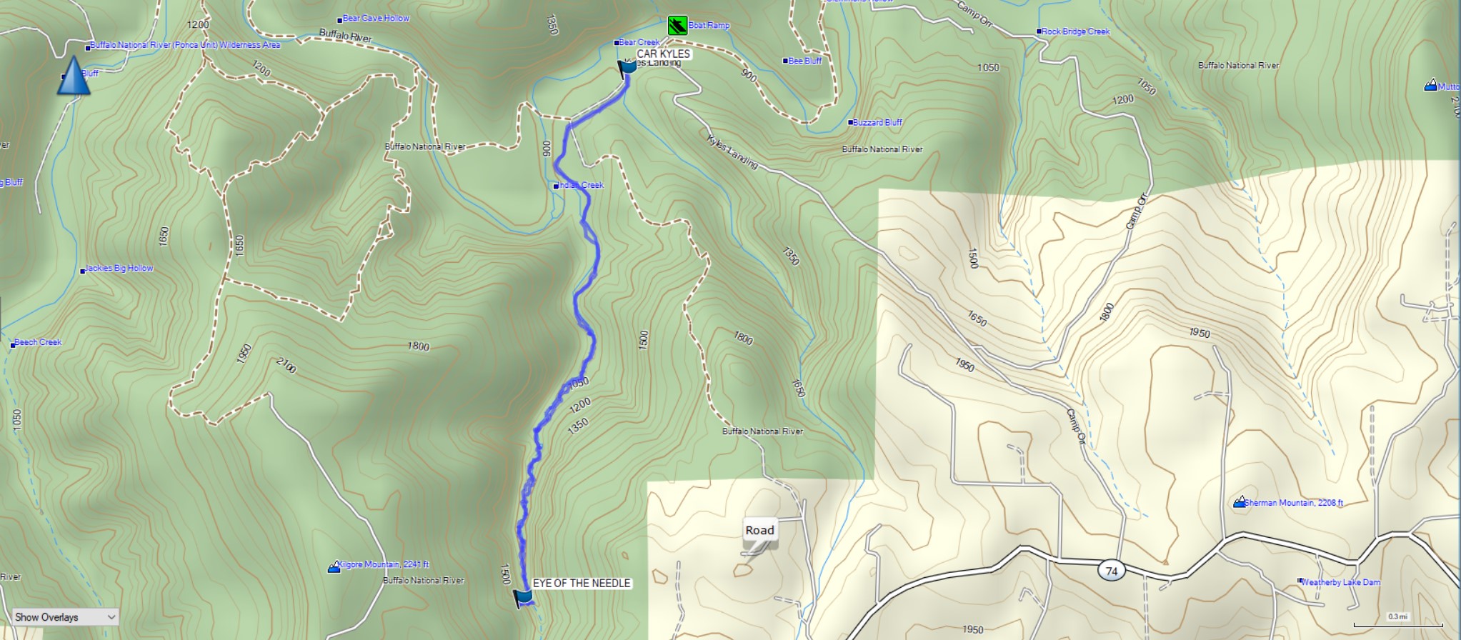
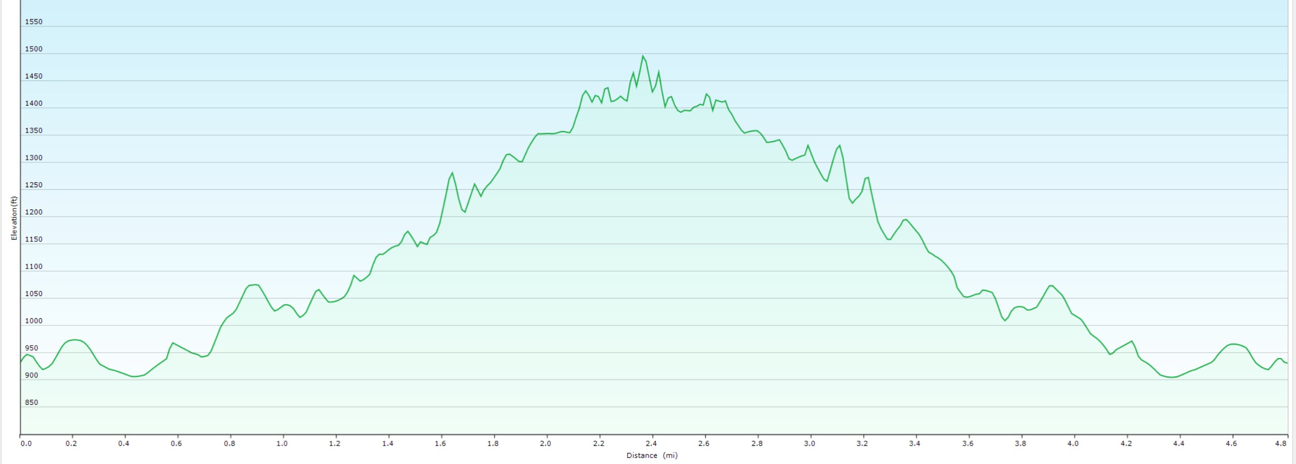
Below is a trail map and elevation graph from my Garmin GPS of the hike.
Download The GPX File
GPX files are also known as GPS Exchange files. These are text files that contain route data that you can download to your computer and then upload to your phone or handheld GPS unit.
I put together a virtual tour of the trail using our 360° Go-Pro camera. This will give you an idea of the rugged beauty that awaits you on this trail. Use your mouse to look around the scene. Use the scroll wheel to zoom in or out. If you are viewing on a phone with motion-sensing tech you can simply move your phone around to view the scene. These are large files to give you the best quality, so please be patient as they load.

The camera we use for 360° photos. Click the photo to get yours today!
Click the grey icon to begin loading the virtual tour.
Check out some of our other hikes like this one to Six Finger Falls, or this one from last year to Hemmed In Hollow Falls. Be sure and follow us on Facebook and check out our Youtube Channel.