
The Buzzards Roost hiking trail and scenic area is located in the Ozark National Forest in Pope County, Arkansas. The trail is basically an old ATV road and is fairly flat. Continue reading to find out the location of this trail and some of the highlights of the scenic wonders you can see there.
How Do You Get To Buzzards Roost Trail?
To reach the trailhead from the north take Highway 7 south to Sand Gap, also labeled on some maps as Pelsor, Arkansas. At the crossroads of Highway 7 and 123 in Sand Gap turn west and follow Highway 123 for about 4.7 miles. Look for FR 1802 on the left (south side of the road). FR 1802 is a relatively smooth gravel road so it should be passable with most vehicles. You will pass the parking area for the Bear Creek Drainage on the way in. You can read about Bear Creek and the waterfalls there in this article.
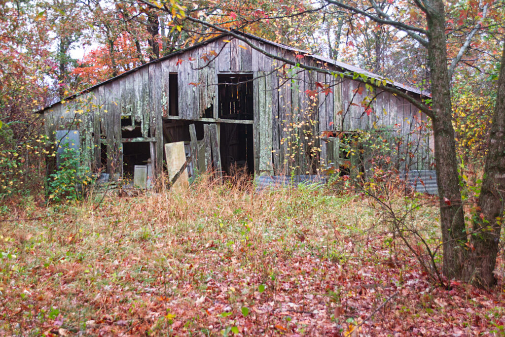
You will reach a fork in the road, and you want to stay left on FR 1805. Follow this until you see a white house on the right that appears abandoned. There is a small parking area on the left beside an old barn.
The distance from Highway 123 to the parking area is about 6.7 miles. I suggest setting your odometer when you turn off the highway. Alternatively, you can download the GPX file below and enter the coordinates of the parking area.
How Long Is The Hike?
The trail is about 2 miles each way. You can add another 1/2 mile each way if you visit the large natural arch that is a little further along the trail after you visit Buzzards Roost. Below is a photo of the large natural arch.
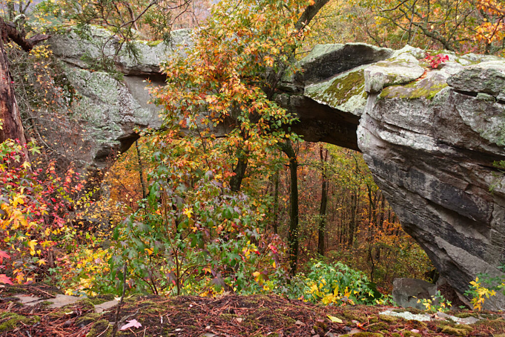
If you visit the large arch the total distance will come close to 5 miles. But since the trail is mostly flat I would rate this one as easy to moderate.
To reach Buzzards Roost you should take the trail to the right before you get to the large arch. If you decide to see the arch first, just track back along the trail until you see the ATV trail to the left. There aren’t any markings but it should be easy to spot. You will reach a large cleared area that appears to be a popular camping spot. The trail starts downhill at the back of this clearing. Just a short distance downhill you will see Buzzards Roost.
What Can You See at Buzzards Roost?
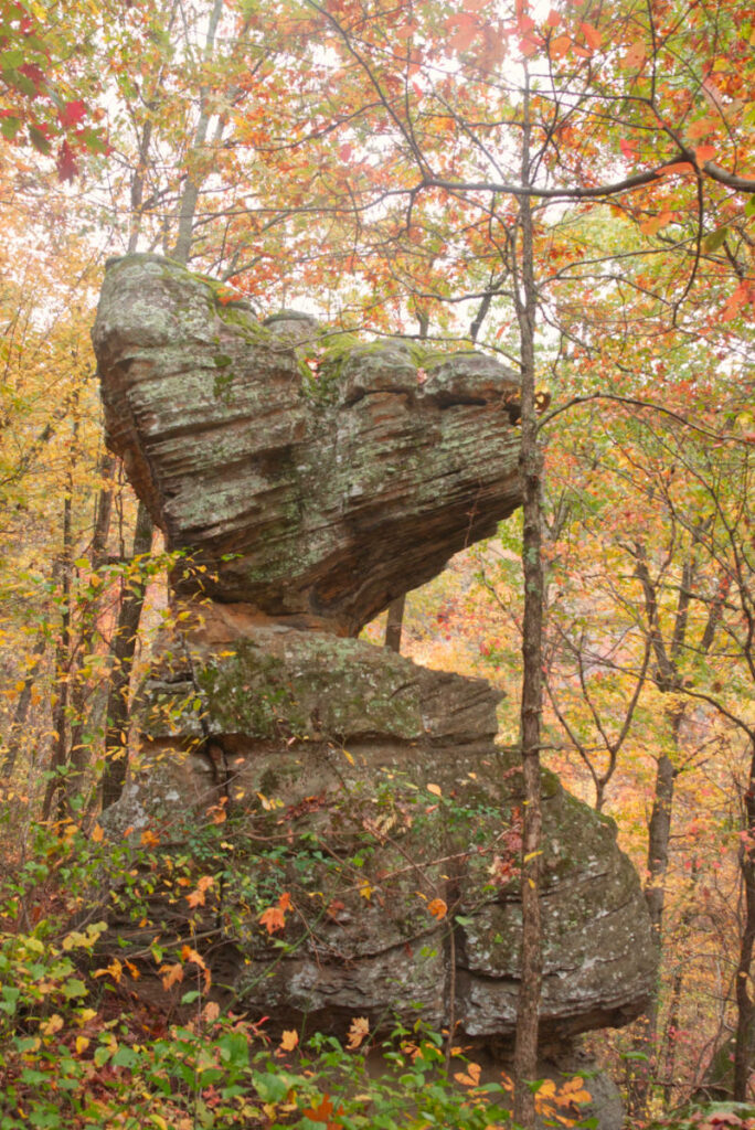
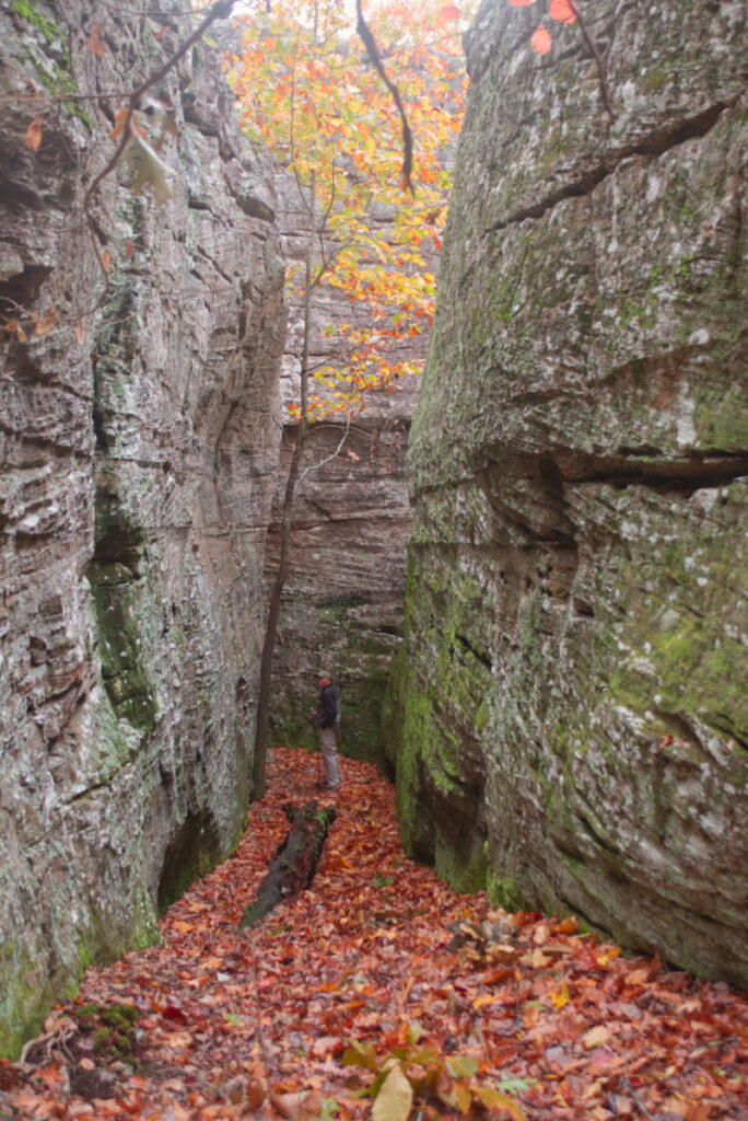
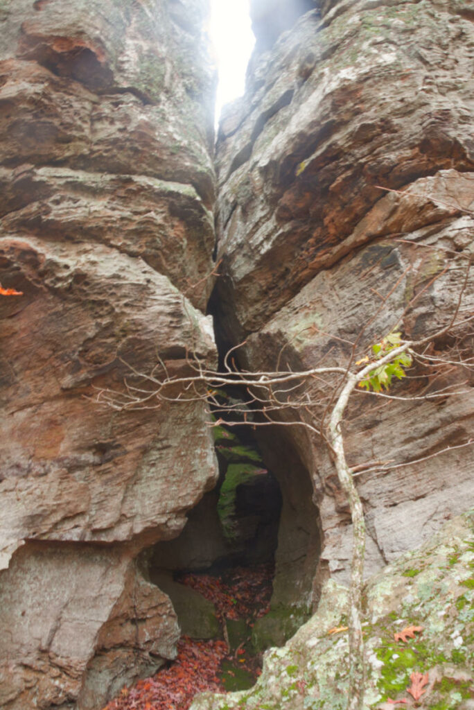
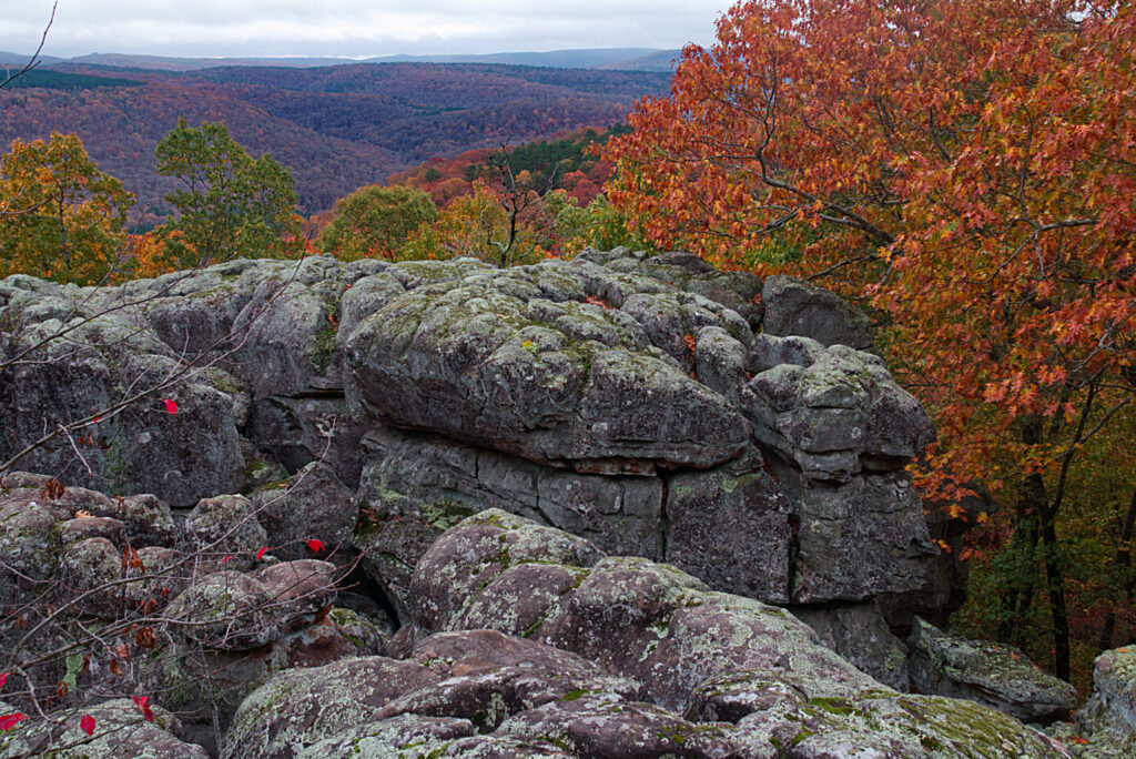
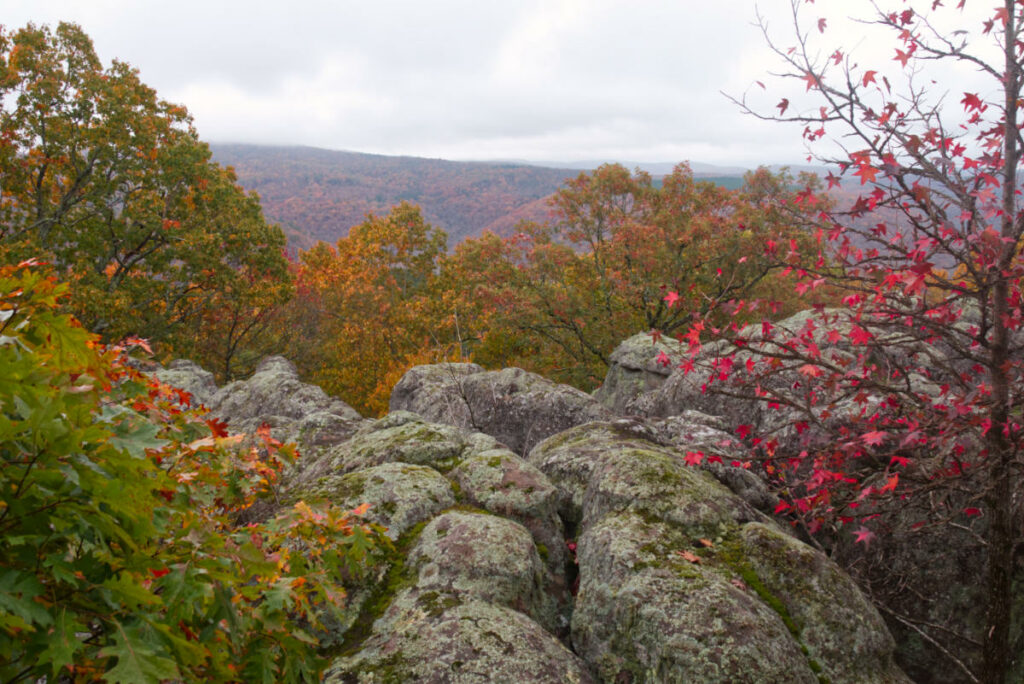
Buzzards Roost is a collection of large sandstone rocks with a small arch, amazing views of the valley below, crevasses, and small caves you can explore. You can climb around on the rocks above for views of the hills and valleys. Just be careful as some of the crevices between the rocks are quite deep. You don’t want to fall and get a nasty injury back here.
You can go around the rock outcropping to get below and explore the nooks and crannies under, around, and between the rocks. There are plenty of places to explore down here. Below are a few pictures I shot of that area.
If you climb out onto the rocks at the top of Buzzards Roost you get to see a wide-open vista of the valley and the hills beyond. We visited in early November so there was still notable color in the leaves. The view was simply spectacular.
Download The GPX File For Buzzards Roost
GPX files are also known as GPS Exchange files. These are text files that contain route data that you can download to your computer and then upload to your phone or handheld GPS unit.
If you are looking for a fairly easy hike with great views and fun for the whole family then check out the hike to Buzzards Roost. I think you will be happy you did.
If you want a little more challenging hike with plenty of waterfalls within a few miles of this trail, check out our post on Bear Creek Canyon.