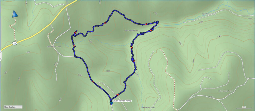
Dismal Creek Special Interest Area is located in the Ozark National Forest just a short distance from the Glory Hole Falls hiking trail. To reach this area continue southwest of the Glory Hole Falls Trailhead on AR Highway 16 for a short distance. Look for a county road on the left that is marked 65. Turn left onto the gravel road and travel approximately 2 miles on this road.
There isn’t a parking area for this hike but there is a wide area of the road for parking. Be sure and don’t block the road. Also, be aware that this is a bushwhack hike so there are no marked trails in the area. To assure you won’t get lost you can scroll down and purchase our GPX file that shows the exact GPS coordinates for the place we parked as well as the route we took.
There is very little if any, cell phone reception in this area. To navigate in this area you should be familiar with a map and compass or carry a hand-held GPS receiver. This is the GPS receiver we use and recommend. You can see the Garmin GPSMap 64sx here.
Begin your trip into the area downhill on the north side of the road. The hike is downhill to the creek. We came upon a side drainage and followed it down to Dismal Creek, as seen in the video above.
Download The Dismal Creek Special Interest Area GPX File
GPX files are also known as GPS Exchange files. These are text files that contain route data that you can download to your computer and then upload to your phone or handheld GPS unit.
Be aware that you will need to cross the creek several times as you travel downstream. Your other option is to climb up and go around some steep areas. We chose the easier of the routes and crossed the creek several times. You can bring water shoes for the crossings, but we were able to cross without getting wet in most of the places we needed to cross.
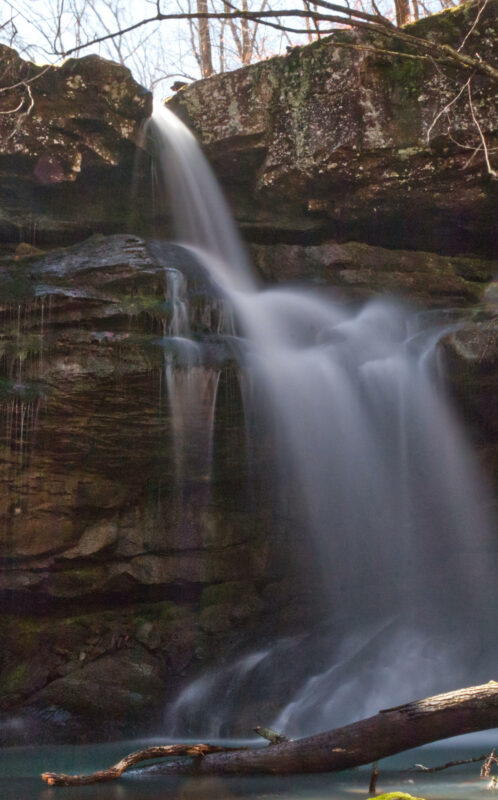
Follow the creek downstream and you will be at the top of the first waterfall, which we believe is named Double Tier Falls. At the top of this waterfall, you also encounter a bluff shelter with a fireplace built from rocks underneath the shelter. You can see this in the video above too.
You will need to cross back across the creek to reach the bottom of the falls, go up and around some steep bluffs, then find your way back to the creek level to get below the falls for photos. Here is my photo of this waterfall.
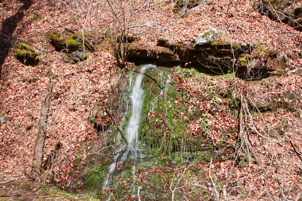
Continue downstream for a while and you need to do another creek crossing. A little further along you will encounter a spring coming from the side of the hill. My photo of the spring is below.
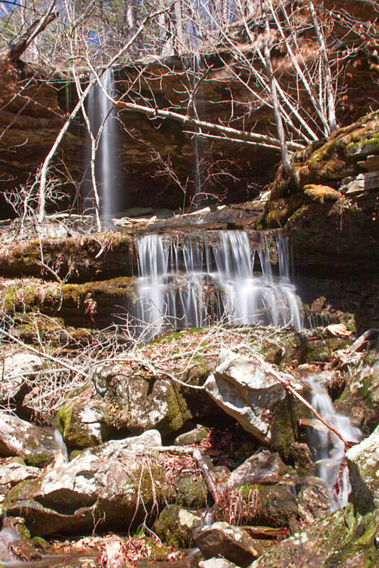
Continue to follow the creek downstream for a short distance further and you need to make another crossing. Then you will need to find a way up the steep bluff line to the last waterfall we visited. This waterfall we believe is named Bluff Shelter Falls. It is a beautiful cascading waterfall that comes off the top of the bluff and cascades downhill into Dismal Creek below.
The total for this hike was about 4 miles with about 500′ of elevation change. There are some challenging parts of this trail to see these waterfalls. But once you get down to Dismal Creek you can simply follow the creek downstream to see all the sights. Be sure and watch the video to see some of the obstacles you will encounter.
We decided that since the last waterfall was at the top of the bluffs, it might be easier to climb up and follow the tops of the hills back to the road. This may have added a little distance to the hike, but it was easier than all the creek crossings and climbing you would need to do to follow the creek back upstream.
Get the GPX file above and load it into your handheld GPS if you want to go this route. Or, simply follow the creek back upstream to where you parked.