
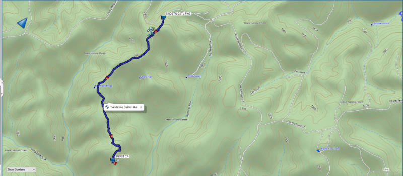
The Sandstone Castle is a popular sandstone rock formation located in the Richland Creek Wilderness area of the Ozark National Forest. The parking area for the trail is located at the following GPS coordinates: N 35° 50.511″ W 92° 59.069″. Scroll down to download the .gpx file to load into your handheld GPS unit.
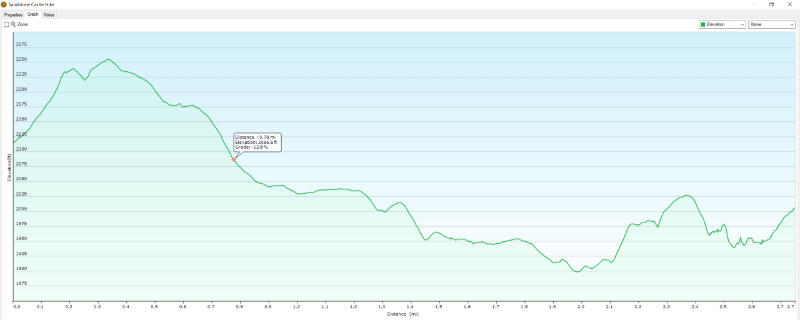
You begin the trail to Sandstone Castle at the roadside. There is a small blue sign up a small embankment listing the distance to Sandstone Castle as 2.4 miles. It also lists the distance to Twin Falls, which is in the same area, as 3.7 miles. The first few hundred yards of the trail are the most difficult. There is around a 16% grade uphill for several hundred yards as you climb above the road below. Once you reach the bench of the hill it is a mostly flat hike for the most part.
If you take the hike to Sandstone Castle in the winter with the leaves off the trees you can see more of the surrounding valleys and landscapes. I’m not sure how much you could see in summer because the forest is mostly dense along the trail. Several overlooks along the way give views of the valleys below of Richland Creek and Big Devil’s Fork.
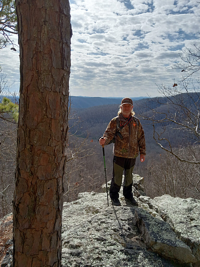
Once you arrive at Sandstone Castle you are treated to a fantastic expansive view of the valley and the hills of the surrounding countryside. Use caution near the bluffs because they are high and steep. A misstep here could result in tragedy. This warning is not to discourage you from visiting this amazing place, but to just use caution as you would in any rugged outdoor area.
The trail continues along the bluff for a short distance where you can go down and explore the bluff shelters below. There are several shelters that were most likely used by Native Americans in the area in the past. You can see them in the video above. One shelter even has a rock fire ring near the entrance so it is apparent that some adventurous people have hiked in and spent the night in the shelter.
Once finished exploring the area you can turn around and hike back out to the trailhead. You can also continue downhill to see another scenic wonder of this area by visiting Twin Falls.
If you are planning a trip to the area a great way to see multiple scenic wonders might be to take two vehicles and station one at the Richland Creek Campground and bring the other to the Sandstone Castle trailhead. Hike to Sandstone Castle and then continue downhill to Twin Falls. Then you can make the short half-mile hike to Richland Falls before you continue on to Richland Creek Campground. Then you can drive back to retrieve the other vehicle from the trailhead.
Download The GPS File
GPX files are also known as GPS Exchange files. These are text files that contain route data that you can download to your computer and then upload to your phone or handheld GPS unit.
There are numerous additional waterfalls and hiking trails in the Richland Creek area. Be sure and check out our posts on Falling Water Falls, Six Finger Falls, Terry Keefe Falls, Lower Horsetail Falls, and Punchbowl Falls.