
I want to let you know about Fern Falls and Lonesome Hollow Falls in this post. Both are beautiful waterfalls you can quickly see just a short distance from Scenic Highway 7 south of Jasper Arkansas.
We easily saw both waterfalls in the space of a few hours on a warm December morning in 2022. Neither hike is very long. Neither hike is hard for someone in reasonable shape either. At 60 years old I can honestly say that neither hike was tough, except for the spot I chose to get to Lonesome Hollow Falls because I wasn’t sure about getting around the bluff line. More on that later, and you can use my GPS track to avoid my mistake, making it easier for you.
Lonesome Hollow Falls
Since we were arriving from the North on Highway 7 we chose to go to the farthest waterfall first. That was Lonesome Hollow Falls. To get to the falls take Highway 7 to Cowell, AR. The turn from the highway is located next to the Cowell Cemetary. The GPS coordinates for the turn-off are 35.820192, -93.162989. Take the road behind the cemetery and there will be a road to your right. Take that road (listed on Google Maps as Taylor Ridge Road 427).
When the road forks stay to the left and continue to follow the road for about .8 miles and there will be a faint road on the right with a dirt berm. Park here and cross the berm to start the hike to Lonesome Hollow Falls. The GPS coordinates for the parking area are 35.80648, -93.15767.
Cross the berm and follow the old road trace as it winds downhill. Shortly you’ll be able to hear the water crashing over the falls. The coordinates to leave the road are 35.803700, -93.158783. Turn right and climb down below the bluff line here. When you get below the bluff line turn right and follow the bluff to your right a short distance to the falls.
This is where I made my error. You can’t really see down to the creek from the spot where you get below the bluff, and I wasn’t sure that this was the right way, so I continued downhill all the way to the creek. This caused me to have to climb back up and around some boulders to get to the falls. We reviewed the route in the Arkansas Waterfalls book by Tim Ernst but I missed the turn. You can see my mistake if you watch the video.
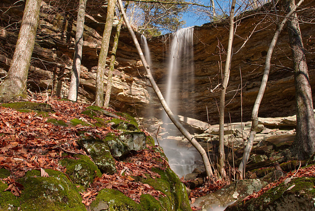
The coordinates for the waterfall are 35.804667, -93.160167. The waterfall is listed at 47′ tall and the area around the falls is spectacular. There are also many smaller cascade waterfalls downstream as well.
Fern Falls
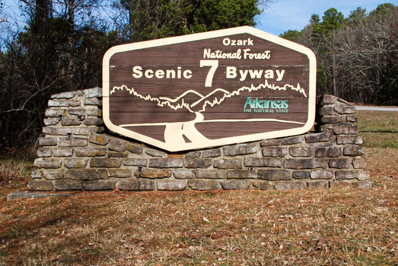
Once we hiked back to the truck it was time to head back up Highway 7 toward Jasper to visit Fern Falls. The parking area for Fern Falls is about 6.5 miles north on Highway 7. There is an area for parking near the sign for Scenic 7 Byway on the west side of the highway.
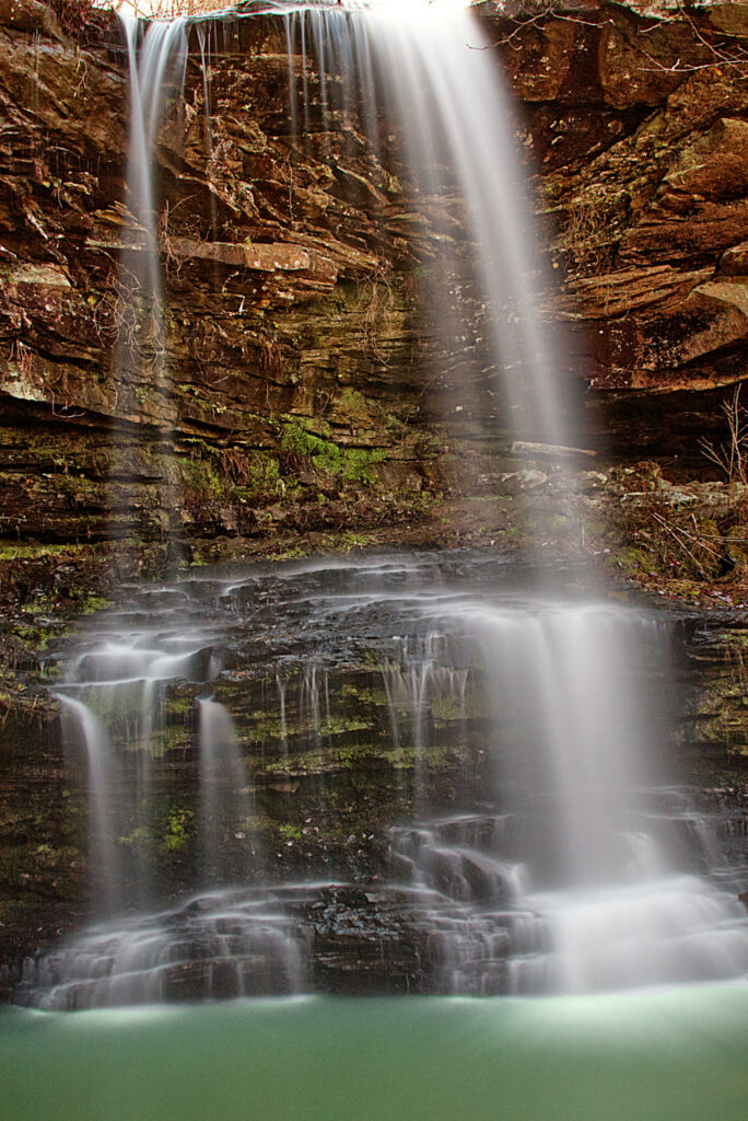
Begin the hike to Fern Falls beside the sign and you’ll see a trail heading west into the forest. Follow this trail until you reach a fork in the old road trace. Take the right fork and begin a slow downhill descent and you’ll soon see a creek on your left. The trail follows the creek and eventually, you will come to another fork. Take the right fork a short distance and you can view the falls from above. Then backtrack and take the fork to the left, cross the creek, and follow the trail a short distance. You’ll see a break where you can scramble down below the falls and under a bluff shelter. The coordinates for Fern Falls are 35.89757, -93.19250. The total for this hike is a little over 1.5 miles round trip.
Plan your visit to the area and take advantage of these short hikes to see two amazing waterfalls. If you are interested in finding other waterfalls be sure and view our video Chasing Waterfalls in the Arkansas Ozarks.