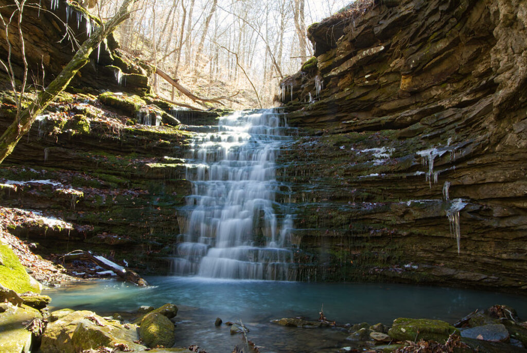
We have put together a list of some of the amazing waterfall hikes in the Ozarks. Each waterfall is linked to the full-page article for that hike. You can read tips for the hike, see photos, and most contain downloadable GPS files you can load into your GPS to help you navigate to them.
Each waterfall is listed alphabetically.
Download 25 Popular Hiking Trails GPS Files
GPX files are also known as GPS Exchange files. These are text files that contain route data that you can download to your computer and then upload to your phone or handheld GPS unit.
25 Popular Hiking Trails GPS Files Download – $9.95
You save 50% by buying these files versus purchasing each one separately.
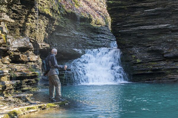
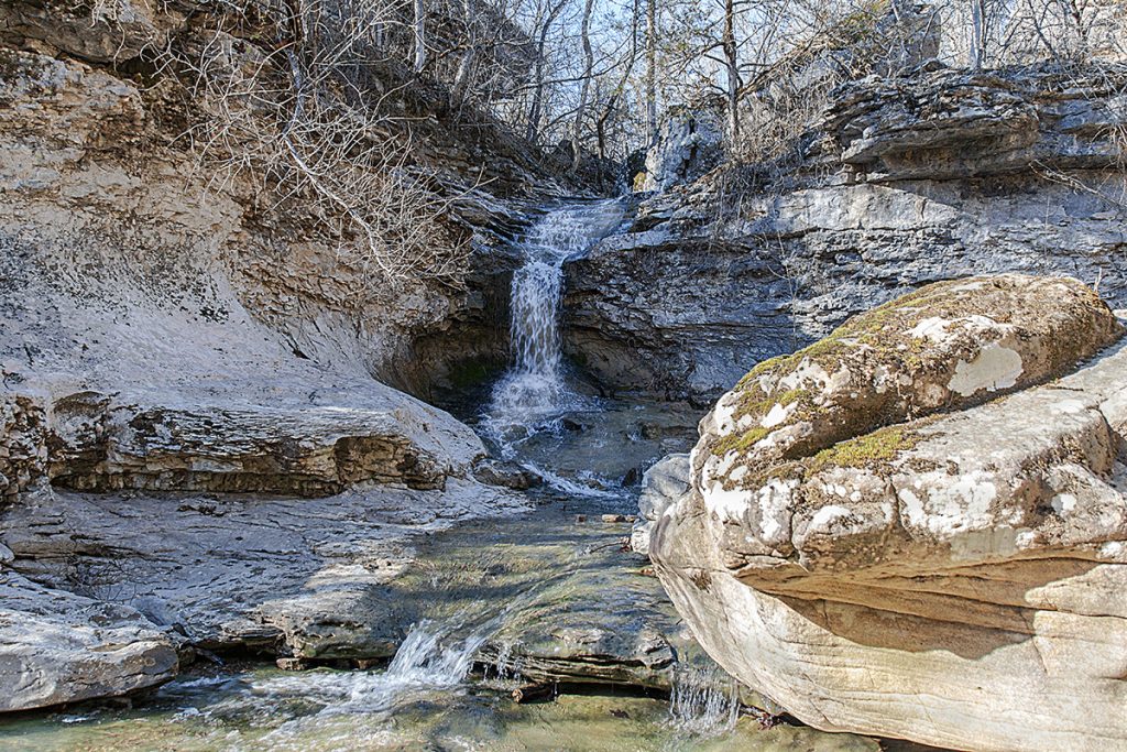
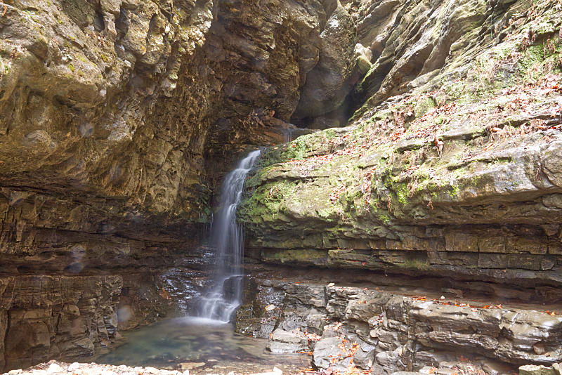
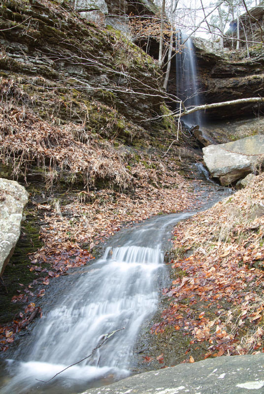
Amber Falls
Amber Falls is named for the daughter of Tim Earnst, who spent many years documenting the waterfalls and hiking trails in this area. He has a book on Arkansas Waterfalls that is available to purchase and carry on your hike. It is an invaluable guide on the trail. Amber falls is a short waterfall with a pool underneath.
Bear Creek Canyon – Baby Bear Falls
The next four waterfalls can all be seen in Bear Creek Canyon on the same hike.
We walked the trail to Baby Bear Falls a few hundred yards and were astonished at another unique waterfall with a gorgeous turquoise pool below it.
– Sidewinder Falls
Sidewinder Falls cascades down a twisting slot in the canyon and although the water was too high for us to get below it, I was able to get a photo from the top with Swamp Falls in the background.
– Slot Pool Falls
Now that you have made it down from the bluffs, you can make your way back upstream to view Slot Pool Falls (AKA Long Slot Falls). If there has been much rain, you will probably get wet crossing the creek. I did get wet feet making this crossing. But the view from below the falls of the beautiful turquoise pool made me forget about my wet feet.
– V Slot Falls
We were unable to get around the falls without getting wet, so we returned up the bluff and headed back the way we came. The trail passes V Slot Falls, and we were able to climb down a little to an outcrop for some photos of the falls from above.
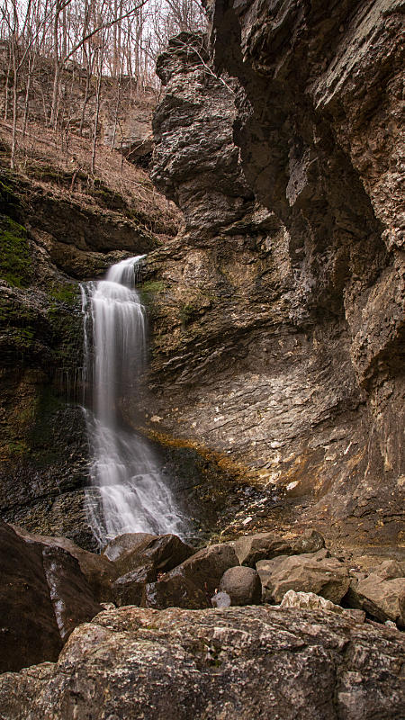
Big Creek Cave Falls
Big Creek Cave Falls is located in Newton County, Arkansas. It is one of many gorgeous places to hike in the Ozark National Forest.
Bowers Hollow Falls
Bowers Hollow Falls is located in the upper Buffalo River Wilderness. I can say that although we spotted several cars on the way in we had the whole trail to ourselves. Let me just say that this is one of the most strikingly beautiful waterfalls we have visited. It is listed as 56′ tall, but it seems taller when you are looking down from the bluffs surrounding the falls.
Broadwater Hollow Falls
Broadwater Hollow Falls is a short distance further along the trail from Paige Falls. The trail is highly trafficked during warm weather. It continues past the falls and includes a spring flowing from a small hole in the rock below the falls. The landscape is breathtaking because of the huge rocks and boulders along the trail, which you can climb over or around to get better views of the falls.
Cecil Creek – Thunder Canyon Waterfall

The weather was perfect for a hike on November 5, 2020. It was clear and cool as the day started but it quickly warmed into the 70s. The fall colors are in full swing and the colors were absolutely brilliant. It was with this backdrop that we left to hike the Cecil Creek Trail on the Buffalo National River and see if we could find the Thunder Canyon Falls.
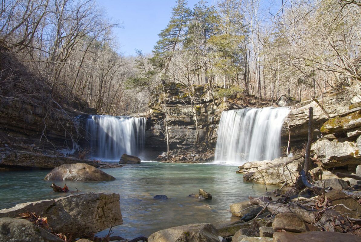
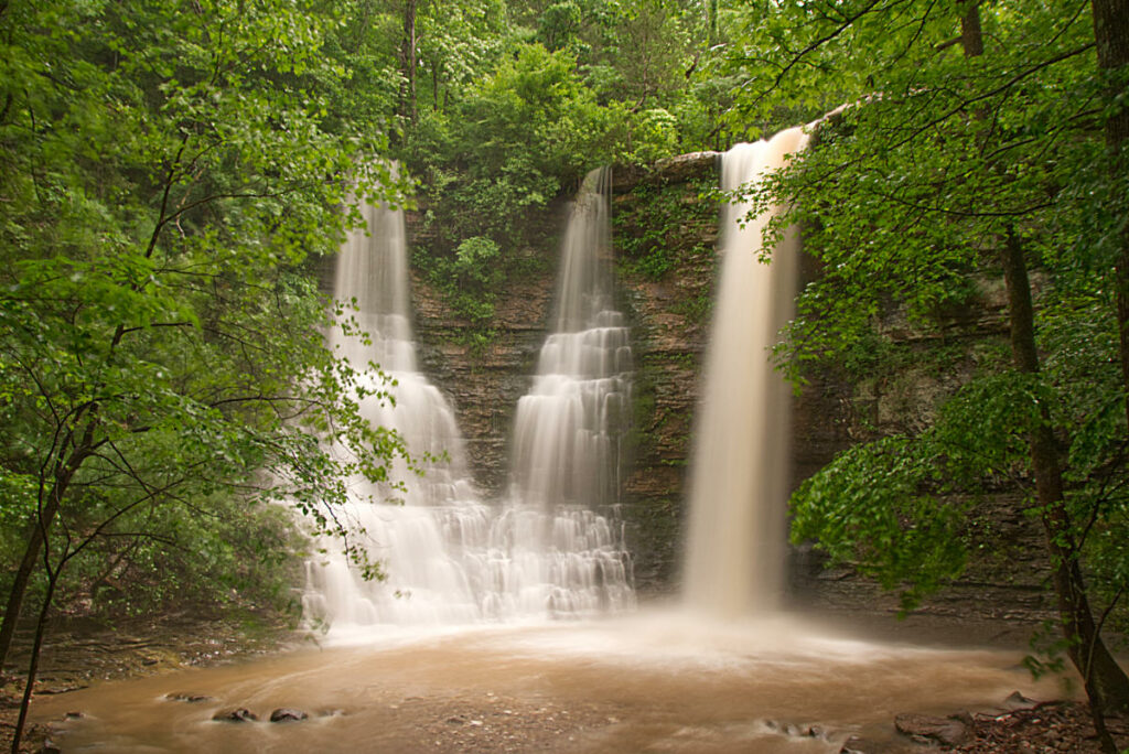
Compton’s Double Falls
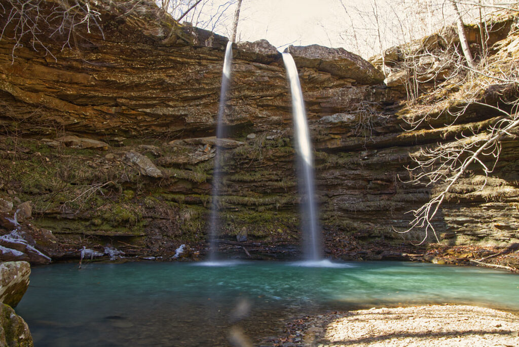
Enjoy some time looking around the top of the falls, then rejoin the trail and continue along the bluff line for a short distance, and the trail leads downhill at a break in the bluff line. This part of the trail is slick and steep, but if you are cautious you should be fine. Once you get down to the creek bed, find a spot where you can cross on the rocks and you can cross the creek again without getting your feet wet. The far side of the creek is a little better walking to get beneath Compton’s Double Falls, and this is the view.
Eden Falls
As you explore Cob Cave you will also be able to see Eden Falls. Eden Falls drops from an opening in the rocks above Cob Cave. The waterfall drops in several sections before finally ending in a pretty blue-green pool next to Cob Cave.
Follow the trail back up out of Cob Cave and turn right to get to the top of Eden Falls. This is where the climb gets somewhat tougher. You will need to climb the stone stairs until you reach the top of Eden Falls. This area can be slick so use proper caution.
Elise Falls
From the parking area, the hike down to Elise Falls is about 0.75 miles. The hike down to the falls is pretty much downhill all the way to Smith Creek. Once you reach the creek, the hike levels off and it is a short hike to Elise Falls.
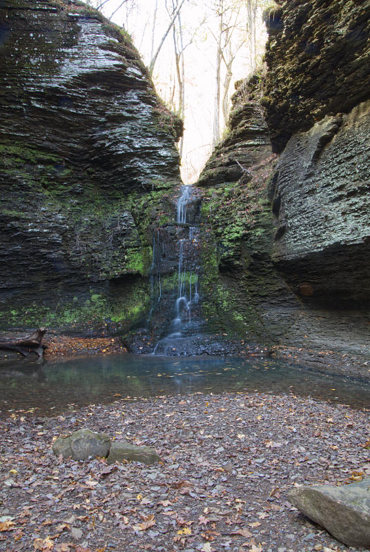
Eye of the Needle
The trail at Indian Creek to the Eye of the Needle isn’t a waterfall hike in the strictest sense. However, there are a number of waterfalls along the trail that flow from the bluffs that line the route. This waterfall exits the bluff where you begin the climb up to see the Eye of the Needle. Caution, the terrain here is rugged and slick as you hike in the creek.
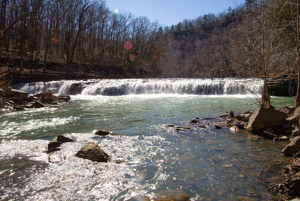
Falling Water Falls
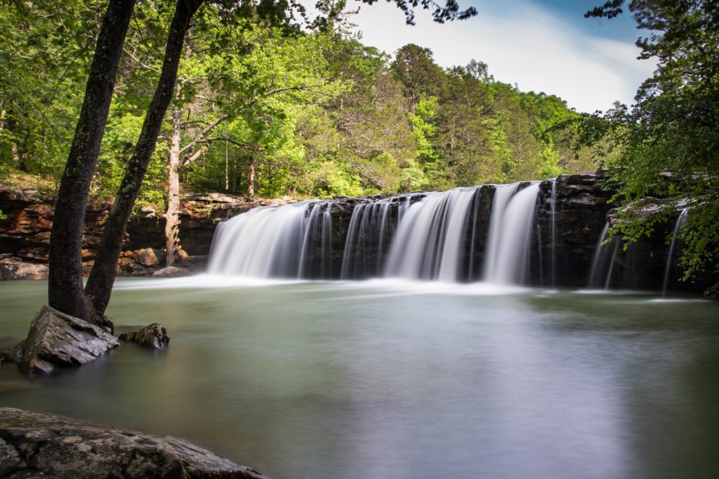
You can drive right up to Falling Water Falls and visit this amazing natural beauty in a car. There is no hiking involved whatsoever. The pool below the falls is a popular swimming hole in the summer. If you want to get photos without other people in them, you may have to plan to visit in the off-season. It’s also best to plan a visit after significant rainfall, as the flow will diminish during the dry season.
Fern Falls
Begin the hike to Fern Falls beside the 7 Scenic Byway sign and you’ll see a trail heading west into the forest. Follow this trail until you reach a fork in the old road trace. Take the right fork and begin a slow downhill descent and you’ll soon see a creek on your left. The trail follows the creek and eventually you will come to another fork. Take the right fork a short distance and you can view the falls from above. Then backtrack and take the fork to the left, cross the creek, and follow the trail a short distance. You’ll see a break where you can scramble down below the falls and under a bluff shelter. The coordinates for Fern Falls are 35.89757, -93.19250. The total for this hike is a little over 1.5 miles round trip.
Fuzzy Butt Falls
Once you cross over Six Finger Falls the trail to Fuzzy Butt Falls is easily seen. The trail leads to a small box canyon a few hundred yards down the trail. In the rear of the canyon, you will find the 16′ waterfall named Box Canyon Falls, also known as Fuzzy Butt Falls. The day we visited there hadn’t been any rain for a while, so I was actually surprised there was any water running at all.
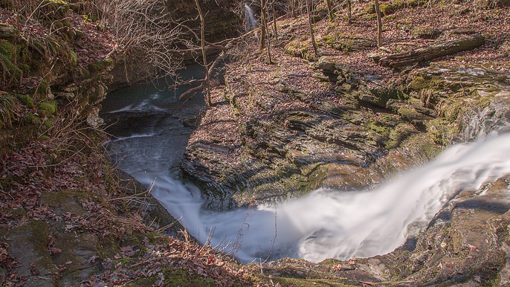
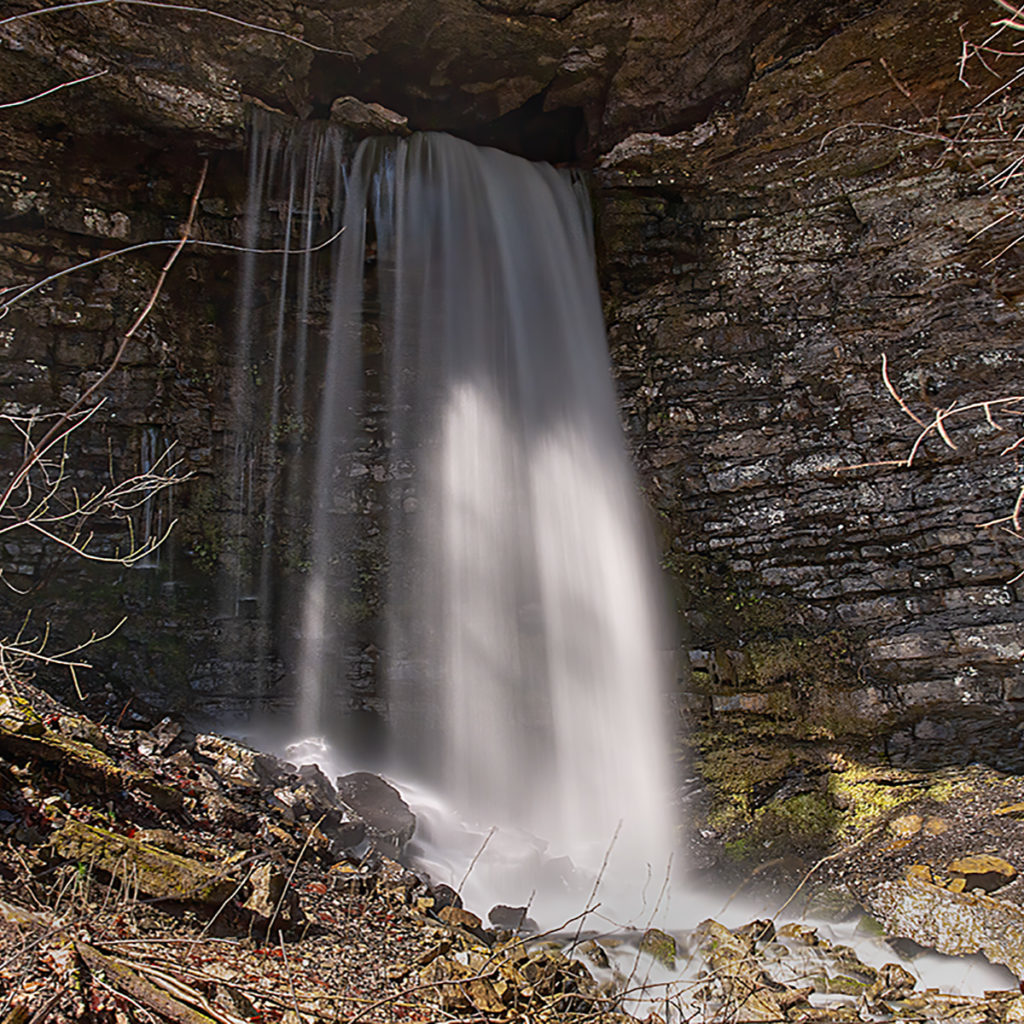
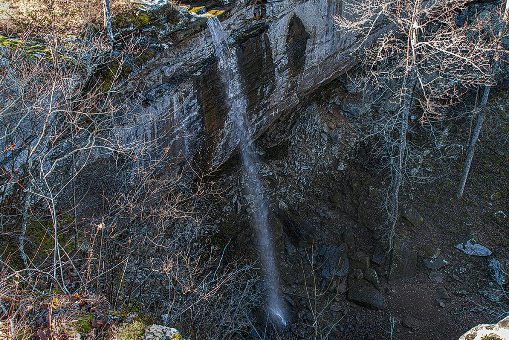
Glory Hole Waterfall
Glory hole falls is a unique sinkhole waterfall in the Ozark National Forest. The parking area for the falls is along AR Highway 16/21 south of Boxley Valley. There is a small sign and a parking area beside the highway.
According to my GPS, the trail is 1.1 miles in each direction. The trail is mostly downhill to the falls, so this means the trail out is mostly uphill all the way. Although it is uphill hiking back out, it is about a 400′ elevation change over a mile, so I still rate this one as easy/moderate, depending on your physical condition.
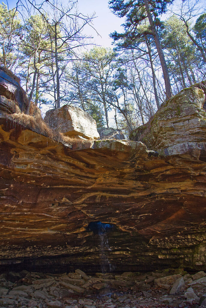
Hadlock Cascade
You can visit this waterfall on the trail to Magnolia Falls. To visit the other falls, take the right fork down and around the bluff line. Where the bluff line ends, turn right and follow the trail along the bluff line to get to the bottoms of Woods Boys Falls and Hadlock Cascade.
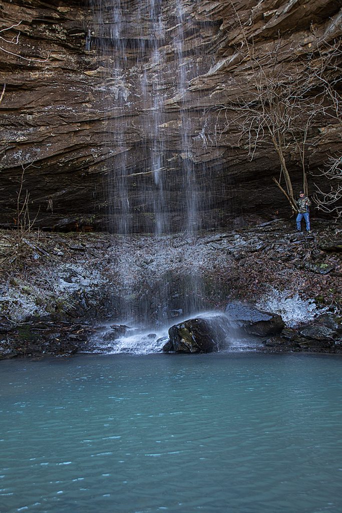
Hemmed In Hollow Waterfall
Hemmed In Hollow Falls is the tallest waterfall between the Rockies and the Appalachian mountains at around 209′ tall. The trail down to the falls is steep and rugged, with an elevation change of about 1200′. I will say that it isn’t as bad as I had expected, given all the accounts I had read online. There are many posts talking about how strenuous the hike is. It isn’t a level stroll through a park, but it isn’t totally terrible either. There are some steep grades coming back out, but if you take your time to stop and catch your breath, and you are in reasonably good shape, it is not that bad.
Ken Smith Falls
The entire hike was measured by my GPS as 6.4 miles. This included the walk around the bluff line and the climb down below Lower Ken Smith Falls and then around to below McClure Falls. If you decide to climb down be very careful. It is steep and slick. It can be treacherous in places because there is a large amount of finely broken shale which shifts underfoot easily.
Liles Falls
If you are looking for an easy day trip to see a beautiful waterfall while you are in the Ozarks, then Liles Falls should be on your list.
These falls are named for Jim Liles. He was very instrumental in getting many of the hiking trails established in the Buffalo National River area. In fact, the Buffalo River Trail crosses over the top of Liles Falls.
I wouldn’t call the walk to see this waterfall a hike, since the distance from the road to the falls is around 100 yards. But once we reached it, I saw why it is a popular destination for those who love waterfalls.
Lonesome Hollow Falls
To get to the falls take Highway 7 to Cowell, AR. The turn from the highway is located next to the Cowell Cemetary. The GPS coordinates for the turn-off are 35.820192, -93.162989. Take the road behind the cemetery and there will be a road to your right. Take that road (listed on Google Maps as Taylor Ridge Road 427).
Lower Horsetail Falls
Lower Horsetail Falls is found off of Falling Waters Road in the Ozark National Forest. You can reach the falls by following what is known as the Horse Trail. To reach the Horse Trail take Highway 16 off Highway 7 from Sand Gap East toward Ben Hur. Turn right onto Falling Waters Road. This road is fairly well maintained, but lower cars may have trouble with it. You will continue past Falling Water Falls (stop and spend some time here because the falls are directly beside the road) and eventually reach a narrow bridge. Park on the other side of the bridge and walk back across the bridge. The Horse Trail will be on the right.
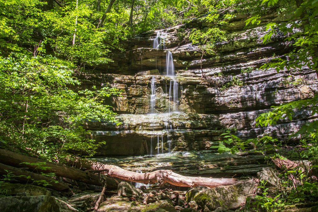
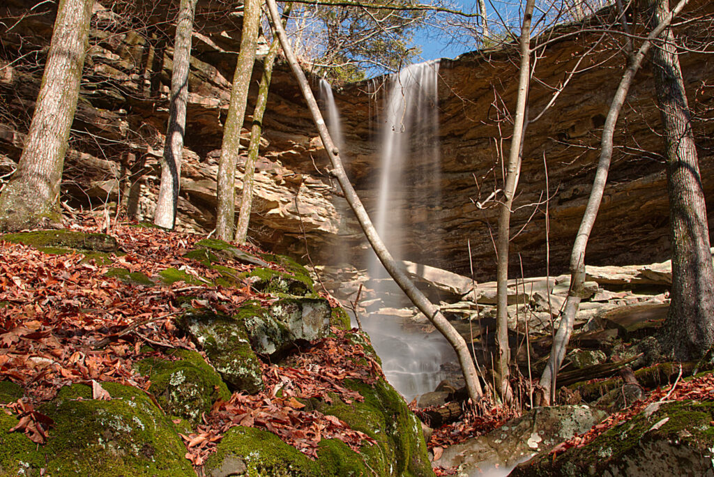
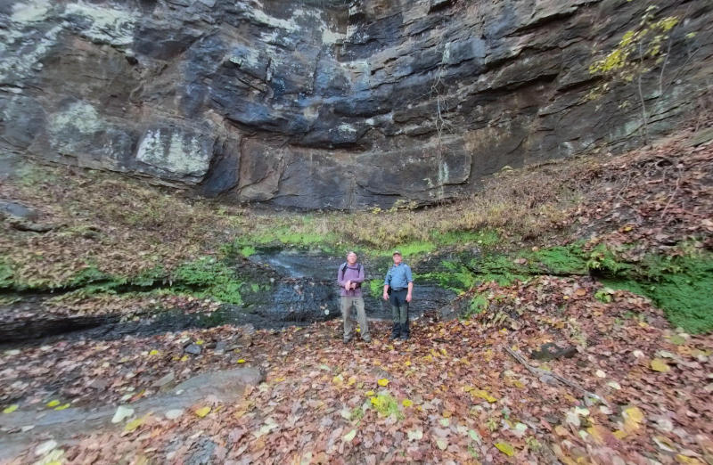
Magnolia Falls
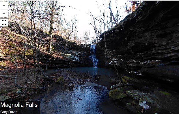
Magnolia Falls lies within the Ozark National Forest near Deer, AR. The trail to Magnolia Falls is a little over 2 miles in and out if you only want to visit these falls. There are two other falls you can visit in the same area easily. These falls are Woods Boys Falls and Hadlock Cascade. From the parking area on Newton County Road 6, the trail is on the right. There is a Wilderness Trail sign on the left side of the road. This is where you can park. The trail slopes down gently as you pass a rock wall built by early settlers.
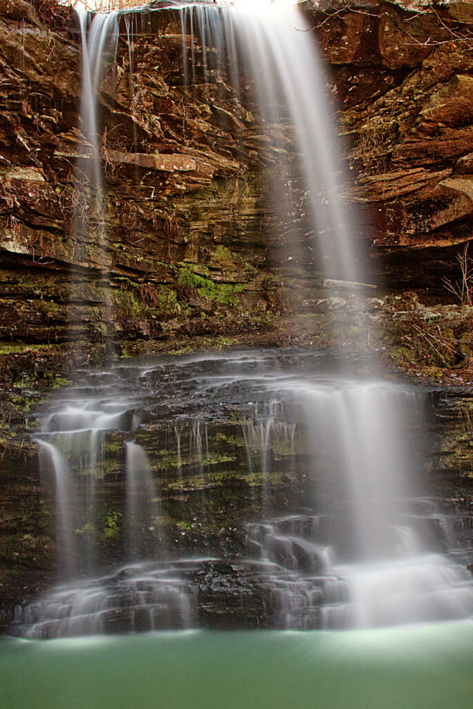
McClure Falls
The entire hike was measured by my GPS as 6.4 miles. This included the walk to below McClure Falls. If you decide to climb down be very careful. It is steep and slick. It can be treacherous in places because there is a large amount of finely broken shale which shifts underfoot easily.
The climb down was well worth the views of the waterfalls from below, and the towering bluffs rising above our heads. The same bluffs we had just walked through were now towering over us in stark contrast to the clear blue sky.
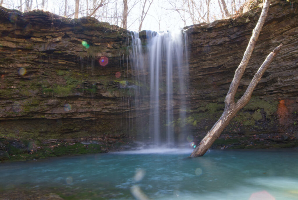
Owl Falls
If you look just downstream from Compton’s Double Falls from the point where you crossed the creek there is a drainage to the right. Go into this drainage for about 50 yards and you will find the beautiful cascade waterfall known as Owl Falls. You’ll have to climb over some rocks to get there, but it is a breathtaking sight, so be sure and see it if you are already this close.
Paige Falls
Follow the road for about 2 miles and you will see some places you can park. Walking a short way further along the road will take you around a sharp bend in the road to a low water crossing. This is the creek that runs down and creates both falls. The trail to the falls will be on your right just on the other side of the low-water crossing. There is also a nice cascade to your left as you cross the low water crossing.
Paradise Falls
Paradise Falls has been one of the places we wanted to get back to all winter. In early April of 2022, the weather cooperated and we had several inches of rain over a week, then it broke cool and clear for the day we planned to hike.
On our hike in 2021, we didn’t get down below the falls so we determined we would make it down there this time. Most people take the trail on the bluff line just above the falls, then take the steep and muddy trail down, using a rope someone tied to a tree.
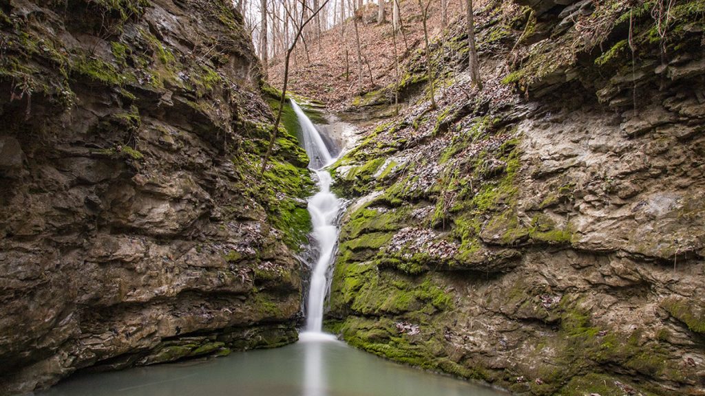
Richland Creek Falls
Richland Falls is located in the Ozark National Forest on Richland Creek. The entire hike was 5.8 miles. We were able to cut off some distance on the way back by using a direct route uphill to intersect the trail.
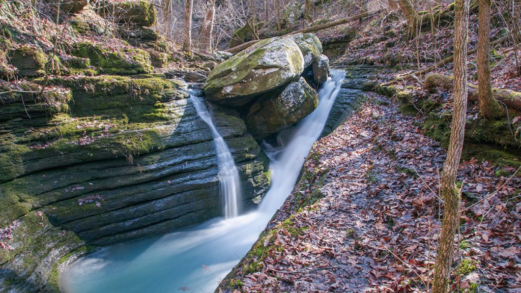
Six Finger Falls

This waterfall can be seen from Falling Waters Road a short distance after you cross the concrete bridge over Falling Waters Creek. The falls will be visible on the left. There is a small pull-off for parking. Look for blue hash markers on some trees on the left.
Sweden Falls
To reach Sweden Falls you take County Road 9 to the south off of State Highway 21 between Kingston and Ponca. The road to the area is fairly rough so a high-clearance vehicle is recommended. No need for a four-wheel drive on this road. Just be aware that in this rocky terrain, the roads are extremely bumpy. Slow speeds are the order of the day when trying to reach the trailhead.
For a great place to stay in the area check out Heaven’s Door Cabins right next door.
Terry Keefe Falls
Terry Keefe Falls is a short hike off Falling Waters Road in the Richland Creek area of the Ozark National Forest. The hike is a little over a mile out and back to the parking area. This short hike is very scenic, with tall bluffs to one side and a small drainage to Falling Waters Creek on the other.
Twin Falls in Richland Creek Wilderness

The trailhead for this hike is located in the Richland Creek Campground. There is a parking area as you drive into the campground and a small road with a gate to the right. This road leads along Richland Creek up to where Falling Waters Creek empties into it. There is a sign where the creeks meet showing the trailhead.
Twin Falls Trail
Twin Falls trail is a short hiking trail that is located at Camp Orr Boy Scout Camp. The area beyond the parking area is private property and there are signs to show you where to park. There is also a small sign pointing the way to the trail to Twin Falls. The trail to the bottom of the falls may be muddy when there have been recent rains. Besides the lower trail, there is also an upper trail that leads to the top of the falls.
Woods Boys Falls
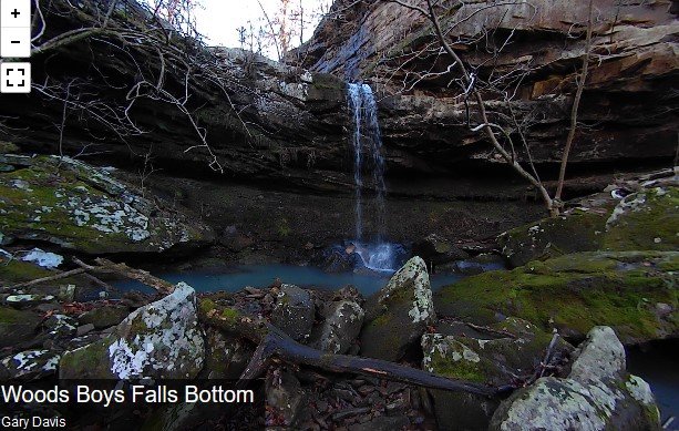
You can visit this waterfall on the trail to Magnolia Falls. To visit the other falls, take the right fork down and around the bluff line. Where the bluff line ends, turn right and follow the trail along the bluff line to get to the bottoms of Woods Boys Falls and Hadlock Cascade.
Download 25 Popular Hiking Trails GPS Files
GPX files are also known as GPS Exchange files. These are text files that contain route data that you can download to your computer and then upload to your phone or handheld GPS unit.
25 Popular Hiking Trails GPS Files Download – $9.95