Sweden Falls is a fairly high waterfall located in the Sweden Creek Natural Area near Kingston, AR. Sweden Falls is the 5th tallest waterfall in Arkansas at 81′ tall. Of course, the tallest waterfall in Arkansas is Hemmed in Hollow Falls. The area around the falls is typical for this area of the Ozarks. Large boulders, tall bluffs, and deep valleys are everywhere you look. This one can be viewed from the top by taking the left trail where it splits. Taking the right trail at the fork will take you to the bottom of Sweden Falls and down into the creek bed along a bluff line.
To reach Sweden Falls you take County Road 9 to the south off of State Highway 21 between Kingston and Ponca. The road to the area is fairly rough so a high-clearance vehicle is recommended. No need for four-wheel drive on this road. Just be aware that in this rocky terrain, the roads are extremely bumpy. Slow speeds are the order of the day when trying to reach the trailhead.
It was a pleasant surprise to find a new gravel parking area marked with cables just a few hundred feet further up the road from the gate where people started the hike in the past. (Jan. 2025 Update: The parking area now has welded steel between the posts.) This lot is level and is in great shape. The trail is well-marked from this spot and is fairly well-used, so it shouldn’t be a problem staying on the trail. (Jan 2025 Update: There are new-looking blue trail markers on both sides of the trees along the trail.)
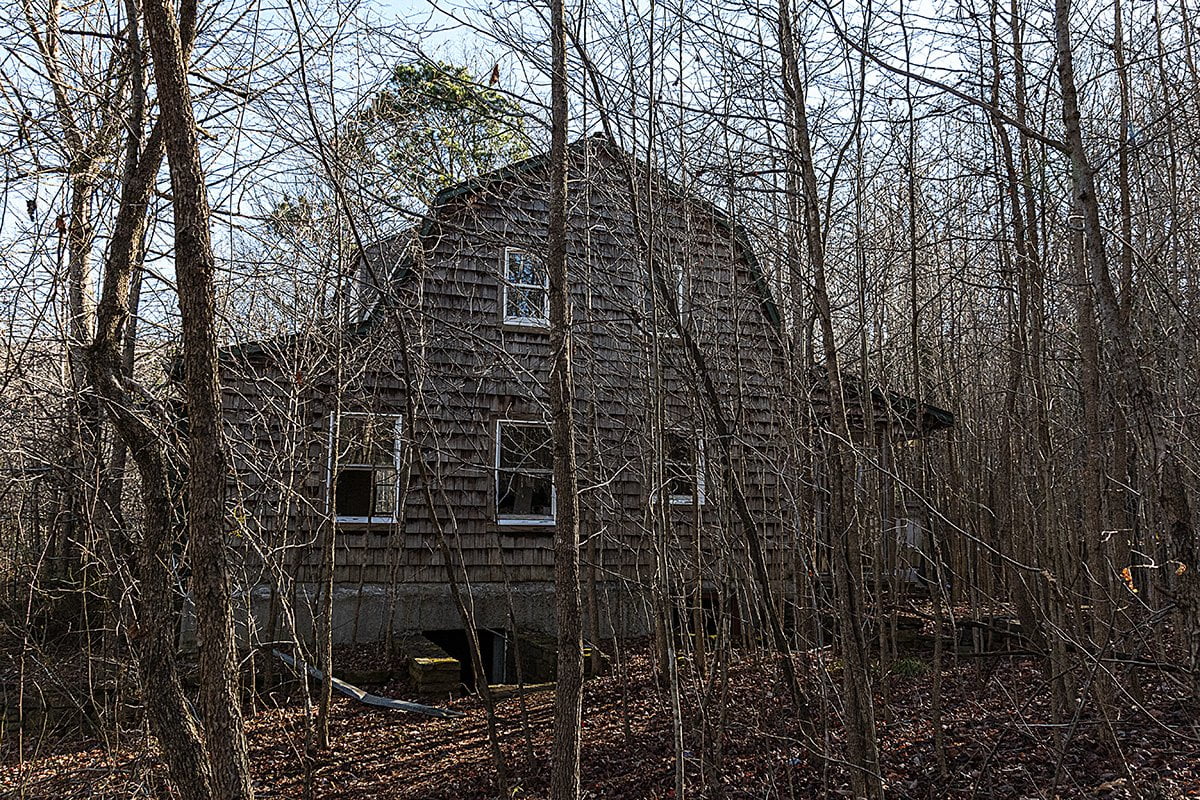
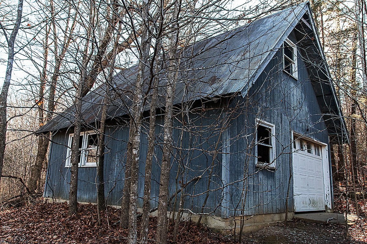
Once you leave the parking lot the trail is downhill for the most part. The first thing you will encounter is the trail intersecting the old trail coming down from the gate you passed on the road in. Stay to the left here and continue downhill. After a short distance, you will encounter an old home place that is in fairly decent condition considering they are abandoned buildings. Below are a few photos of what you’ll see there. (Jan. 2025 Update: Most of the old home place appears to have been removed. We saw no sign of the house or the blue barn pictured below.)
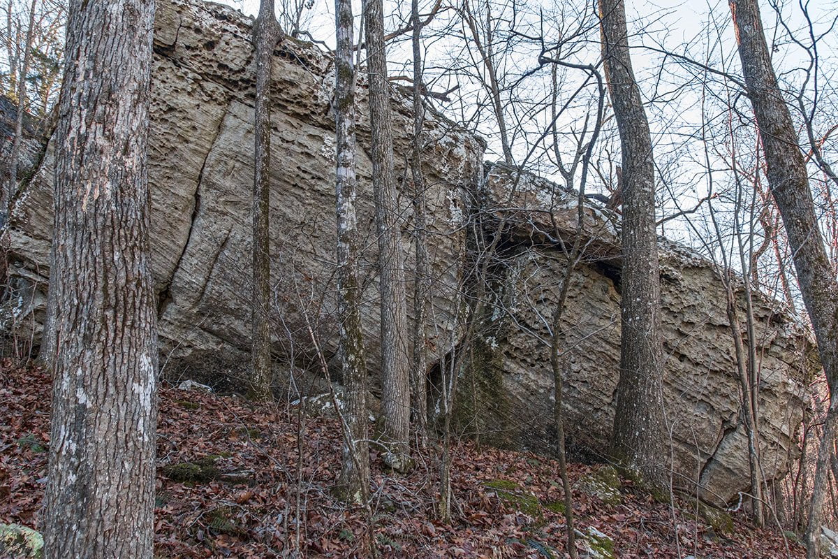
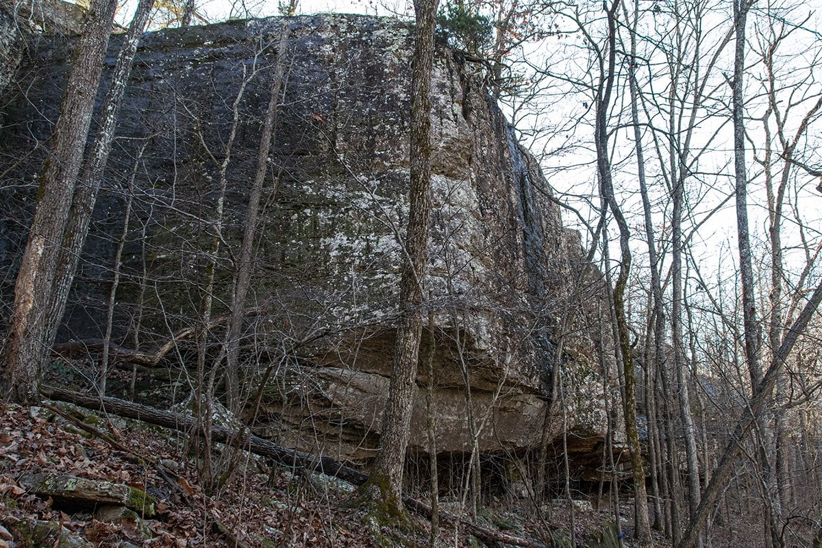
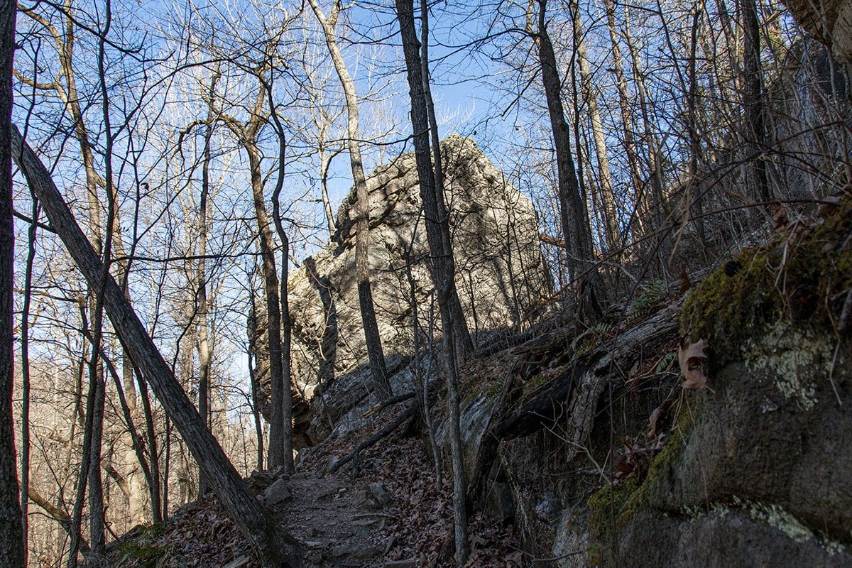
After exploring around the old homestead, continue down the trail a short distance and the trail will fork. The trail to the left leads to the top of the falls and the trail to the right descends to the bottom of the falls along the bluff line. We took the trail to the bottom of the falls first. You will have to scramble over and around some rocks, and the water seeping from the side of the bluff will be dripping down from above. In spite of this, the trail is not difficult, and you won’t get too wet. Below are a few photos from the lower trail.
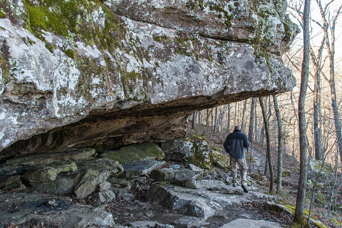
The trail ends at the falls and you are looking up 80′ to where the water flows over the rock ledge at the top and crashes onto the rocks below. You can walk behind the waterfall under a rock overhang that was almost certainly used by Native Americans for shelter when they inhabited this area.

The camera we use for 360° photos. Click the photo to get yours today!
The next 2 Photos Are 360 Photos. Use Your Mouse Or Move Your Phone To Look Around.
After you explore around the bottom of the falls you can now head out the way you came. Follow the trail back up to where the trail splits off. You can continue out to the parking area. However, I highly recommend you hike the trail along the top of the bluff to the top of the falls. There are some amazing views of the surrounding area and the bluffs that run along Sweden Creek.
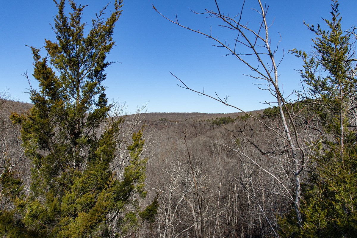
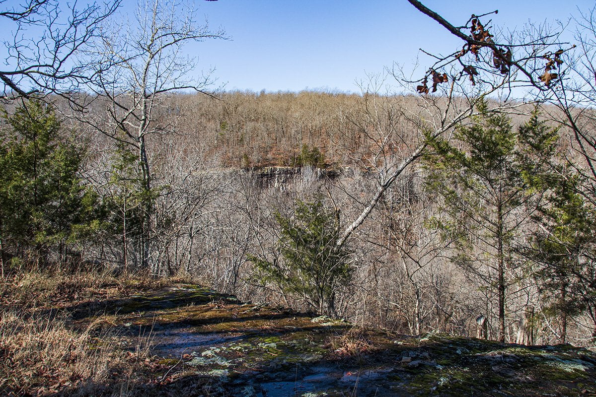
Once you get to the top you will be treated to amazing views of Sweden Falls. Below are a few shots from the top area of the falls.
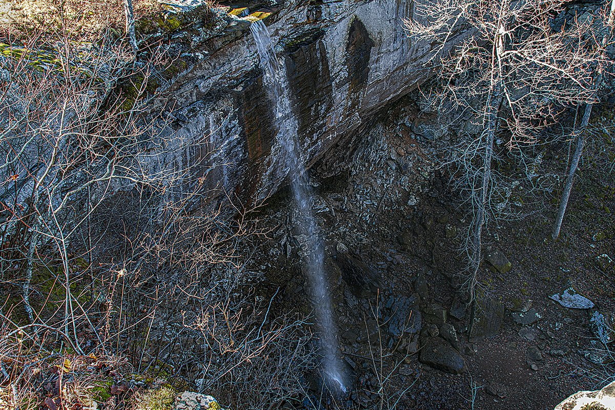
Please be careful in this area as the rocks can be slick if they are wet from the rain. The bottom of the creek is very slick when the water is running too. There are no safety rails so be sure and keep a close eye on children.
360 Photo. Use Your Mouse Or Move Your Phone To Look Around. Be Sure And Look Down!
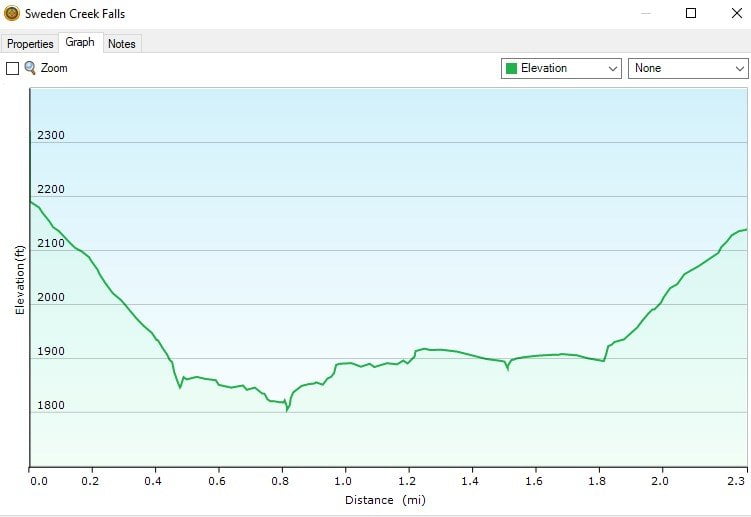
Now you can start the hike back to the parking area. Just follow the trail back along the bluff line until you intersect with the main trail then start your hike uphill back to the parking area. The trail from the parking area to the falls is around 1.5 miles. Hiking to the top of the falls will add around 1/2 mile to that. My GPS said 2.3 miles, but there was some walking around exploring, so I’m going to say 2 miles total. Below I have added the GPS track and elevation graph from my GPS to give you an idea of the track and elevation change associated with this hike.
Download The GPX File
GPX files are also known as GPS Exchange files. These are text files that contain route data that you can download to your computer and then upload to your phone or handheld GPS unit.

On the map above click on “View Larger Map” to go to Google Maps. You can copy & paste the code below into Google Maps to view the location if needed. You can also use the code in Google Maps on your phone. Use the satellite view for the best overview.
Code
XGCX+WC Kingston, Arkansas
For a great place to stay just minutes from here check out Heaven’s Door Cabins only minutes from the trailhead,
I would recommend this hike for those looking for a fairly easy hike to see a waterfall. We saw several people with children on the hike and I would say it is kid-friendly.
If you would like to follow more of our hiking and other adventures in the Ozarks be sure and follow our Facebook page and subscribe to our YouTube channel.