We began the hike to Antenna Pine Overlook from the Compton Trailhead in Compton Arkansas. This is the trailhead that also includes the hike down to Hemmed In Hollow Falls. Read on to find out what you need to know to reach this overlook of the Buffalo River Valley with amazing views.
What Is Antenna Pine?
If you search for information on Antenna Pine Overlook online you won’t find much detailed info. The small amount we did find wasn’t very detailed. Here is what my research did find.
I found that in the past the Boy Scout troops that visited Camp Orr on the Buffalo River would cross the river and make the steep hike up to the overlook. There was an old pine tree there nicknamed Antenna Pine. The scouts would climb the tree and place the flag of their troop at the top of the tree. When another troop found a flag in the top of the tree they would “capture” the flag and return it to camp, replacing the flag with their own.
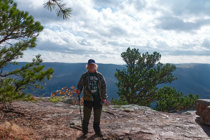
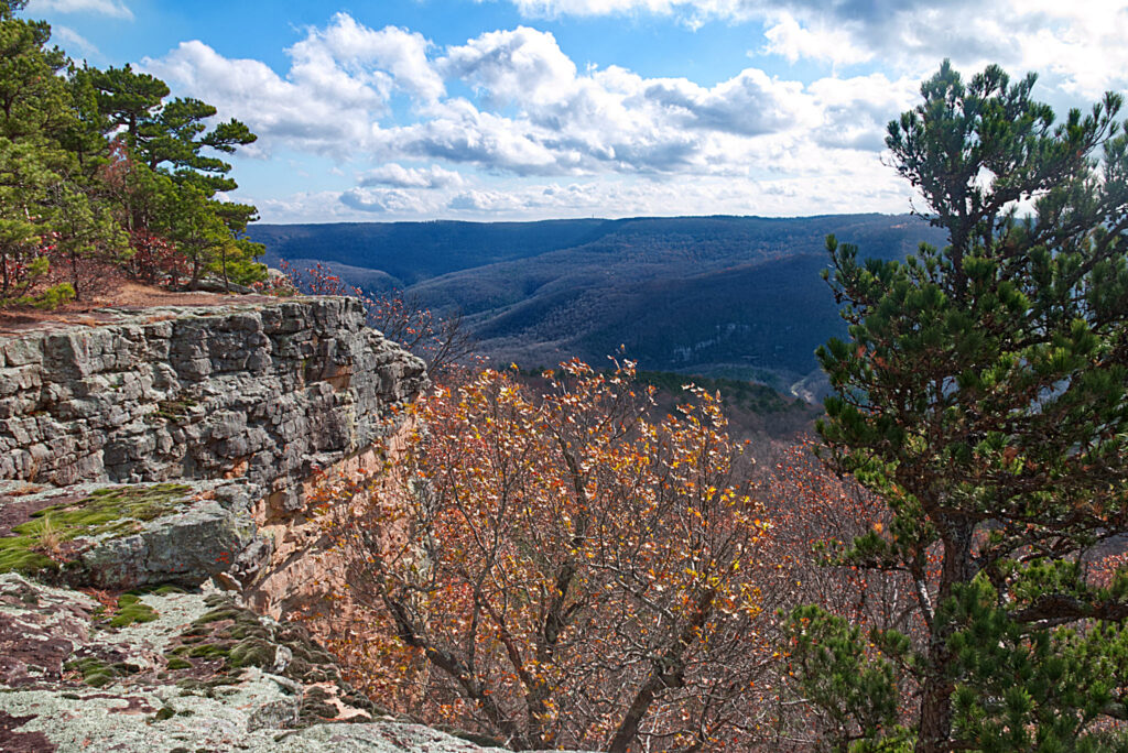
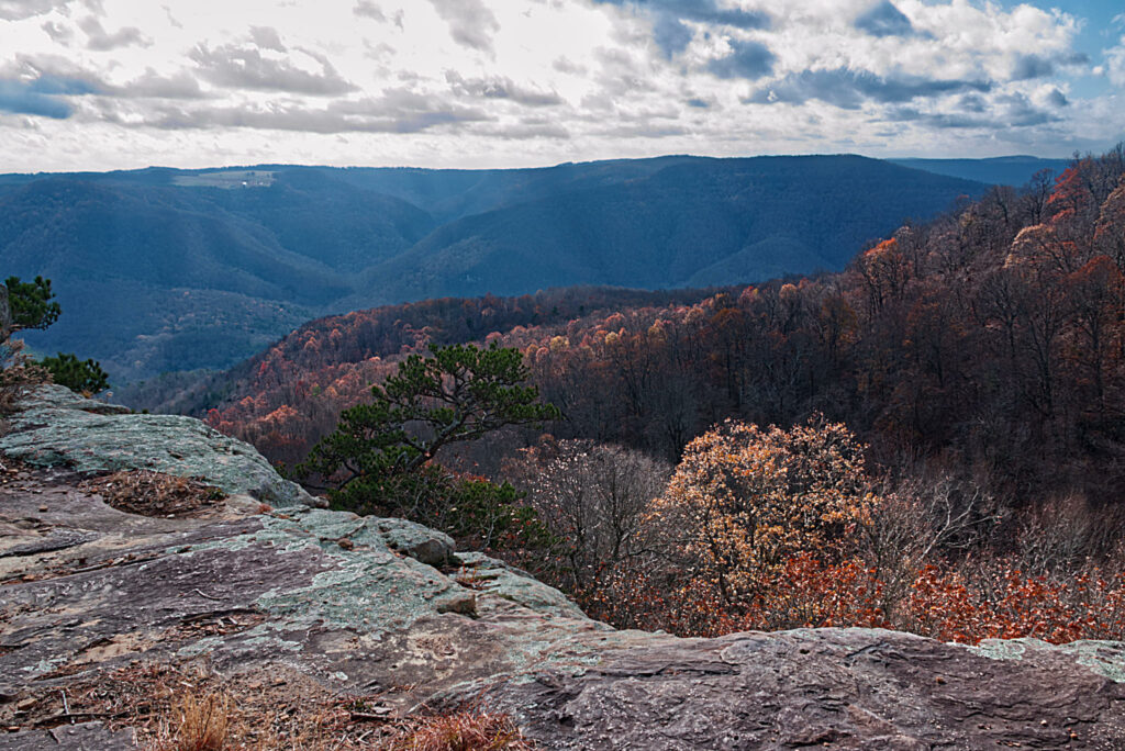
The bluff just below the hill where the tree is located has amazing views of the river valley below. You can also pick out the road leading to Kyle’s Landing as well as the Eye of the Needle on the far side of the river.
How do you get to Antenna Pine Overlook?
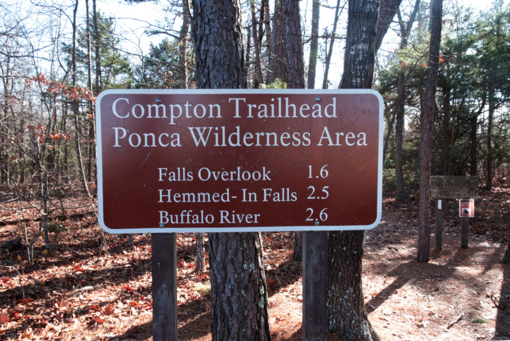
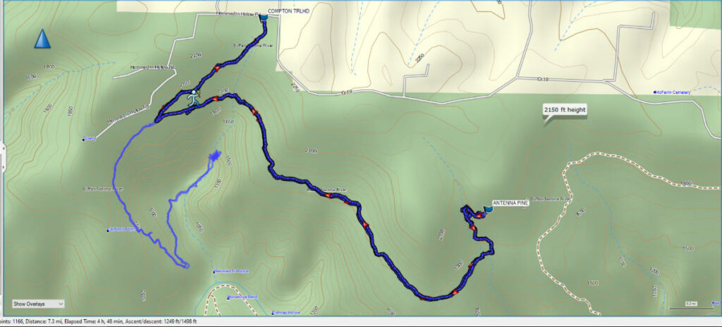
There are several ways to reach the overlook. I did find posts saying you can reach it from Erbie Road by parking along the park boundary and coming in from the top. Since we weren’t sure that the GPS coordinates we found online were correct we began our hike at the Compton Trailhead in Compton, Arkansas. This is the trailhead you would begin the hike to Hemmed In Hollow Falls too, so in warmer weather, the parking area may be crowded. However, on this day at the end of November, we had the whole parking area to ourselves when we arrived just before 9 am.
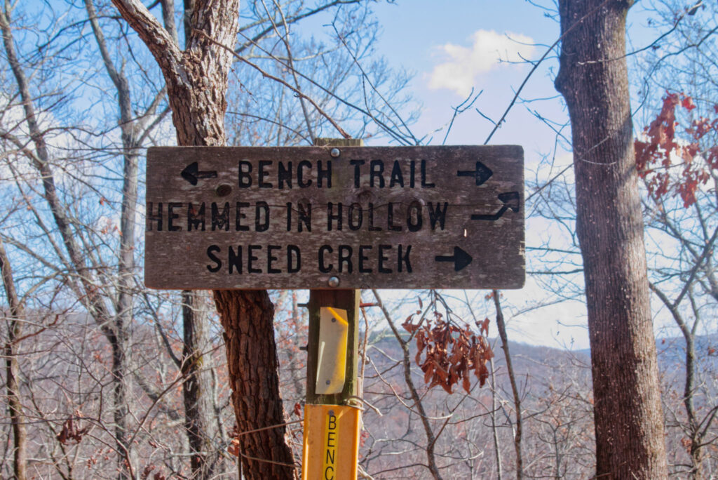
After a while, you will reach the Bench Trail that runs along the top of the bluffs surrounding the hollow. Take a left at the sign you see below.
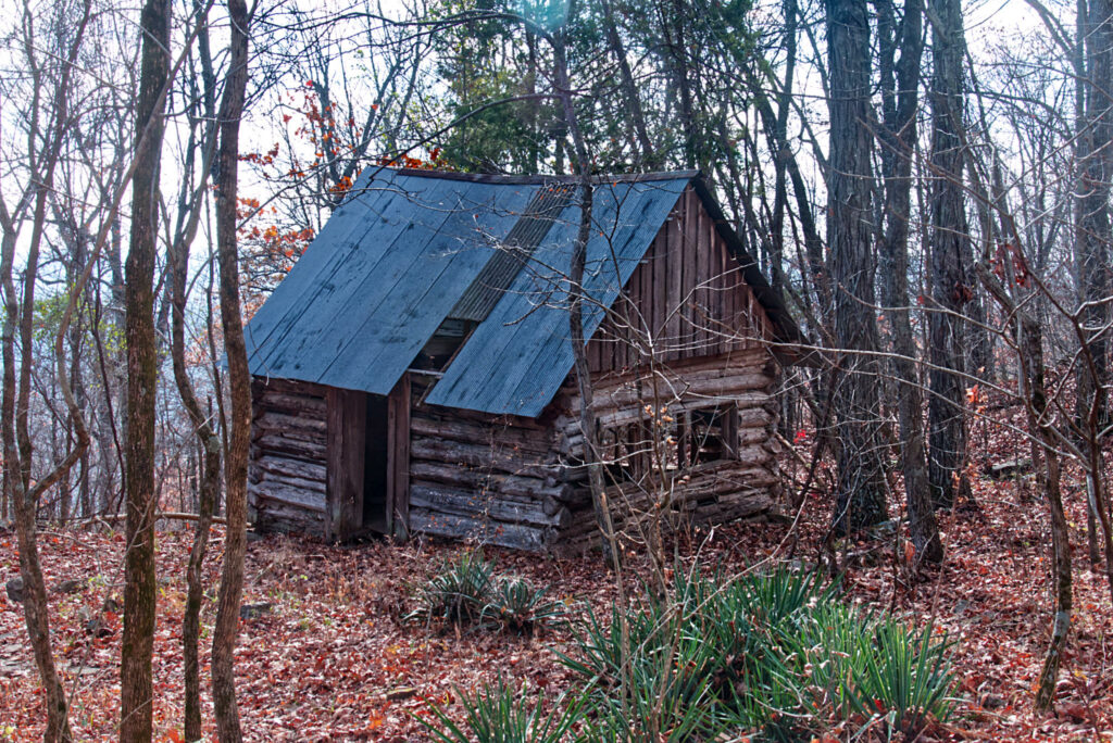
After a few hundred yards you will come upon a small cabin beside the trail. I saw this mentioned as “Wild Vick’s Cabin” online, but I’m not sure this is the name of the cabin. I couldn’t find it listed on the Park Service website. In any event, it is a cool old cabin for you to see how people lived in the area in the past.
From this point, the trail to Antenna Pine is around 3 miles. The trail is fairly flat with some great views of the river valley when the leaves are off the trees. There are also bluffs, old rock walls, and other interesting sights along the way.
As you near the bluff the trail has a fork to the left and you can see some orange trail marker ribbon tied along the trail. This trail will take you up to the bluff below Antenna Pine. Follow the bluff to the left, again marked by ribbon and you will reach a spot where you can scramble up by doing some climbing. This point isn’t for the faint of heart. The climb is on the bluff face will few spots for hand holds. A fall here could result in a serious injury. This isn’t to discourage you from making the climb, but to reiterate that you should be VERY CAREFUL because you are miles from rescue should an injury occur.
If you do make the climb you will continue to hike uphill until you reach the top and are rewarded with the views you see below.
If you want to visit this amazing area yourself you can view our GPS map below, and you can even download the .gpx file to upload into your handheld GPS to help you get there.

Download The GPX File
GPX files are also known as GPS Exchange files. These are text files that contain route data that you can download to your computer and then upload to your phone or handheld GPS unit.
For ease of finding it on Google Maps, I have included the map below.