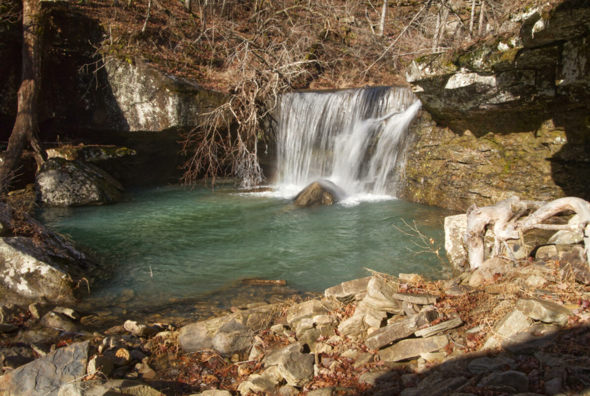
Hamilton Falls is a 12 foot tall waterfall located about 1/2 mile upstream from the more well known Twin Falls. These waterfalls are located in the Richland Creek Wilderness area of the Ozark National Forest. Watch the video above or read on to learn about this moderately difficult bushwhack hike.
Hamilton Falls Parking
GPS Coordinates N 35.825536 W 92.947361
There are numerous ways to reach Hamilton Falls. Some people come in from the south, turning from Pelsor on Highway 16 to reach Falling Waters Road. Others say the best route is from the Hill Cemetery. We found another route that is a little shorter route, and has had some foot traffic since we were there last year.
The coordinates above are at a small pull-off on an old road trace. Someone has constructed a small fire ring there with rocks. You can pull in there to get off the road to park. Coming in from this way also brings you past the parking area for Sandstone Castle.
Hiking to Hamilton Falls
Behind the place where you park there is a faint road trace and trail. The trail follows the bench for a while before you start downhill. You will come to a fork in the old road trace. At the fork you want to stay to the right and follow the old road trace downhill. Be aware that the road is grown up and you will be heading downhill from this point.
The road trace will disappear soon after you begin heading downhill. From here it is a bushwhack downhill. There are some thickets and downed trees you will have to make your way around. This is where a GPS with the waterfall coordinates entered will come in very handy. This is the GPS we recommend and use.
GPS Coordinates for Hamilton Falls: N 35.811788 W 92.963817
Continue downhill and you will find a small stream that runs downhill to Kill Devil Creek. Cross the creek and continue downhill. On a previous trip here to see Twin and Richland Falls we made the mistake of following the creek until it reached Kill Devil Creek. Don’t make this mistake because the creek has steep walls and it drains off a tall bluff that makes it impossible to get down to Hamilton Falls. We were just able to see the waterfall from the bluff, but we chose not to back track to get over to it. So just cross the creek upstream where you can easily step across it without getting wet.
Once you are on the right side of the small creek there are some rocky areas on the way downhill. Eventually you will hear the water and Hamilton Falls will appear in front of you. When you reach the falls you will be at the top. To the left you can scramble down a fairly steep bank and get below the falls for some photos and a well deserved rest. You’ll need that rest because your hike out is all uphill.
Conclusion
Hamilton Falls is one of the many waterfalls in the Richland Creek Wilderness. Some of the iconic waterfalls in the area include Richland Falls & Twin Falls, Falling Water Falls, Six Finger Falls, and Terry Keefe Falls.
This is a moderately challenging hike and it is recommended that you make use of GPS in the area if you are unfamiliar with getting around in the area.