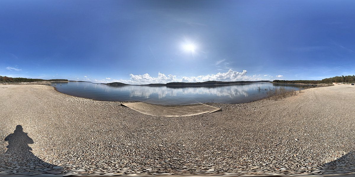
The Frost Point Access is a concrete boat launch area with ample parking at normal water levels. Be sure and check the lake levels before planning a trip. The launch may be inaccessible during times of high water, such as we experienced in the summer of 2021. The photo was taken in late winter 2021 when the lake was close to power pool. I found a reference to the ramp being usable within 10 feet on either side of the power pool level. I haven’t found any other reference to that, so you can take that for what it is worth.
Frost point access is located on Marion County Road 8100 on the lower end of Bull Shoals Lake, near the small town of Bull Shoals. The launch ramp is a well-maintained concrete ramp. There are no facilities in this area other than the boat ramp. The ramp is located on Frost Point, a residential area. There are many points and creeks in the area for the fisherman.
Here is a map of the lake from the US Army Corps of Engineers. Other parks and marinas in the area include Lead Hill Campground in Diamond City, Highway 125 Recreation Area in Peel, and Buck Creek Park on the Missouri side of the lake on Highway 125. There is a marina located not far across the lake in Bull Shoals with full-service facilities.
Be sure and purchase your Arkansas fishing license online before your trip. Check out our virtual visits to other areas on Bull Shoals Lake for a family-friendly getaway.
The camera we use for 360° photos. Click the photo to get yours today!
360 Photo of Frost Point Access
Use Your Mouse or Move Your Phone to Look Around
On the map above click on “View Larger Map” to go to Google Maps. Then copy & paste the code below into Google Maps to view the location. Use the satellite view for the best overview.
Code
C92H+7M Bull Shoals, Arkansas