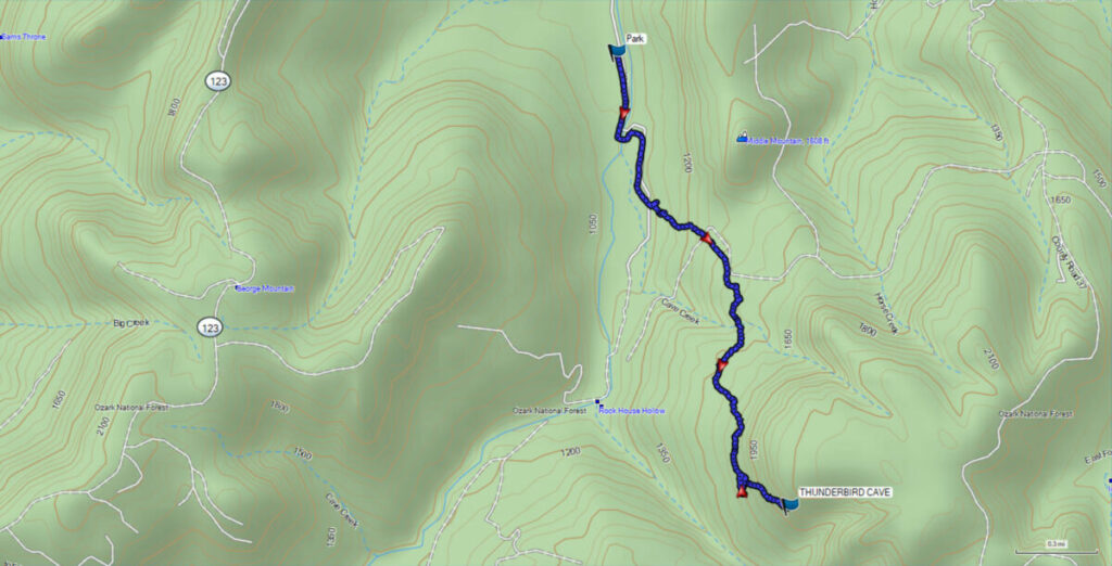
Thunderbird Cave is a strenuous and difficult bushwhack hike near Bass, AR. We’ve done many demanding hikes over the last few years, including Hemmed in Hollow. This one was even more taxing than that. The distance we hiked was 3.9 miles round trip. You can shorten the distance by parking at the old homestead, but we parked up the road across from a gate where there is a wide spot to park on the side of the road. Read on to find out about this latest adventure.
How to Get There
GPS Coordinates: N35.86272 W93.01676
From Western Grove south of Harrison, AR take Highway 74/123 south to Mt. Judea. At the fork just past the high school keep straight on Highway 74E. When you reach the T on Highway 74 just outside Bass, turn right onto CR 37. When you reach Cave Creek turn right on CR 67 and follow it until you reach a spot along Cave Creek where you can park without blocking the road. You can drive along this road until it crosses the creek and park near the old homestead. The road is narrow at this point and you have to cross the creek so it may not be passable at certain times, especially after heavy rains.
*Be advised that this area borders private property. At the time of our visit the private property is well marked with purple paint, so be aware and avoid trespassing.
Hiking to Thunderbird Cave
Thunderbird Cave GPS Coordinates: 35.846361, -93.007093
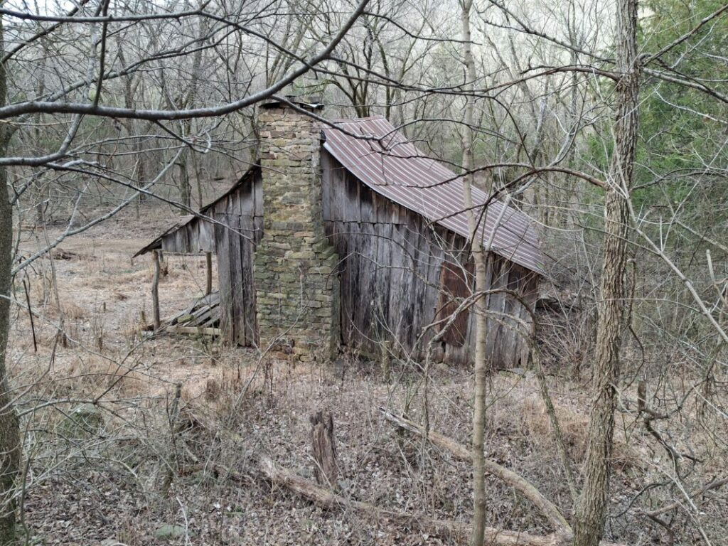
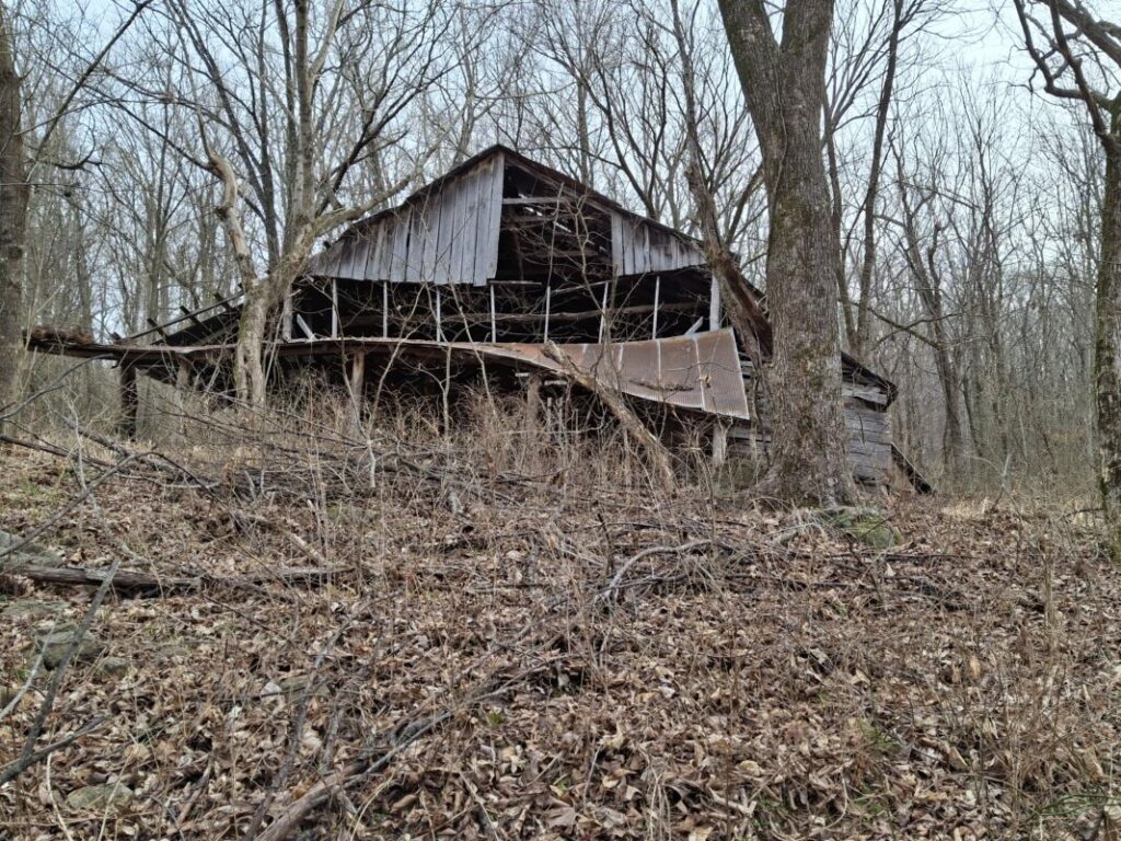
There is an old road trace from the old homestead heading uphill and passing by a barn. Travel a short distance up the road and then leave the road as you start uphill. As stated, this is a bushwhack hike. You will be generally hiking to the southeast as you make your way uphill. Be warned that there are many downed trees and the area is strewn with large rocks. This makes hiking difficult, especially after the leaves have fallen.
As you continue uphill you will come to a bluff that you will have to climb above. We tried one break in the bluff, but found it too steep with lots of shale, making it too dangerous to climb. We backtracked a short distance and used a natural drainage to get above the bluff.
At this point, the climb gets really tough. At times we were scrambling on hands and knees to make it up to the next bluff line. Once you reach this upper bluff line the cave will be a short distance to the right.
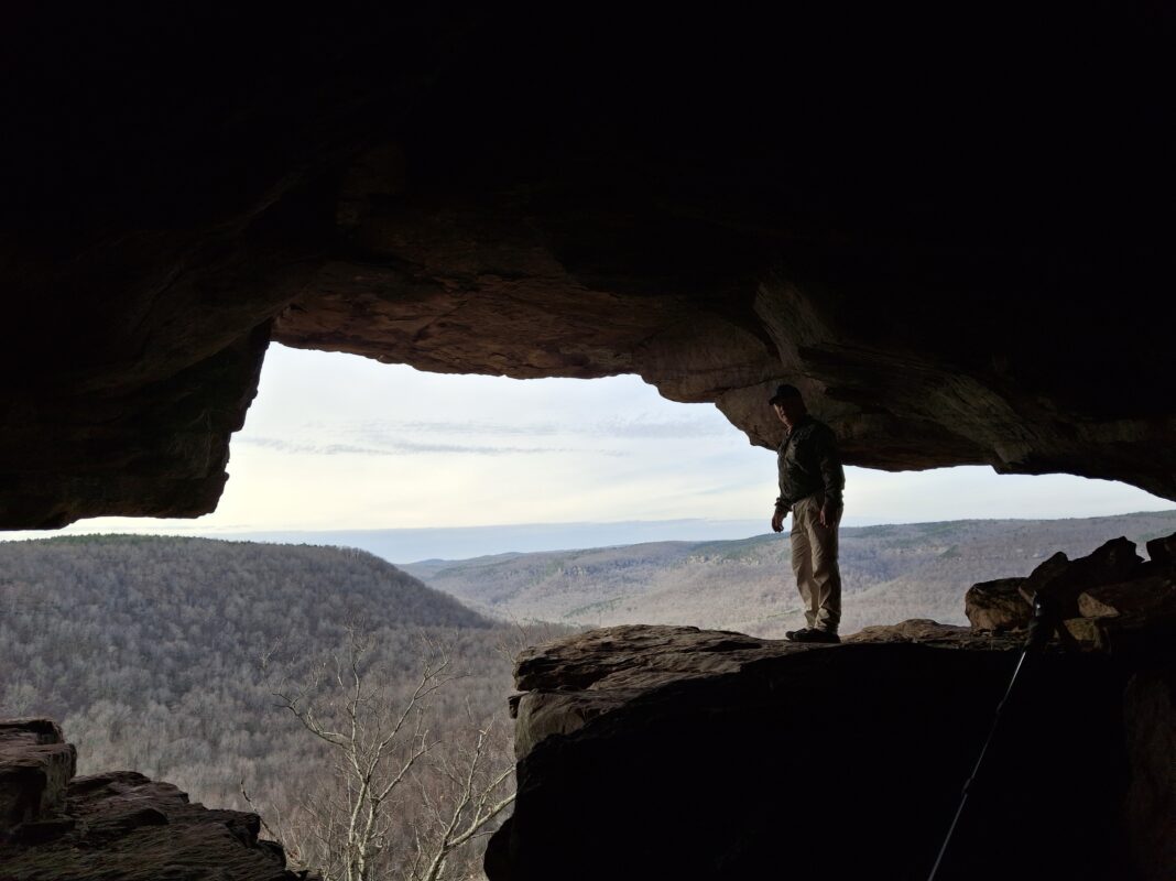
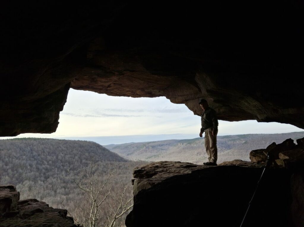
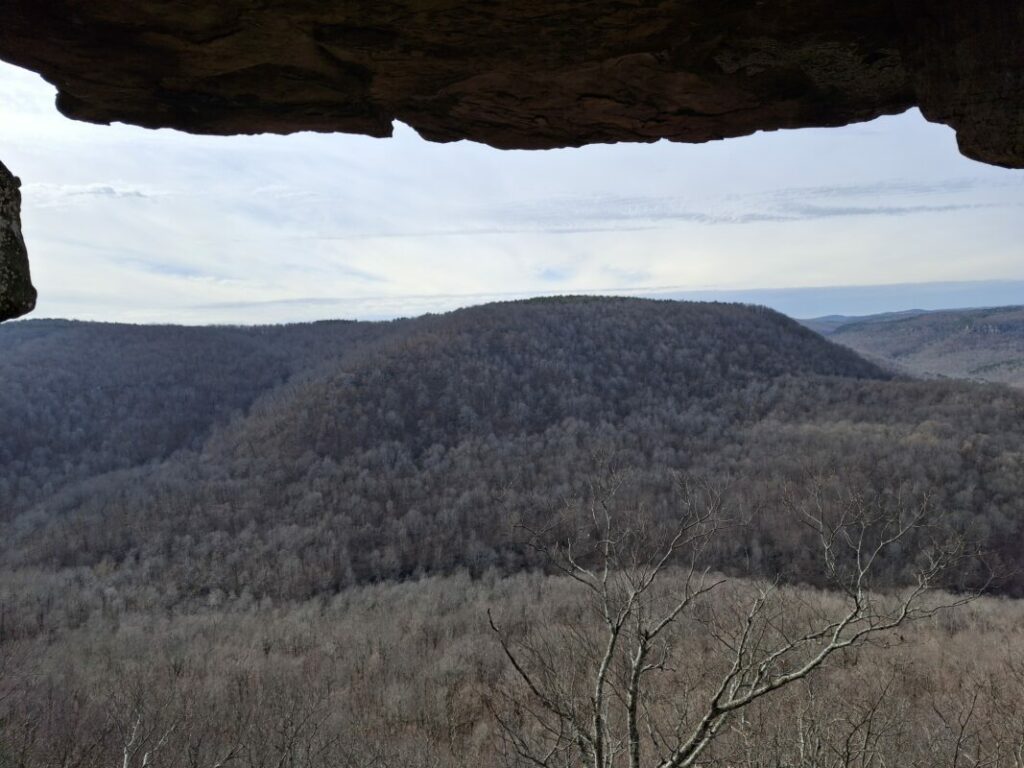
You can enter from the rear of the cave through a narrow opening in the rocks. Once you make it through the front of the cave offers expansive views of Rockhouse Hollow and Cave Creek 1,000 feet below along with the surrounding hills and valleys.

Watch the video below to see entering the cave and views of the surrounding landscape.
If you want to attempt this hike yourself you can download the GPS file to follow our route to the cave. Just click the button below to download the file for free.