Nestled in the heart of the Ozark National Forest, Cub Hollow emerges as a hidden gem off the beaten path, located just off Highway 7 near Cowell, Arkansas. This enchanting area, known for its polyfos (phosphorescent) qualities, offers a unique natural spectacle that captivates the imagination of all who visit. Surrounded by the rugged beauty of the Ozarks, Cub Hollow’s serene environment and mysterious glowing features provide an unparalleled opportunity for adventure, exploration, and connection with nature. Whether you’re a seasoned hiker, a nature photographer, or simply someone seeking a peaceful retreat away from the hustle and bustle of everyday life, Cub Hollow invites you to discover its wonders and create memories that will last a lifetime. Join me as we explore the magic and mystery of this extraordinary place in the Ozark National Forest.
Parking for Cub Hollow
Cub Hollow Parking Coordinates: N35.80256° W93.12702°
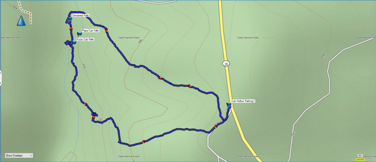
Begin your hike into Cub Hollow from the parking coordinates. In the Google map above you can view a Street View image of the pull-off beside AR Highway 7. It is about 3 miles south of Cowell Cemetery on the west side of the highway. This area is within the Ozark National Forest, and it is a wilderness area. There isn’t a designated parking area and the entire hike is a bushwhack. The best way to find your way into the hollow is to use GPS coordinates for one of the waterfalls in the area.
There isn’t any information on Google maps at this time. However, I plan to add photos and the coordinates to Google Maps soon. In the meantime, you can download the GPX file below and upload it into your GPS device.
Feb. 2025 Update – Mama & Roly-Poly Cub Falls
In early Feb. 2025, we ventured back into Cub Hollow to find Mama Cub and Roly-Poly Cub Falls.
Begin your hike down the old logging road from the parking area at the highway. As you follow the road you will see some orange marker ribbons for a volunteer trail down into cub hollow. The first task is to find a break to get below the bluff line. We stumbled upon a drainage to get below the bluff as we neared the coordinates of Mama Cub Falls. We found this to be easy to navigate and seemed a little easier than the one mentioned in Rick Henry’s Hiking Blog.
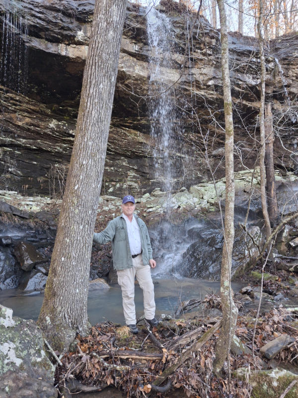
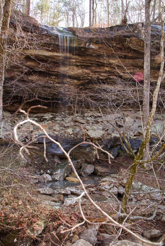
The first waterfall we came to was Mama Cub Falls. This is a fairly tall waterfall that drains over the bluff line into the drainage below. You can get behind the waterfall under the overhanging bluff for some interesting photos. Mama Cub Falls is pictured in the photo above.
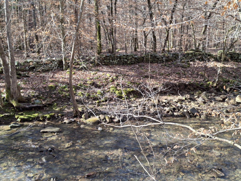
After you leave Mama Cub Falls follow the drainage downstream. Multiple small cascade waterfalls along this stream are very photogenic. Once you reach Cub Hollow Creek turn right and continue downstream. There are many more cascades along this creek, and you’ll see a rock wall along the creek too!
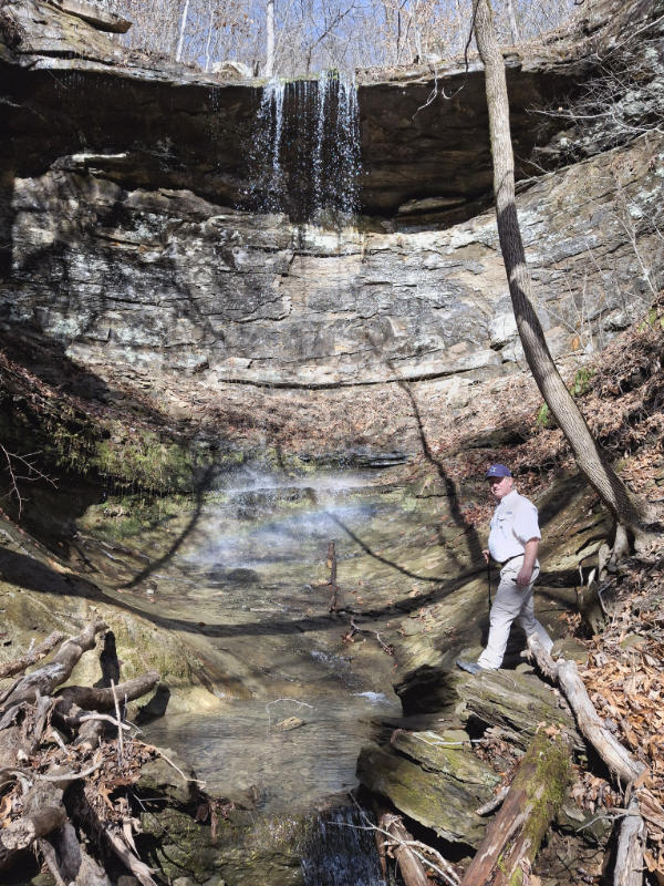
Once you reach the coordinates for Roly-Poly Cub Falls you’ll need to cross the creek. We were able to do it easily by rock jumping. Once across the creek make your way up the short side drainage to reach the falls. I am pictured below at Roly-Poly Cub Falls.
Once you leave the falls here you can continue to explore upstream and find more waterfalls. We decided to begin the steep climb out here. The main goal here is to find a break in the bluff line to be able to ascend. If you download our GPS file you can find the bluff break we used easily. This is a steep climb with an elevation gain of a little over 800′. The entire hike is 2.7 miles total if you follow our trail.
Keep reading to find out more about our previous hike into the area.
Cub Hollow – Fuzzy Cub Falls
Fuzzy Cub Falls Coordinates: N35.80474° W93.13371°
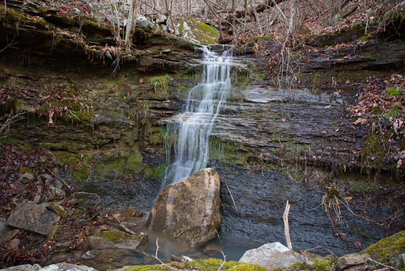
The first waterfall you come to on this hike is Fuzzy Cub Falls. This is a short cascade waterfall that drains into the main creek shortly below it.
I should say you will come to this waterfall first if you follow our GPS track. If you decide to bushwhack a different way you may come to one of many waterfalls in this area. This is a polyfos area that has many waterfalls in a concentrated area.
When we started the hike we followed an old road into the area and then ventured off trail and followed the GPS to the coordinates. We had to track a little to the northeast once we reached a bluff as we tried to make our way directly to the falls. You can see that in the video we posted above.
Cub Hollow – Papa Cub Falls
Papa Cub Falls Coordinates: N35.80505° W93.13346°
The next waterfall we visited in Cub Hollow was Papa Cub Falls. To reach Papa Cub Falls cross the small stream below Fuzzy Cub Falls and head upstream. You will have to find your way around some huge rock slabs as you make your way upstream.
After making your way around these obstacles you will need to cross the main creek. When we were there it was low enough that we crossed on rocks in the creek and didn’t even get wet feet. Make your way up a small rise beside the creek and you will see Papa Cub Falls flowing over the bluff to your right.
We went on this hike about 4 days after significant rainfall, and as you can see in the photo, there was only a small amount of flow off the bluff. This is one that would definitely be better seen right after a good rain in the area.
After visiting Papa Cub Falls you can hike a short distance upstream to one more waterfall if you are following our path.
Unnamed Waterfall
Unnamed Waterfall Coordinates: N35.80559° W93.13388°
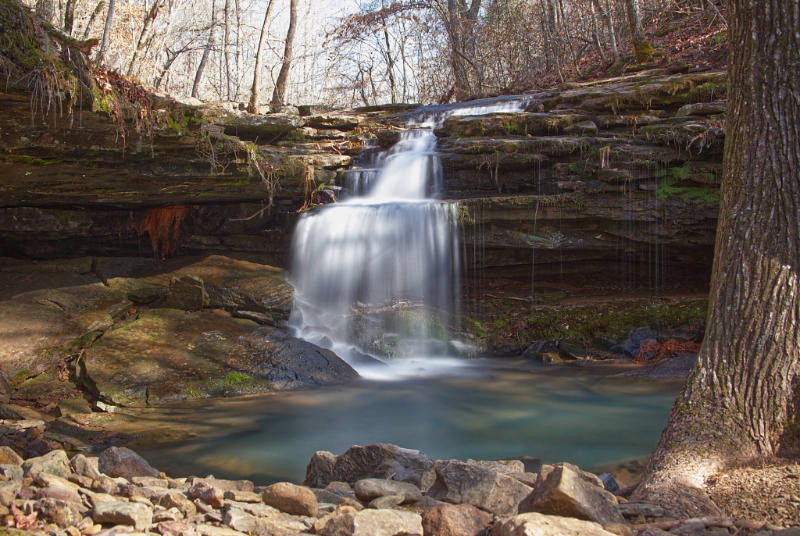
Our final waterfall in Cub Hollow for this hike seemed to be unnamed. I couldn’t find a name for this one in the few references I even found for this area. I will admit it was the most picturesque of the three waterfalls we visited that day.
This waterfall is on the main creek, just upstream from Papa Cub Falls. In fact, we could see it just as we walked away from Papa Cub Falls. However, if you visit in the summer the leaves and underbrush might make it a little tougher to spot.
In any case, simply follow the stream upstream a short distance, and you’ll see this waterfall right in the main creek.
Hiking Back Out
From this point you have two options. We chose to make our way around the waterfall to the left and then cross back over the creek upstream from the falls. From here we began our trek uphill and followed a pretty direct route back to where we parked.
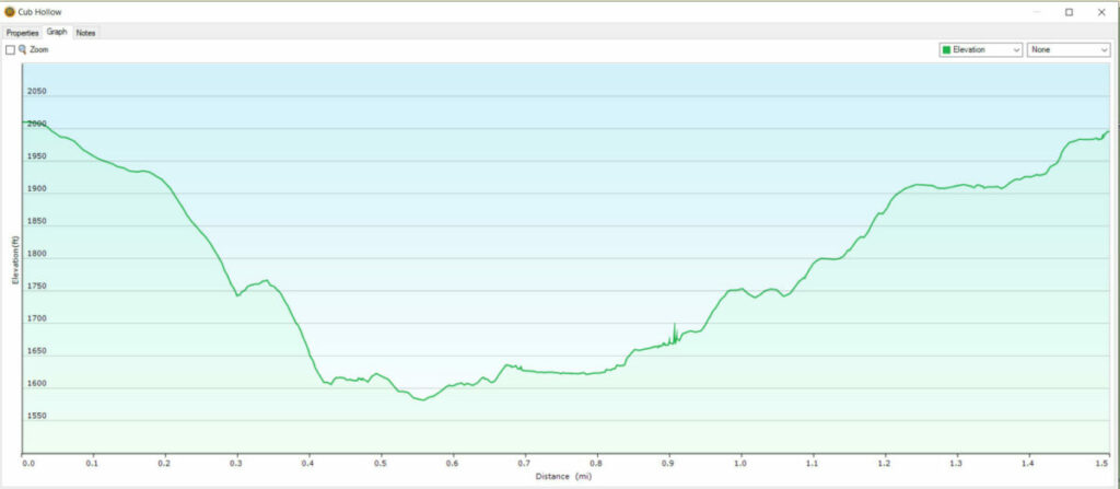
There was a little over 400 feet of elevation change, and the entire hike following our path was a little more than 1.5 miles. You can see this information on the elevation/distance graph below.
Another option would be to follow our track out and use it to enter instead, and go to the Unnamed Waterfall first, then continue downstream. There are many more waterfalls downstream from these waterfalls, and a few that are a short distance up side drainages.
I fully plan to return and explore this area further another time. But if you want to do a short hike right off Highway 7, then this could be one you might want to add to your list. If you want to follow our route I have a link to the GPX file below. Once you download it, simply use the software that came with your particular brand of GPS unit, to upload it to your unit.
For more great information on hiking the Ozarks be sure and check out our hiking blog.
Another great resource is the Arkansas Waterfalls Guidebook by Tim Earnst.