
Stepp Creek Falls is one of the waterfalls noted in the Arkansas Waterfalls Guidebook by Tim Earnst. We decided to visit a few days after heavy rain, and the trip did not disappoint. This is a picturesque 25-foot waterfall in the southern reaches of the Ozark National Forest near Nail, AR.
Stepp Creek Falls Driving Directions
Parking GPS Coordinates: 35.85496 -93.30037
If coming in from the north on Highway 7 take Highway 16 West south of Cowell. Drive 9 miles through Nail and look for NC-8908 on the right. After about 0.9 miles the road will split. Bear left onto NC-8910 and travel about 0.25 miles and look for an old logging road on the left beside a fenced pasture. Park here to begin your hike.
Stepp Creek Falls Hike
Begin the hike by following the old logging road a little over 1/4 of a mile. Leave the road at around GPS coordinates 35.85927, -93.30551 and begin heading downhill. We noted orange tape marking a volunteer trail around this point. Just follow the trail downhill to a bluff break where you can get below Upper Stepp Creek Falls. The coordinates for the upper falls are 35.85767, -93.30896.
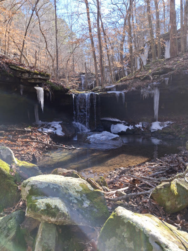
Around 100 yards downstream you’ll find Lower Steep Creek Falls. From here you can take a photo of the lower falls with the upper falls in the background as shown below.
At this point, you can hike back out or continue downstream to the confluence of Stepp Creek with another creek, or you can hike back up the way you came. On this trip, we decided to continue downstream where we encountered a small waterfall where the two creeks meet.
This is where I made the mistake of not taking a photo of this waterfall, planning to shoot it as we returned. But as you will soon see, we decided not to return this way and I missed the opportunity.
If you refer to Tim Earnst’s Arkansas Waterfalls Guidebook you’ll notice there are waterfalls marked upstream and downstream in the creek the Stepp Creek drains into. We decided to hike upstream to view the waterfalls there.
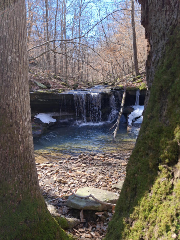
After a short hike upstream we found this lovely waterfall with a clear pool pictured below. This waterfall and the other mentioned below do not seem to have names that I can find.
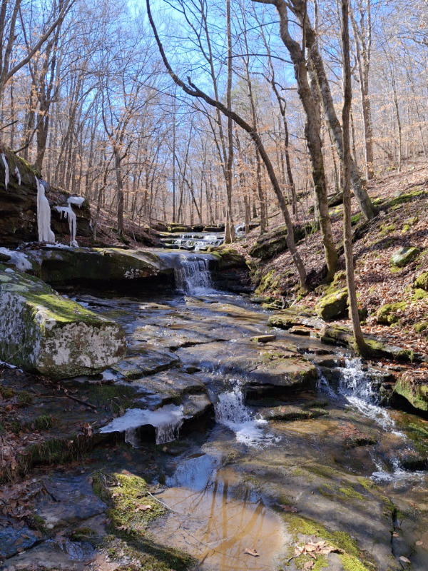
After we stopped at this waterfall and rehydrated we continued upstream a short distance and found the long cascade waterfall shown in the image below. On the way there we also passed a cave entrance. We didn’t take the time to look for it, but you could definitely feel the blast of cool air from the bluff as we walked by. There wasn’t a sign of an obvious cave entrance, but when you feel that cool air coming from the bluff you know there is one somewhere. Shortly after this we saw the scene below.
At this point, we decided to head back. Looking at the contour map on the GPS it was clear that we were almost back to the level of the parking area. We decided it would be easier to go uphill from here and bushwhack back to the parking area. That’s why I missed the chance to shoot the waterfall at the intersection of the two creeks.
If you decide to take this route back make note that this part of the national forest borders private property. After a short bushwhack uphill through thick beech trees we encountered another old logging road across the creek from the one we used to come in. After following it for a while we made a trek uphill to get close to the level of the parking area.
On top of the hill, we encountered a fence line and we followed it back toward the parking area. Guided by my trusty Garmin GPS we followed the fence line until it intersected with another fence. We turned left and followed this fence around the pasture and back to the parking area.
This was a little bit of a rough bushwhack and we needed to be sure not to get on private property. But it did cut off some of the climb back out we would have done had we followed our trail back the way we came. However, if you want an easier hike back out then just follow your route back to the parking area that you came in on.
Overall, this is a relatively short and moderately challenging hike. The distance we covered was 2.2 miles with around 300′ of elevation change. There are other waterfalls downstream if you want even more to see on your hike.
Whichever you choose just be aware of the private property bordering the national forest and practice leave no trace by packing out your trash when you leave.