The storms did not disappoint this week. We had thunderstorms after dark on successive nights just 3 days after the first storms of the week arrived on April 24. On the night of April 24, we had a line of thunderstorms pass through with abundant lightning. The storms were forecast to arrive in our area just before sundown. This gave me the opportunity to get out and shoot a time-lapse of the clouds earlier in the afternoon. I wanted to visualize how the clouds changed as the front approached.
The video below shows a time-lapse of the clouds as they change throughout the afternoon until right at dark.
Once it got dark I tore down the camera and sped off to the place I had chosen as my first setup. I wanted to be able to see clearly to the west and northwest. The storms were approaching from a northwesterly direction. My lightning app was showing quite a bit of lightning to the west as well.
As the squall line cleared the hills I could see lightning flashing constantly in the distance. This is a good sign for a lightning photographer. Now if only the rain would hold off until I could get some decent shots.
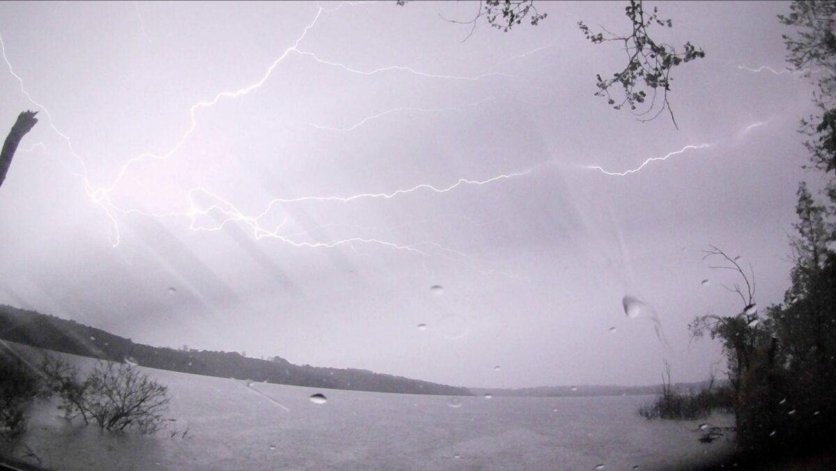
As with all good things, this was simply not to be today. The rain quickly became hard enough that I had to take down the cameras and retire to the car for the rest of the storms. Even so, I think the video below shows that with a little determination you can still get some pretty decent lightning shots while staying safely in your car. I usually retire to my vehicle when the lightning app on my phone indicates a strike close to the ten-mile ring. That is the personal safety limit that I have set for myself.
Now for those that are wondering, yes, I do know that lightning can travel up to 20 miles from a storm. So I actually watch the sky and my lightning app anytime lightning gets within 30 miles. I exercise extreme caution at 20 miles and anything that gets close to 10 miles makes it time to seek shelter. No photo is ever worth risking your life for.
The video below shows what is possible with an action cam shooting through a car windshield.
The next storms of the week were forecast to arrive on the evening of April 27. Further to our south, the storms were forecast to produce large hail with a tornado possible. The forecast for north Arkansas was not quite as ominous with mainly straight-line winds and possible hail. I arrived at my spot to view the storms to the west and southwest. I captured a few clips right at sunset, but the real show began after dark and the storms had passed to the east of my position. I quickly repositioned down to the lake with a clear view to the east and got the rest of the lightning shown in the video below.
The following evening the Storm Prediction Center in Norman, OK issued a forecast that put our area under an enhanced risk of severe storms. The storms were moving in from the northwest and so I positioned again at my choice spot for lightning photos looking in that direction. Most of the lightning was rain-wrapped and in the clouds, so the action was sparse as the wind and rain whipped around my vehicle. Once again I had to think fast and move to a more favorable area. I moved down by the lake with a view to the east, and once again I was able to capture some amazing lightning streaking across the sky, as shown in the video below.
To see my previous post on the storms from the Easter Sunday storm outbreak you can visit this page. We want to thank all those who support our efforts to bring you these reports and videos. We really appreciate it!