Tucked away near the quaint town of Compton, Arkansas, lies the trail to Hideout Hollow, a captivating destination that promises an escape into the heart of nature’s unspoiled beauty. This relatively short hike, spanning just 0.9 miles, is a journey through the lush landscapes of the Ozarks, culminating in the breathtaking sight of a waterfall plunging approximately 50 feet into a serene hollow below. Perfect for adventurers of all skill levels, the trail to Hideout Hollow offers a splendid blend of accessibility and the rugged charm of the wilderness. Whether you’re in search of a peaceful afternoon retreat or a picturesque backdrop for your next photo, Hideout Hollow beckons with the allure of its cascading waters and the promise of a memorable excursion amidst the natural splendor of Arkansas. Join me as we explore the tranquil beauty and hidden wonders of Hideout Hollow.
Parking Area
Coordinates: N36.07303° W93.26493°
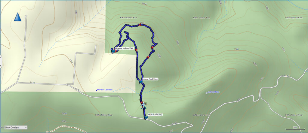
To reach the parking area for the Hideout Hollow Falls Trail turn off Highway 43 in Compton, Arkansas onto County Road 19. Follow this gravel road for about 3 miles and the parking area will be on your left. This is the same road you take to reach the Compton Trailhead for Hemmed-in Hollow Falls.
Once you park the trail enters the forest on the north side of the parking area. This is a well worn trail so it is easy to follow.
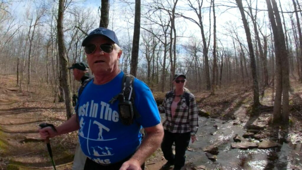
The Trail to Hideout Hollow
As noted above, this is a highly trafficked trail, so it is easy to follow. However, if you do your research before heading out you will note that many writers tell of the way to get below the falls. The way below the falls if you follow the trail to Hideout Hollow involves crossing the creek above the falls and then crawling along a ledge with an overhanging bluff to climb down below the falls. Many writers recommend not going alone on this trail for that reason. This way down is a bit sketchy, so we decided on what we think is a better way, if you want to get below the falls for photos.
Our Trail into Hideout Hollow
Coordinates to Leave The Trail: N36.07714° W93.26565°
On this hike we checked the topo map and planned a route that did require some bushwhacking, but it allowed us to get below the falls without crawling the ledge. More about that later in the article.
Leave the trail at the coordinates above and head uphill over a small knob to the right of the main trail. Once you cross the rise you will be looking over the valley and Cecil Creek far below.
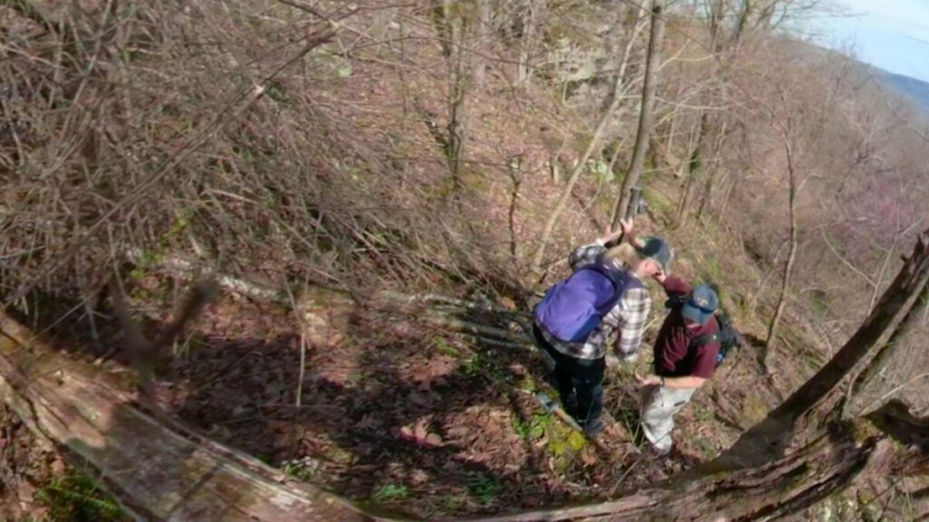
If you follow our GPS track you will find a spot where you can scramble down below the bluff and you’ll be on the same elevation on the topo map as you will be below Hideout Hollow Falls. Just head to the left and follow the bluffs, keeping them on your left. Follow them around and you will eventually come to a the creek leading from Hideout Hollow Falls. We did find that if you stay close to the bluffs once you make the turn into Hideout Hollow the walking is easier than scrambling over the rocks closer to the creek.
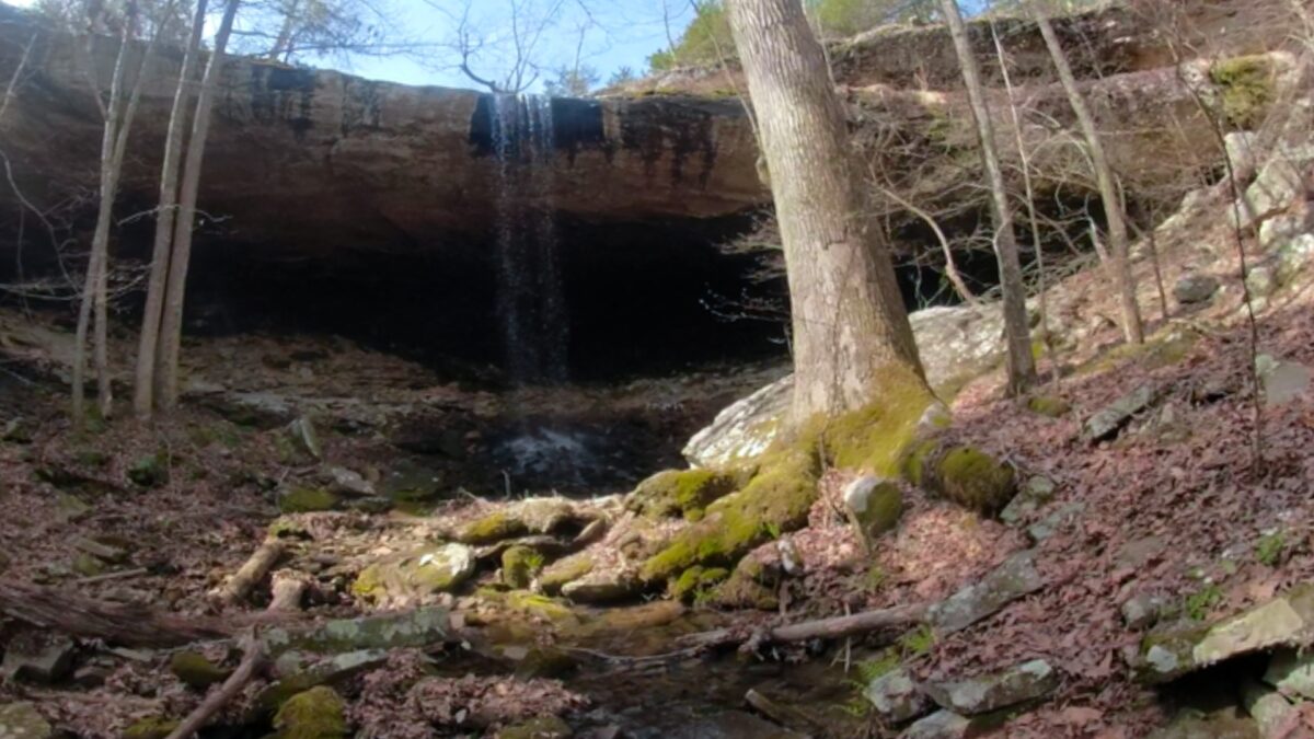
Hideout Hollow Falls
Coordinates: N36.08067° W93.26953°
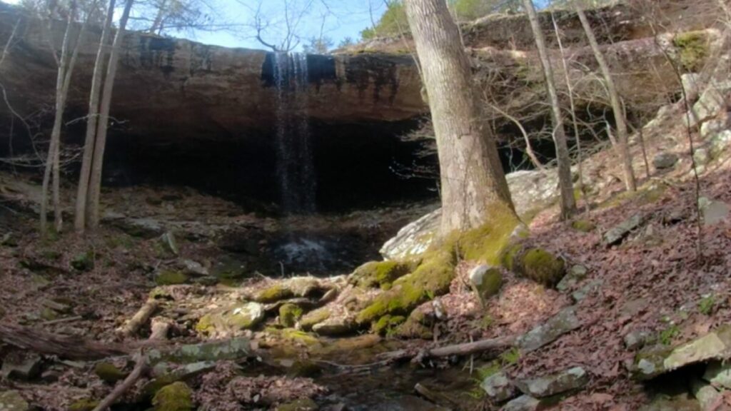
The gem of the hike is making it to Hideout Hollow Falls. The water pours over the side of an overhanging bluff and creates the creek below. Legend has it that Jesse James and his gang hid out in this hollow for a while. Since his hometown was only 2 hours north in Jane, MO, this is not unlikely.
There is another legend that a band of men who were trying to avoid the draft in World War 1. Known as the Slacker Gang, they hid out here for months until they finally submitted to the draft. The name comes from this legend and it was named after the National Park Service took over the surrounding land.
Leaving Hideout Hollow
After you have explored the area for a while and it’s time to head out you have two options. You could backtrack along the route we took into the hollow, or you can take a chance and climb up to that ledge mentioned earlier.
We crossed the creek and looked at the ledge. Someone has piled up rocks below the ledge to make it easier to climb down. The rock pile looks unsteady, but we found with a little effort we could use them to climb up to the ledge. Honestly, the ledge isn’t as narrow as it looks in photos, but it’s still a place to be very careful. If you slip, it is a 50 foot fall onto the rocks below. I will say I’m not sure I would have elected to try climbing down from the ledge, but it wasn’t too bad going out.
There is an overhang that requires you to crawl on hand and knees for around 10 feet before you can stand up. We removed out backpacks and pushed them along in front of us until we made it to the place where the overhang was tall enough for us to stand.
Download The GPS File
GPX files are also known as GPS Exchange files. These are text files that contain route data that you can download to your computer and then upload to your phone or handheld GPS unit.
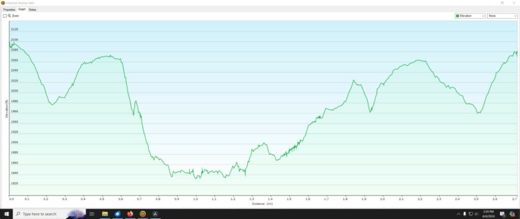
Elevation/Distance Graph
For more great information on hiking the Ozarks be sure and check out our hiking blog.
Another great resource is the Arkansas Waterfalls Guidebook by Tim Earnst.