Description
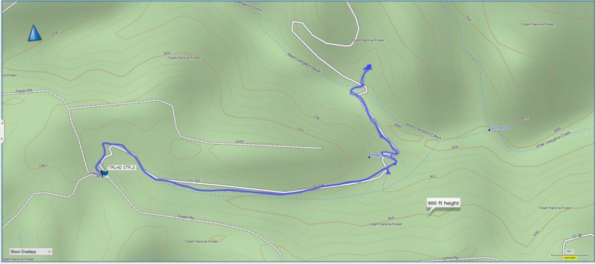
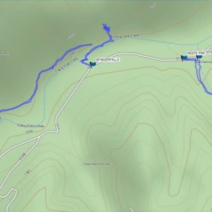
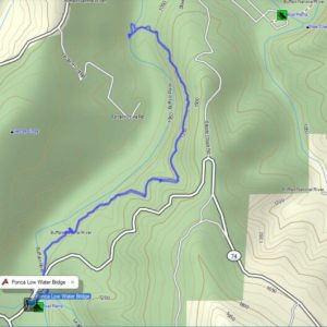
This product is a digital GPS file that contains the coordinates and route information for the Steele Falls Trail in Arkansas.

Discover the Beauty of the Steele Falls Trail
Embark on an exhilarating wilderness adventure along the Steele Falls Trail! This captivating hiking trail offers an immersive journey through untouched natural beauty. Prepare to be awe-struck as you explore the untamed wilderness and uncover the hidden treasures that await along the Steele Falls Trail.
Immerse yourself in the serenity of the wilderness as you traverse the trail. This remarkable trail winds through ancient forests, traverses bubbling creeks, and unveils breathtaking vistas at every turn. With each step, you’ll feel the invigorating embrace of nature and a sense of freedom that only the wild can provide.
As the name suggests, Steele Falls awaits you along this extraordinary trail. Picture yourself standing in awe as the cascading water plunges into a crystal-clear pool below. The sheer beauty and raw power of the falls create an unforgettable sight that will leave you mesmerized and longing to capture the moment forever.
The Steele Falls Trail is a gateway to the heart of the wilderness, inviting you to disconnect from the noise of modern life and reconnect with the untamed beauty of nature. This trail is thoughtfully designed, offering both beginner-friendly sections and more challenging stretches for experienced hikers. It’s a journey that caters to all skill levels, ensuring that everyone can experience the magic of the wilderness.
Remember to respect the environment, pack essentials like water and snacks, and always be prepared for the unexpected.
Unleash your spirit of adventure and let the Steele Falls Trail be your guide to an unforgettable wilderness experience. Revel in the untouched beauty of nature, breathe in the crisp mountain air, and create memories that will last a lifetime. Lace up your hiking boots, embrace the call of the wild, and embark on a remarkable journey along the Steele Falls Trail.
Plan Your Perfect Hike with Ease to Steele Falls Trail
Planning a hike can be a daunting task, especially if you’re unfamiliar with the trail. But with the Steele Falls Trail GPX File, you can plan your perfect hike with ease. This digital file includes detailed information about the trail, including distance, elevation changes, and difficulty level. You can even customize your route based on your preferences and fitness level. With the GPX File loaded into your handheld GPS, you’ll have everything you need to make the most of your hiking experience.
Capture Unforgettable Memories
The GPX File isn’t just a tool for navigation – it’s also a way to capture unforgettable memories. With accurate GPS coordinates and route information, you can focus on enjoying your hike and taking in the stunning scenery, without worrying about getting lost or off-track. And when you reach the waterfall, you can snap breathtaking photos and videos to share with your friends and family. With this GPX File, you can make memories that will last a lifetime.
How to Use The File
After you checkout, you will receive a link to download the file. After downloading the file you can use the software that came with your brand of GPS unit to upload the file to the unit. From there you can call up the route information on your handheld GPS without the need for a connection to cell phone towers. Many of these areas are without cell phone reception, so you may not be able to use your phone mapping app to guide you. You never have to worry about that when you purchase the GPX file. You get instant access and you will always have it for future reference.
Don’t wait, get your copy of the file today!
You might also like some of our other GPS hiking trail files.


Reviews
There are no reviews yet.